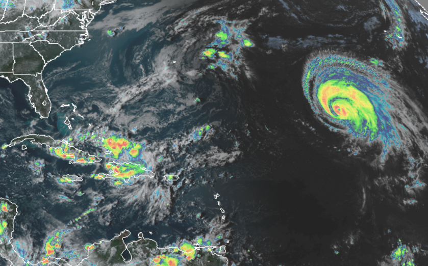
Major Hurricane Lorenzo continues to spin about in the central Atlantic Ocean. Yesterday it made history by becoming a Category 5 hurricane more north and east than any other recorded hurricane before it. Today, the massive storm is whipping up waves across much of the North Atlantic; North America, Europe, and even Africa will see rough surf and big waves from this huge system.
The storm has lost some strength, but continues to pack quite the punch today. As of the latest advisory from the National Hurricane Center, the center of Hurricane Lorenzo was located near latitude 26.9 North, longitude 44.2 West. Lorenzo is moving toward the north-northeast near 10 mph. The National Hurricane Center believes a turn to the northeast is expected on Monday with a gradual increase in forward speed through Wednesday. Maximum sustained winds are near 115 mph with higher gusts, making Lorenzo is a category 3 hurricane on the Saffir-Simpson Hurricane Wind Scale. Gradual weakening is expected over the next couple of days, but Lorenzo is expected to remain a large hurricane throughout that time.
Hurricane-force winds extend outward up to 80 miles from the center and tropical-storm-force winds extend outward up to 255 miles. While the damaging wind field is over 500 miles wide, the actual cloud canopy extends more than 850 miles, or roughly the distance from Newark Airport to Orlando Airport. The estimated minimum central pressure based on data from NOAA reconnaissance aircraft is 948 mb or 28.00 inches.
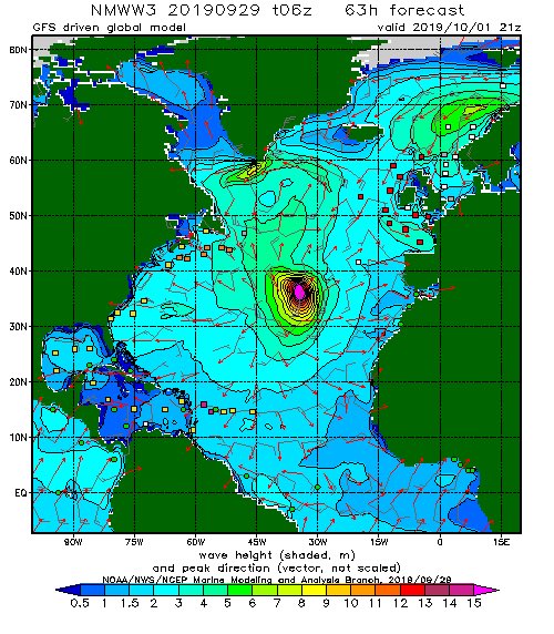
Because of its huge wind field, Lorenzo is kicking-up large surf across much of the North Atlantic. Dangerous surf will reach much of the U.S. East Coast tomorrow with waves reaching Europe and Africa in the coming days. These high waves will create dangerous rip currents from Florida to Maine even though Lorenzo is moving towards Europe. Closer to the center of the storm, a very large area of 50′ waves are expected, with a pocket of 100’+ waves modeled by computer wave model forecasts.
