Subtropical Storm Ana, the first named storm of the 2021 Atlantic Hurricane Season, continues to spin about north and east of Bermuda while a system near the Texas Gulf Coast is sputtering-out, ending chances of tropical cyclone formation there.
With Subtropical Storm Ana, 2021 is the seventh year in a row with at least one named storm prior the official start of the Atlantic hurricane season that is June 1st. A subtropical cyclone is a non-frontal cyclone with characteristics of both tropical and extratropical cyclones.
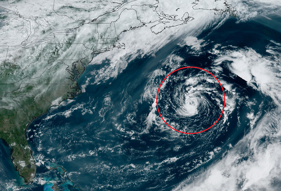
As of the latest advisory from the National Hurricane Center (NHC) in Miami, Florida, Subtropical Storm Ana was located about 175 miles northeast of Bermuda with maximum sustained winds of 45 mph. Ana was drifting to the west at 3 mph with a minimum central pressure of 1006 mb or 29.71″. According to the NHC, a turn toward the north at a slow forward speed is expected later today, followed by a faster motion toward the northeast Sunday and Monday.
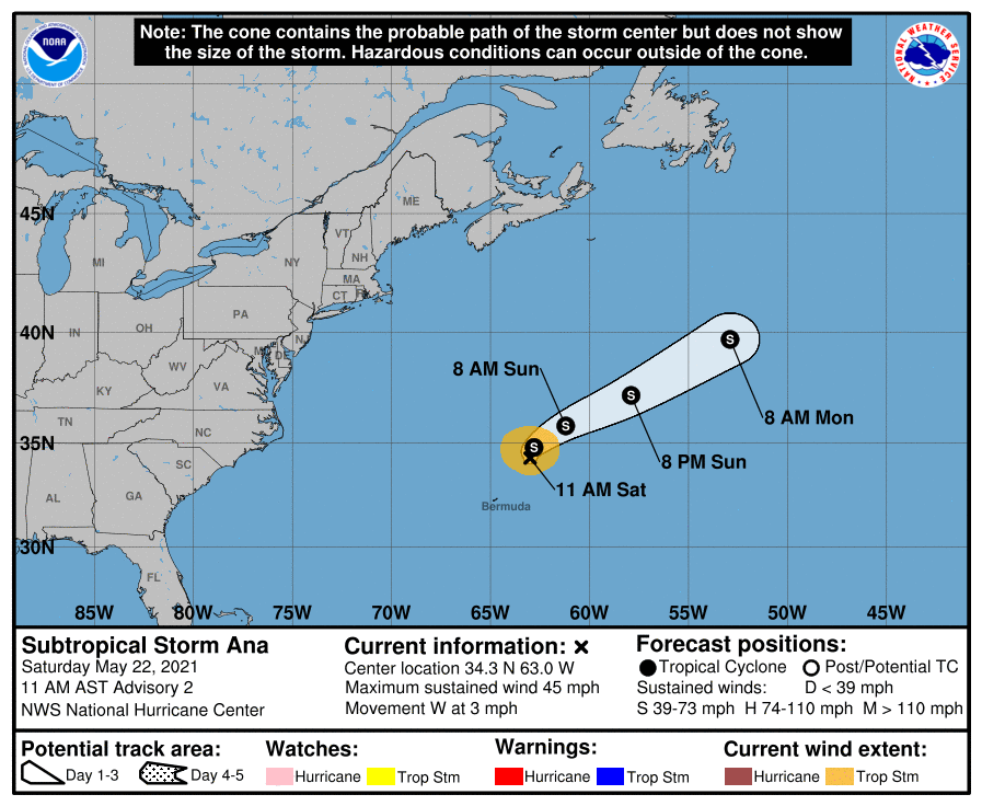
With Ana moving away from Bermuda, the Bermuda Weather Service has dropped a Tropical Storm Watch that was in effect there earlier.
On its path north and east, Ana should weaken and eventually dissipate in the coming days, posing no threat to landmass during its existence.
Meanwhile, the NHC continues to track a disturbance near the Texas Gulf coast. While the system looked like it was gaining some structure and strength in satellite photography yesterday, the system is losing its punch with its center of circulation now over land in extreme south Texas.
While tropical cyclone formation in the Gulf of Mexico isn’t expected now, the system will still produce heavy rainfall over portions of southeastern Texas and southwestern Louisiana today. Given the complete saturation of soils with ongoing river flooding along the Texas and Louisiana coastal areas, these rains could lead to flash, urban, and additional riverine flooding across this region according to the NHC.
There are no other systems within the Atlantic hurricane basin showing signs of tropical cyclone formation at this time.
