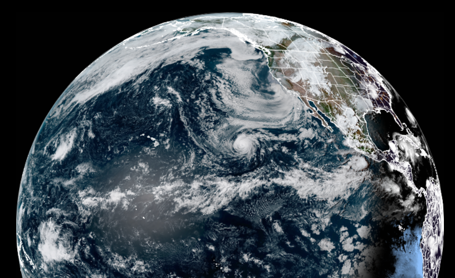
Hurricane Linda, with maximum sustained winds of 100 mph, continues to march closer to Hawaii. The National Hurricane Center (NHC), which is currently tracking the hurricane, believes it’ll become a post-tropical cyclone as it moves towards Hawaii. However, soaking rains and gusty winds could still impact the Aloha State as soon as this weekend.
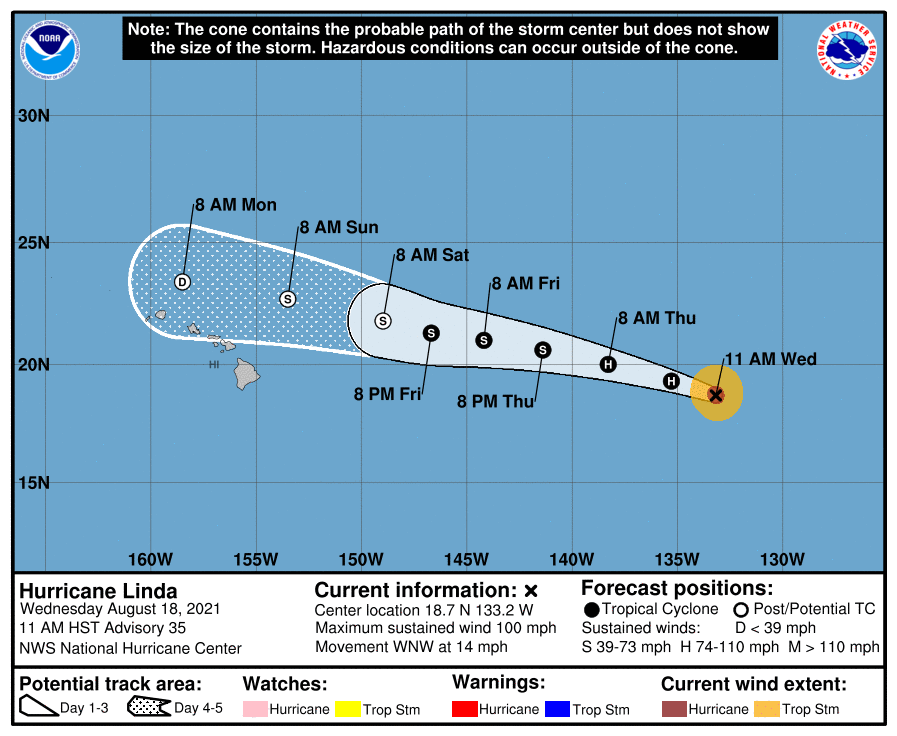
The last advisory from the NHC pegged the center of Hurricane Linda roughly 1,430 miles east of Hilo on the Big Island of Hawaii. With a minimum central pressure of 977 mb or 28.85″, maximum sustained winds were at 100 mph. The storm is moving to the west-northwest at 14 mph.
The NHC says Linda should continue to move west-northwest at the current speed through the weekend. While the hurricane is moving closer to Hawaii, it is also traveling over much cooler waters. Due to the colder weathers, the NHC says steady weakening is forecast through Friday and Linda is expected to become a gale-force post-tropical cyclone on Saturday.

This weekend, the National Hurricane Center expects the center of this system to travel north of the Big Island of Hawaii and continue a west-northwest path. It is possible the center of the circulation could approach Maui, Oahu, or Kauai Islands. Whether the center passes over or near any island, it is likely moisture tied to the remnants of the storm will pass through the entire state, bringing the potential for heavy rains on Sunday and Monday. Heaviest rains will fall on the east-facing sides of the islands.
There are no advisories in effect for Hawaii tied to this storm, but that could change this weekend.