Hurricane Kiko is forecast to weaken and pass well north of Hawaii, keeping all of its rain and wind far away from the islands in the Aloha State. However, the hurricane, once a category 4 storm on the Saffir-Simpson hurricane wind scale, will kick up surf over a very large area, including on shores facing the storm across the island state.
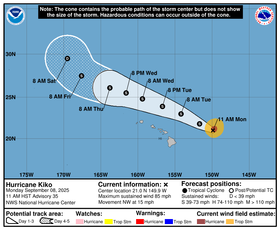
At 11 am local time ( 5 pm Eastern), the center of Hurricane Kiko was located by Air Force Reconnaissance “Hurricane Hunter” aircraft near latitude 21.0 North, longitude 149.9 West, or roughly 350 miles east-northeast of Hilo, Hawaii. Kiko is moving toward the northwest near 15 mph and this motion is expected to continue for the next few days. On the forecast track, Kiko is expected to pass north of the main Hawaiian Islands on Tuesday through Wednesday.
The Hurricane Hunter aircraft determined Kiko was a Category 1 hurricane with 85 mph sustained winds. However, the Central Pacific Hurricane Center expects it to weaken further and become a tropical storm by tomorrow morning.
Swells generated by Kiko are expected to gradually build and are forecast to peak along east-facing exposures of the Hawaiian Islands later today through midweek, potentially producing
life-threatening surf and rip currents.
With Hurricane Kiko forecast to pass well north of the island chain Tuesday and Wednesday, in addition to generating large surf along east facing shores, the storm will be disrupting the trade winds that typically blow across the islands, producing increased humidity with areas of heavy rainfall. Some of these isolated, pop-up showers may produced localized flash flooding issues but are not directly associated with the moisture around the core of the hurricane which is far from Hawaii.
The National Weather Service in Honolulu, Hawaii wants people to be prepared for the possibility of heavy rain and thunderstorms even with the hurricane far from the islands. “Moisture along the periphery of the system will spread over the state Monday night and Tuesday,” they said in their latest forecast discussion. “Initially, this will provide an increase in clouds and mainly windward showers, but as trade winds become disrupted, afternoon sea breezes will likely trigger spotty interior rainfall. These showers could be locally heavy in places, and we cannot rule out a brief thunderstorm as the atmosphere destabilizes on Tuesday. As dew points creep into the low to mid 70s, rather humid conditions will prevail.”
