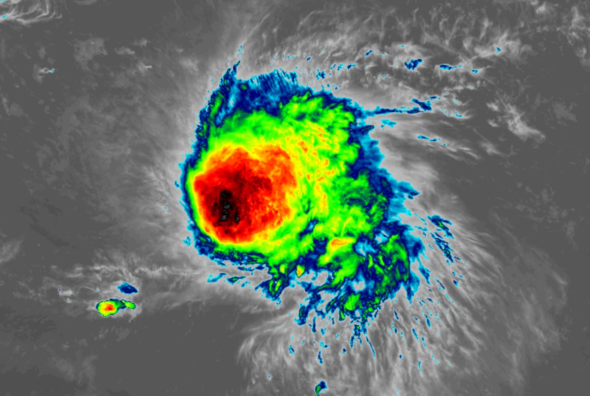
Tropical Storm Fiona continues to march west, inching closer to U.S. interests in the U.S. Virgin Islands and Puerto Rico. While the storm looks impressive on weather satellite photography, it remains in an atmosphere hostile for any intensification. The National Hurricane Center (NHC) is waiting now on data from hurricane reconnaissance aircraft scheduled to get precise weather readings in, above, and around the season’s latest tropical storm.
According to the NHC, moderate westerly shear continues to displace Fiona’s deep convection about a degree to the east of the low-level center, with convective cloud tops as cold as about -80 degrees Celsius. The storm has winds estimated to be 50 mph; the NHC will adjust the actual strength once pending additional data from an Air Force Reserve Hurricane Hunter aircraft investigating the storm is ingested into computer systems. Moderate shear, generally out of the west, is expected to continue for the next several days. The NHC says that in itself should suppress significant strengthening, but it may not be enough to prevent any strengthening at all.
Strong low- to mid-level ridging over the western Atlantic is steering Fiona due west and this general motion, with some gradual decrease in forward speed, is likely to continue for the next couple of days. Beyond the next 5 days, confidence is lacking on where to forecast the storm’s next move. There is notable model divergence after 36 hours, with the stronger model output from the GFS, HWRF, and HMON model solutions turning a slower Fiona northwestward over the northern Leeward and Virgin Islands. On the other hand, other computer models such as the ECWMF, UKMET, and all of the consensus aids maintain a faster westward to west-northwestward motion across the far northeastern Caribbean Sea through the next three days. Given the expectation that moderate shear is likely to continue, the NHC track forecast favors the less-intense scenarios and shows a solution moving just south of the Virgin Islands and then near Puerto Rico in a few days.
After three days, a forecast weakness near the western extent of a ridge of high pressure over the Atlantic should allow Fiona to gain some latitude and possibly turn toward the northwest, moving across the Greater Antilles into the far southwestern Atlantic.
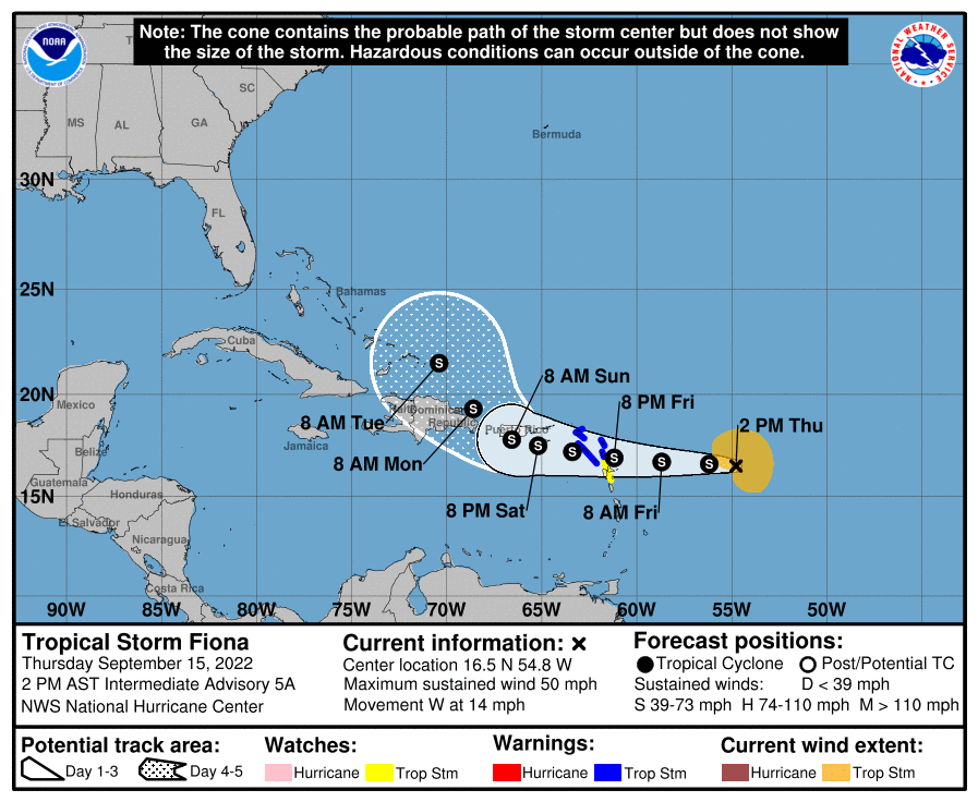
Based on the forecast track, the NHC says that additional watches or warnings will likely be required later today for portions of the Leeward Islands, Puerto Rico, and the Virgin Islands, and interests in these locations should monitor the latest forecast updates.
For now, tropical storm conditions are expected in portions of the Leeward Islands within the warning area by Friday evening. Tropical storm conditions are possible in portions of the Leeward Islands within the watch area by Friday night. Heavy rains from Fiona will reach the northern Leeward Islands tomorrow afternoon, spreading to the British and U.S. Virgin Islands and Puerto Rico Saturday into Sunday morning, and reaching eastern Hispaniola Sunday. This rainfall may produce flash and urban flooding, along with isolated mudslides in areas of higher terrain.
Elsewhere in the Atlantic, things have quieted down once again. While the peak of the hurricane season was last weekend, there are no signs of other systems on the horizon. The National Hurricane Center says there’s no chance of other tropical cyclones forming throughout the entire Atlantic Hurricane Basin over the next five days.
