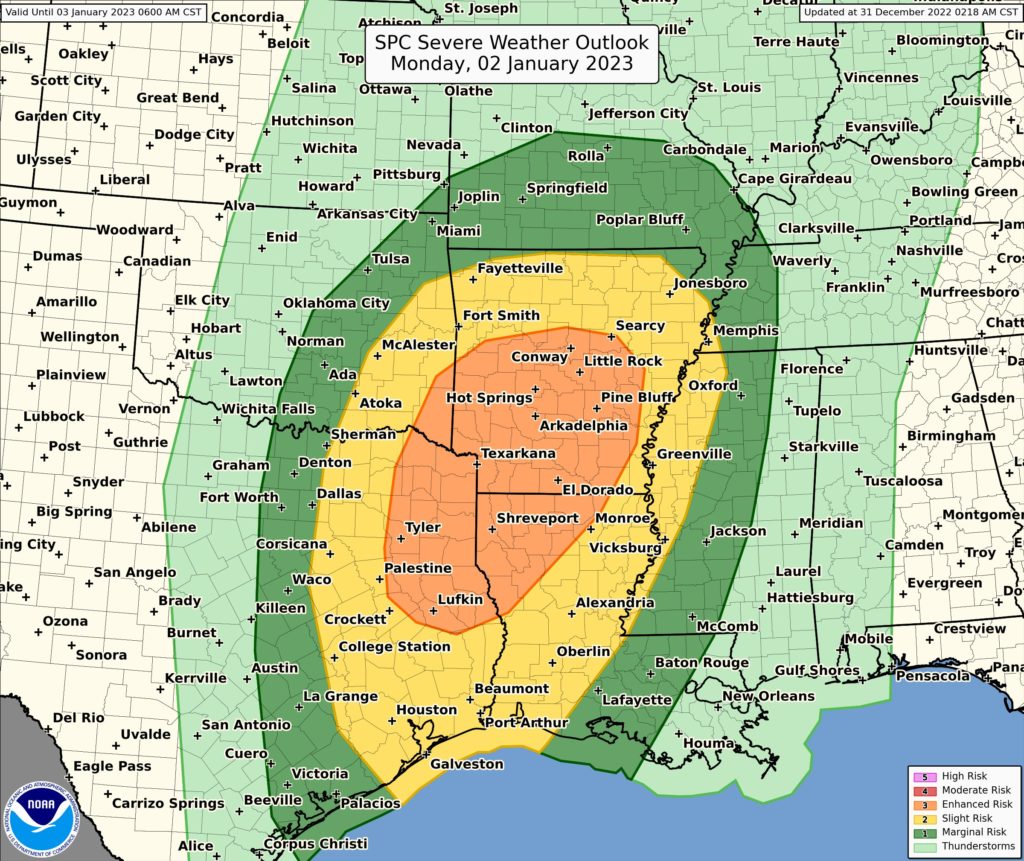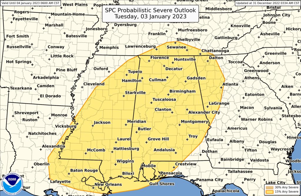
The National Weather Service’s Storm Prediction Center (SPC) is warning that 2023 will kick-off with a severe weather outbreak. Severe thunderstorms are expected Monday and Monday night from eastern Oklahoma and Texas into Louisiana and Arkansas and vicinity. Damaging gusts and tornadoes will be the main hazards with these storms. On Tuesday, the risk of severe weather will shift east of the Mississippi River Valley into the southeastern states of Alabama, Mississippi, as well as parts of Georgia, Tennessee, and Florida.
According to the SPC and their latest Convective Outlook, a strong large-scale mid and upper level trough is forecast over the Rockies and the Four Corners vicinity early Monday. This system will eject east and northeast, with most forecast guidance indicating a neutral to negative tilt to the trough as it moves over the Plains. Strong deep-layer southwesterly flow will overspread the southern Plains to the mid and lower Mississippi Valley while a strong low-level jet is forecast to move over the ArkLaTex area by late Monday afternoon. A southerly low-level flow will transport Gulf moisture north as a surface low deepens over the central Plains and shifts east and northeast. As this occurs, a dryline front will shift east across the southern Plains during the afternoon, and into the Ozark Plateau and Texas Coastal Plain overnight. These atmospheric ingredients will help provide sufficient destabilization in the atmosphere across much of eastern Oklahoma and Texas into Arkansas and Louisiana, with the with the greatest risk focused near southeast Oklahoma and the ArkLaTex area.
The SPC also warns that favorable vertical shear forecast to be present will support organized, rotating convection with an attendant risk from potentially significant damaging gusts and a couple of strong tornadoes.

On Tuesday, the upper trough will slowly shift east from the Plains to the Mississippi Valley, shifting the threat of severe weather east too. Showers and thunderstorms will likely be ongoing across parts of the Lower Mississippi Valley ahead of an eastward-advancing cold front. The SPC says that modest instability will overlap with strong vertical shear, and organized severe thunderstorms are expected across portions of the southern U.S..
With this severe weather set-up on Tuesday, damaging wind gusts and a few tornadoes appear possible given favorable vertical shear supporting rotating storms.