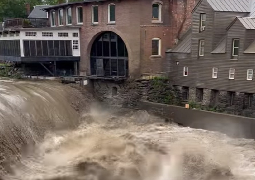
Life threatening floods are hitting Vermont hard today and officials are urging people to stay on safe high ground out of danger until the flood threat passes. The National Weather Service office in Burlington describes today’s flooding as “significant and catastrophic” as a historic flooding situation unfolds across the state.
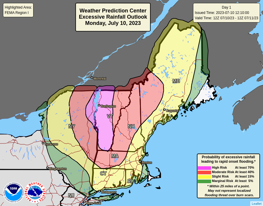
Rounds of heavy rain will continue to impact Vermont and north central New England through tonight, producing widespread 2-5″ of rain, with localized amounts of 7″+. With saturated soil and elevated river levels from recent rainfall, widespread significant to potentially catastrophic flash flooding is expected today and tonight. Widespread area and river flooding will persist into Tuesday even after the rain departs the area. Areas that have seen recent heavy rainfall, areas with steep terrain, and locations near fast-responding small streams have the highest chances of seeing flooding conditions unfold.
Turn around, don’t drown! NEVER drive through flood waters! Follow the advice of thr police and stay in place at high, safe locations out of flood danger zones. #VTwx https://t.co/GqAqvU7yE8
— the Weatherboy (@theWeatherboy) July 10, 2023
According to the National Weather Service, waves of heavy rain moved through the region overnight, with some towns getting over 3″ in just a few hours. Multiple road washouts have been reported in southern Rutland and Windsor Counties.

The heavy rainfall will also lead to sharp river rises, leading to widespread area and river flooding through
Tuesday. Unfortunately, muggy and unsettled conditions continue through the rest of the week with another system likely to bring rain to the area on Thursday into Friday.

Forecasters say the potentially widespread catastrophic flooding on this scale hasn’t been seen in Vermont since Hurricane Irene’s impacts in 2011. That system, which impacted Vermont as a Tropical Storm, dumped widespread 2-5″ amounts of rain with localized amounts of 7″ in the Green Mountains. Unlike today’s storm, that storm was joined with strong winds which tumbled over trees and power lines.
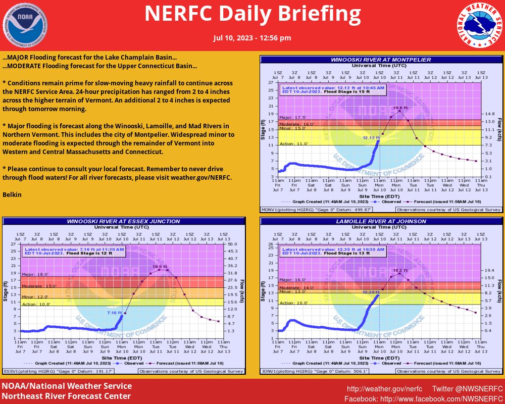
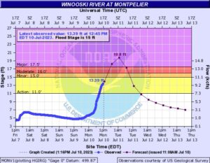
The Winooski River at Montpelier is expected to crest in the “MAJOR” flood category around midnight tonight. When Irene hit in 2011, a historic crest of 19.05 feet occurred in Montpelier. The flooding is forecast to rise almost a foot more to 19.8 feet by Tuesday morning.
According to the National Weather Service, Montpelier will be hit very hard. The Montpelier business district will be covered by water 8 -10 feet deep as widespread flooding of the Winooski valley will occur. Downtown Montpelier will be inundated, and local roads will be covered by water. Route 2 and railroad tracks along the river will be covered with water. There will be widespread field flooding throughout the Winooski River valley. This stage is equivalent to the FEMA 1 Percent Annual Chance Flood. Route 2 will flood at Bailey Avenue bridge, and the entrance to the Montpelier High School. Parking lots behind state office buildings next to the river will flood between Taylor Street and Bailey Avenue, and the approach to Taylor Street bridge will be inundated. Low lying fields and farmland will be inundated. Flooding will also begin on State Street at the Bailey Avenue bridge. Flooding may occur along Route 302 between Montpelier and Barre. Downstream from Montpelier to Waterbury, low lying local roads and farmland will flood. Water will approach the State of Vermont office complex in Waterbury.

Vermont Governor Phil Scott led a press conference today providing residents with an update on the situation. According to the Governor, 11 swift water rescue teams were positioned in strategic areas of the state on Sunday evening in anticipation of rescue needs. Those teams have conducted more than ten rescues since early this morning and calls for help continue to come in. Two rescue teams from North Carolina arrived in Vermont this morning to assist in operations, and more crews from Michigan, Massachusetts, New Jersey, and Connecticut are on their way to supplement their teams.
“If you can, please stay home today. However, if floodwaters are approaching your home, leave immediately. Make an evacuation plan before it becomes necessary,” warned Vermont State Police. They added, “Do not drive or walk through floodwaters. The water can obscure washouts, carry debris and strong currents, and be deeper than it appears.”