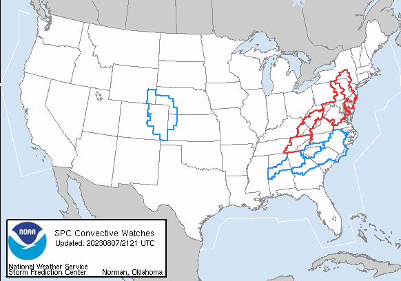
The National Weather Service and its Storm Prediction Center (SPC) has been busy today, issuing many Severe Thunderstorm and Tornado Watches and Warnings for a broad area of the eastern United States. Right now, Tornado Watches are up from eastern Tennessee to central New Jersey where the greatest threat of tornadic thunderstorms exists. Within this Tornado Watch zone, numerous Tornado Warnings have also been issued for RADAR-indicated tornadic cells.
Beyond tornadic cells, the SPC is also warning about damaging wind gusts that could be up to hurricane force. In their Public Severe Weather Outlook, the SPC warns about “widespread damaging winds, some hurricane force, a few tornadoes, and isolated large hail up to baseball size.”
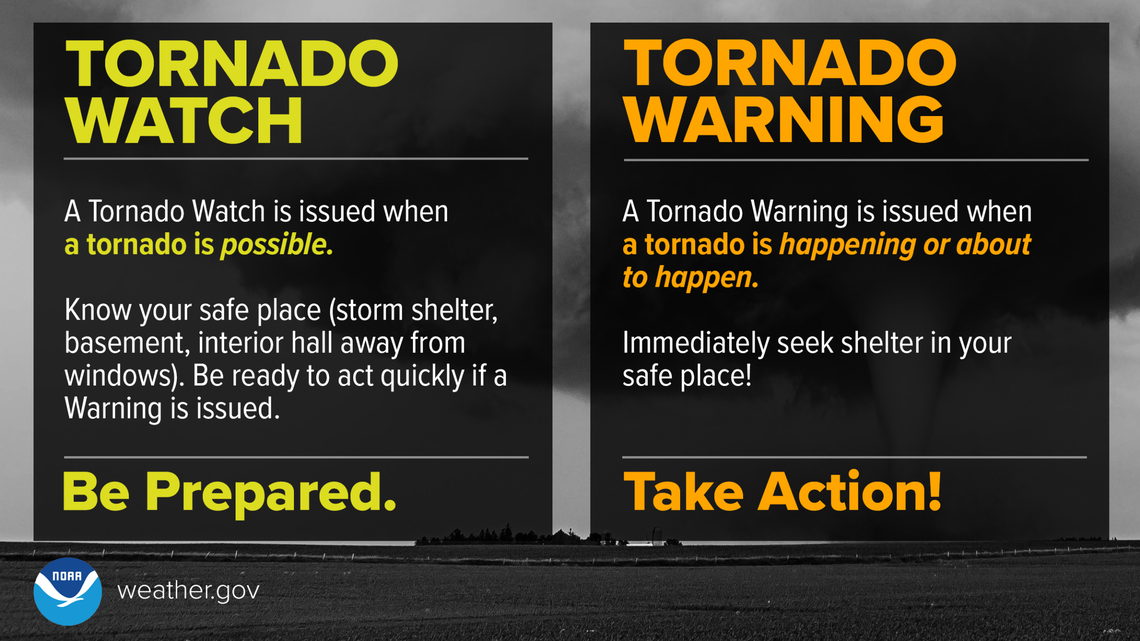
“Review your severe weather safety procedures for the possibility of dangerous weather today. Stay tuned to NOAA Weather Radio, weather.gov, or other media for watches and warnings. A watch means that conditions are favorable for severe thunderstorms over the next several hours. If a severe thunderstorm warning is issued for your area, move to a place of safety, ideally in an interior room on the lowest floor of a sturdy building.
According to the SPC, supercell structures exist across northeast Pennsylvania and a Quasi-Linear Convective System (QLCS) exists along the Pennsylvania, Maryland, Virginia border area, which will continue to approach the Hudson Valley. “A few instances of low-level rotation have occurred with the northeast Pennsylvania storms, with continuous reports of damaging gusts being received with the aforementioned QLCS,” the SPC said in a special Mesoscale Discussion issued this afternoon. Over the Hudson Valley, an adequate buoyancy/vertical shear parameter space exists to promote a continued severe threat with the ongoing storms as they approach the Delaware River. While damaging gusts appear to be the main threat given increasing linear storm modes. a couple of tornadoes could still occur with persistent supercells and/or QLCS circulations.
The SPC also says that adequate buoyancy has also materialized farther north into east-central New York, where approaching storms are also increasing in number and intensity. Due to this, the SPC may issue additional Tornado or Severe Thunderstorm Watches to the north and east of where the current watches are.
