• Skip to primary navigation
  • Skip to main content
  • Skip to primary sidebar

Weatherboy

Weatherboy Weather News, Maps, RADAR, Satellite, and Forecasts.

  • Local
  • Earth Science News
  • RADAR
  • Current Warnings
  • Satellite
  • Current Maps
  • Forecast Maps
  • Video

Tropical Storms Lee and Jova Forecast to Strengthen into Major Hurricanes

by Weatherboy Team Meteorologist - September 5, 2023

Current view of Earth from the GOES-East Weather Satellite shows Jova in the Pacific circled in red while also circled in red in the Atlantic is Lee. Both are forecast to become major hurricanes. Image: NOAA


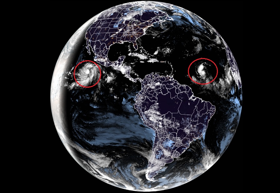
The National Hurricane Center is busy tracking two new tropical storms –one in the Atlantic and the other in the Pacific– that they forecast will rapidly intensify into major hurricanes in the coming days. The storm in the Pacific was named Jova while the storm in the Atlantic was named Lee earlier today.

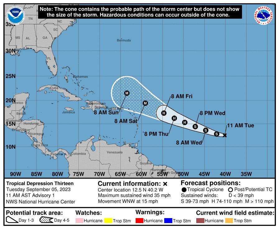
As of the last advisory from the National Hurricane Center (NHC), Tropical Storm Lee was located roughly 1,315 miles east of the Lesser Antilles. With maximum sustained winds of 45 mph and a minimum central pressure of 1005 mb or 29.68″, the storm is moving to the west-northwest at 16 mph.

According to the NHC, Lee is forecast to becomeĀ  a hurricane within the next few days, and likely become a major hurricane with 110+ mph winds by Friday. It is still too soon to say where it’ll head beyond next weekend; impacts to the U.S. and Canadian east coast are possible beyond that point.


Latest forecast track for Lee. Image: NHC


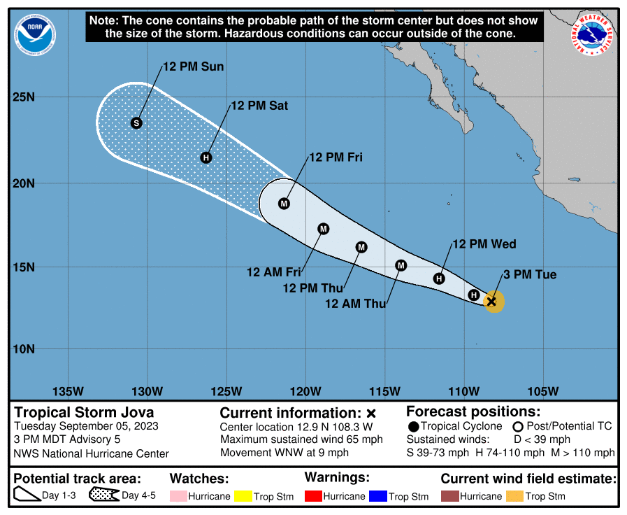
Meanwhile, the NHC is also busy tracking Tropical Storm Jova. As of the latest advisory from the NHC, Jova had maximum sustained winds of 65 mph and minimum central pressure of 998 mb or 29.47″; it was moving to the west-northwest at 9 mph.

According to the NHC, Jova is forecast to rapidly intensify and become a hurricane by tomorrow and a major hurricane by Wednesday night. It will move west-northwest and northwest in the coming days, staying away from land. As it heads west into the open Pacific, it or its remnants are expected to pass well north of Hawaii at this time.

Latest forecast track for Jova. Image: NHC


Primary Sidebar

Sponsored Ad

Search

Latest News

  • Threat of Damaging Winds and Flooding Rains Return to Mid Atlantic on Thursday
  • Tropical Cyclones Fizzle Around Hawaii While Tsunami Threat Passes
  • Tsunami Warning In Effect for all of Hawaii; Tsunami Advisory in Effect for Entire West Coast of U.S./Canada
  • Tsunami Warning and Watches Issued for U.S. West Coast, Hawaii, and Alaska
  • Hurricane Iona Becomes Major Hurricane South of Hawaii; Near Category Four
  • Hurricane Iona, Tropical Storm Keli Gain Strength Near Hawaii; Third Storm On the Way
  • Tropical Cyclone Develops Near Hawaii
  • Earthquake Rattles Central Arkansas
About | Careers | Contact | Contests
Terms | Privacy | Ad Choices
Weatherboy is a (R) Registered Trademark of isarithm LLC, All Rights Reserved.
All content herein is Copyright by Isarithm LLC 1997-2022