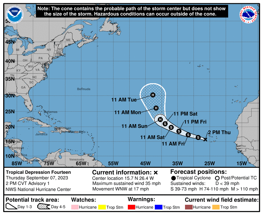
Tropical Depression #14 has developed in the eastern Atlantic; the National Hurricane Center expects it to intensify into the season’s next hurricane and be named Margot. There are no watches or warnings in effect for this storm at this time.
This new tropical cyclone is located about 160 miles west of the Cabo Verde Islands and has maximum sustained winds of 35 mph. The storm is moving to the west-northwest at 17 mph. The minimum central pressure is 1005 mb or 29.68″.
The National Hurricane Center expects the storm to continue marching west-northwest over the next several days while it picks up strength. Gradual strengthening is expected during the next several days, and the depression is forecast become a tropical storm later today or tonight. The meteorologists there also expect the storm to reach hurricane status by Sunday morning.
While this storm shouldn’t impact any land, it could impact the overall atmospheric “traffic pattern” over the Atlantic, helping influence the location of nearby high pressure and not-so-near Hurricane Lee as it moves closer to the U.S. and Canadian East Coast.