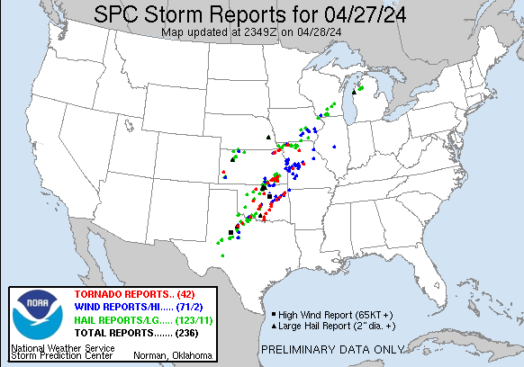
A significant tornado outbreak continues in portions of the central states. According to the National Weather Service’s Storm Prediction Center, there were 42 reports of tornadoes, 71 reports of damaging wind events, and 123 reports of hail including 11 damaging, large hail events. Meteorologists will tally today’s severe weather and share a count tomorrow.
Severe storms, capable of wind damage, a couple tornadoes and isolated large hail are likely this evening across parts of east Texas, northern/central Louisiana and southern Arkansas. A few severe storms, associated with wind damage and hail will also be possible in a broader area from the southern Plains and Lower Mississippi Valley northward to the Ozarks and Lower Missouri Valley.
Sad scenes coming in from tornado-ravaged portions of the U.S.: https://t.co/OoLXhnrx8i
— the Weatherboy (@theWeatherboy) April 28, 2024

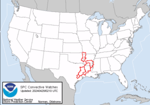
Currently, numerous counties and parishes across Texas, Louisiana, Arkansas, and Oklahoma are under Tornado Watches. Within these widespread Tornado Watches, Severe Thunderstorm and Tornado Warnings are being issued for especially dangerous cells.
More active and unsettled weather is forecast to continue across the mid-section of the country through the next couple of days as multiple disturbances embedded within a slow-moving upper-level trough traverse the western U.S. toward the Great Plains. The low pressure system responsible for the latest outbreak of strong to severe thunderstorms across the central to southern Plains today will continue to track northeast across the upper Midwest on Monday. According to the National Weather Service, another bout of strong to severe thunderstorms can be expected to impact areas farther east across the ArkLaTex region through tonight as the trailing cold front associated with the low pressure system edges farther to the east. In addition, heavy downpours associated with these storms will result in flooding concerns across the region. By Monday, the highest threat of severe weather and heavy rain will shift farther southeast toward to central Gulf Coast region, mainly over Louisiana, as the front begins to weaken. A lower risk of severe weather and heavy rain will extend farther northeast into the Tennessee Valley on Monday.