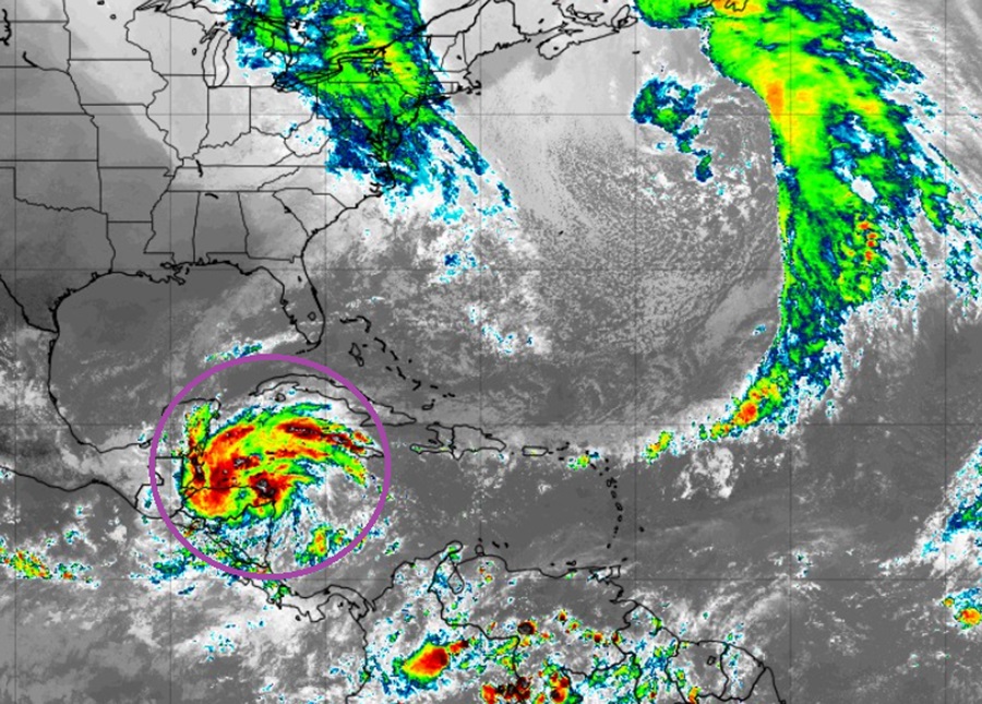
Tropical Storm Sara developed today out of the area the National Hurricane Center had been calling Potential Tropical Cyclone #19. However, its says as a tropical cyclone concern may be limited due to its forecast interaction with the Yucatan Peninsula. Earlier forecasts suggested the storm would stay over open water allowing it to grow; instead, it now appears the storm center will stay primarily over land, taking away its ability to be an ongoing tropical threat.
While the long range risks have fallen, there is still a short-term threat of epic flooding and landslides.
As of the latest update from the National Hurricane Center, Tropical Storm Sara was located about 165 miles east-southeast of Isla Guanaja, Honduras and about 65 miles north-northwest of Cabo Gracias a Dios on the Nicaragua / Honduras border. With maximum sustained winds of 40 mph, the storm had a minimum central pressure down to 998 mb or 29.47″.
Sara is moving toward the west near 10 mph. According to the National Hurricane Center, a westward motion at a slower forward speed is expected during the next couple of days. A slow west-northwestward motion is forecast by late Saturday. On the forecast track, the center of Sara will move near the northern coast of Honduras during the next couple of days, and approach the coast of Belize on Sunday. Some strengthening is possible if the center of Sara remains offshore of the northern coast of Honduras.
On the forecast path, Sara is expected to move directly over the Yucatan Peninsula and drop incredible amounts of rain. Through early next week, rainfall amounts of 10-20″ with isolated storm totals around 30″ are expected over northern Honduras. This rainfall will lead to widespread areas of life-threatening and potentially catastrophic flash flooding and mudslides, especially along and near the Sierra La Esperanza. Elsewhere across the rest of Honduras, Belize, El Salvador, eastern Guatemala, western Nicaragua, and the Mexican State of Quintana Roo, Sara is expected to produce 5-10″ of rain with localized totals around 15″ through early next week. This will result in areas of flash flooding, perhaps significant, along with the potential of mudslides.
With the storm moving deep into the Yucatan Peninsula, the National Hurricane Center expects Sara’s circulation to be significantly damaged. In their latest update, they believe the integrity of the storm will be so weak that it should dissipate the storm within 5 days before it enters the southern Gulf of Mexico. Whether or not that happens will help determine what the remnants of this storm will do to the U.S. Gulf Coast with time. At the least, moisture should stream north into the United States from the Gulf of Mexico, setting the stage for soaking rains for some.