The National Hurricane Center says Hurricane Rafael has become better organized and stronger in their latest update while also discussing the chance that a new system may form nearby in the coming days. The Atlantic Hurricane Season had a late start this year and it may have a busy ending; the season officially ends November 30 but storms do linger into and even form in December from time to time.
Hurricane Rafael is currently spinning about in the Gulf of Mexico about 260 miles west-northwest of Havana, Cuba and 325 miles northeast of Progreso, Mexico. Maximum sustained winds have increased to 105 mph while minimum central pressure is down to 968 mb or 28.59″.
Because the storm is over open water, there are no coastal watches or warnings in effect.
Rafael is moving toward the west-northwest near 9 mph for now and the National Hurricane Center (NHC) says a turn toward the west is expected tonight, with this general motion at a slightly slower forward speed continuing through the weekend. On the forecast track, Rafael is expected to move over the southern Gulf of Mexico for the next few days. Some small intensity fluctuations are possible tonight but weakening is forecast to begin later tomorrow and continue through the weekend.
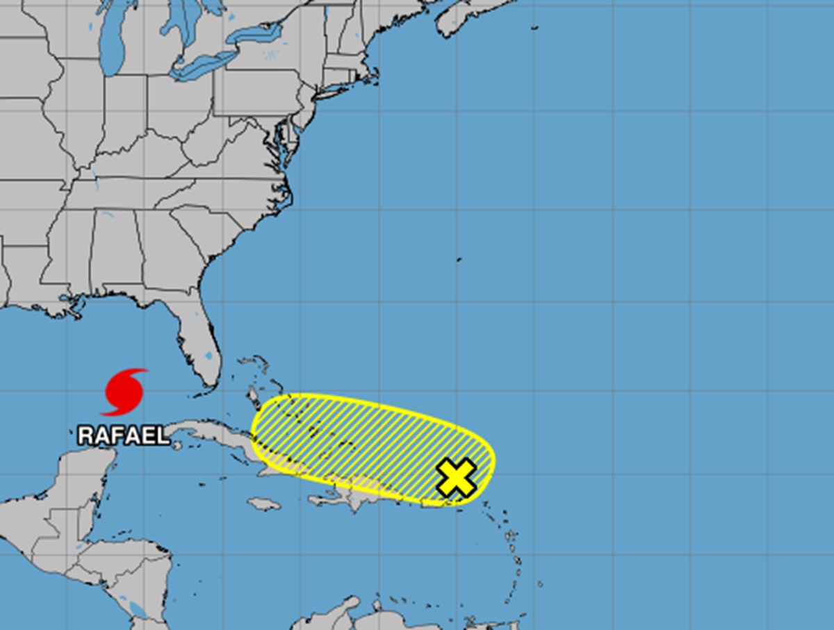
While Rafael meanders in the Gulf of Mexico, the National Hurricane Center is also watching another nearby area for signs of possible tropical cyclone development. According to the NHC, a trough of low pressure located near and north of the Virgin Islands continues to produce disorganized showers and thunderstorms. Some gradual development of this system is possible during the next couple of days while it moves westward near the Greater Antilles. If the system does develop, it’s too soon to say whether or not this would be another system in the Gulf of Mexico or perhaps an East Coast threat. Regardless of development, locally heavy rains are possible across the northern Leeward Islands, the Virgin Islands, Puerto Rico, Hispaniola, and the southeastern Bahamas through Saturday.
Elsewhere in the Atlantic, there are no other areas of concern that the National Hurricane Center is monitoring for potential tropical or subtropical cyclone development.
