According to the FAA, airspace in portions of the Mid Atlantic was closed tonight to allow for “space operations”; NASA previously said that there would be an attempt to launch a sub-orbital spacecraft from the NASA Wallops Spaceport. A short time ago, NASA released a brief statement: “The mission launched on December 13 at 8pm and is complete.” There are no photographs or videos from tonight’s launch; the visitors center was closed to both the public and the media and no livestream was available. NASA and the U.S. Government have offered no additional comment on tonight’s secretive launch.
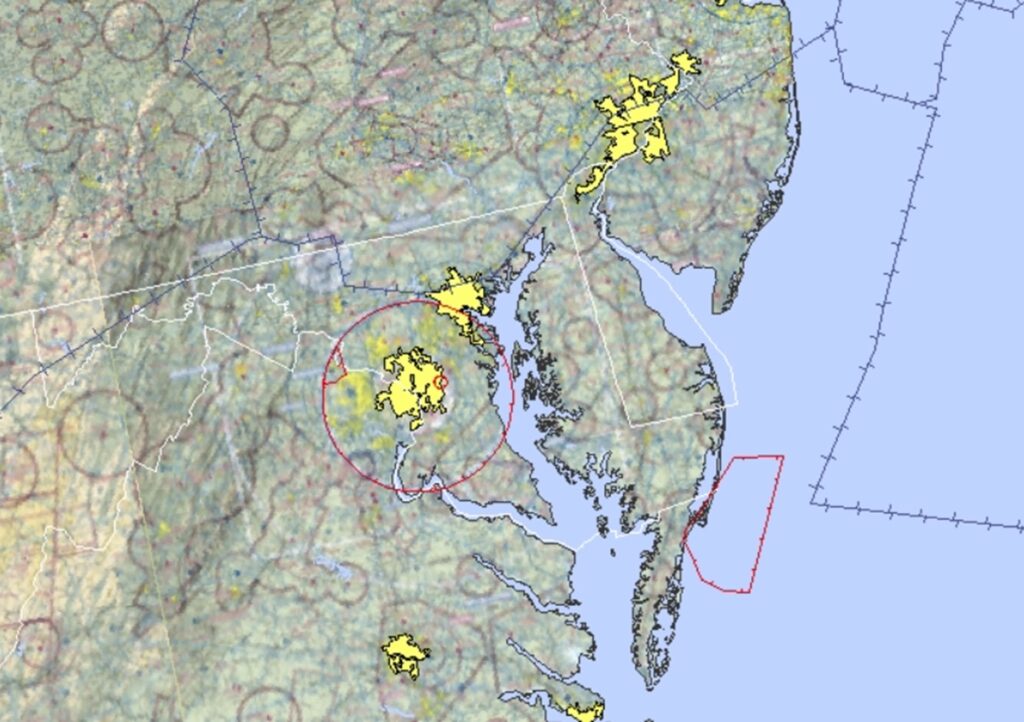
The Federal Aviation Administration says “no pilots may operate an aircraft in the areas covered by this NOTAM from the surface and up to and including 30,000 feet. A NOTAM, or Notice to Airmen, is a notice that provides flight operators with important information about flight conditions, hazards, and other matters that could affect a flight. NOTAMs are filed with aviation authorities to alert pilots of potential hazards or other issues that could impact a flight.
In the case of this NOTAM, it is in effect during portions of the evening on December 13, 14, 15, 16, and 17 and includes an area around and to the east of the Wallops Spaceport facility along the Virginia and Maryland coast. With NASA confirming tonight’s launch, it isn’t yet known whether or not all the NOTAMs will remain in effect for the next several evenings. With prior launches, NOTAMs are issued on back-up launch dates/times in case something causes a launch to scrub. As of publication time of this article, the NOTAMS were still in effect for the next several days.

The spaceport on the Virginia coast is no stranger to rockets. Nor is it a stranger to drone activity. The Flight Facility at Wallops is operated by the Goddard Space Flight Center in Greenbelt, Maryland. The spaceport, located on Wallops Island on the Eastern Shore of Virginia about 100 miles north-northeast of Norfolk, primarily serves to support science and exploration missions for NASA and other federal agencies. Since its founding in 1945, there have been over 16,000 rockets launched from Wallops, with rockets of a wide range of shape and size launched. Some rockets have been as small as Super Loki meteorological rockets to orbital-class vehicles. Cargo rockets with supplies to the International Space Station are launched from this base.
In addition to rocketry, the spaceport also supports drone activity along the east coast. In 2013, the Wallops facility was home to the HS3 Hurricane and Severe Storm Sentinel mission, which used Global Hawk drones typically used in military applications to study the weather. The Global Hawk is about 15.2′ tall and has a 116.2′ wingspan; it can fly 11,000 nautical miles up to 65,000 ft. high. From Wallops Island, Global Hawk can dwell for 18 hours at 1,370 miles from its Virginia base or about 10 hours at 3,291 miles from takeoff. The Hurricane & Severe Storm Sentinel (HS3) was a 5 year mission specifically targeted to investigate processes involved in hurricane formation and intensity . That mission used two Global Hawks, both of which were housed at the Wallops Island facility for hurricane season.
Activity at the spaceport isn’t always public. Often top secret military rockets are launched. NASA will alert the public that such secret launches may create thunder-like noise in portions of the Mid Atlantic, but are often light on details and specifics. Past secretive rocket launches have been performed for the U.S. Navy, the U.S. Space Force, and the National Reconnaissance Office, the space-based arm of the U.S.’s Department of Defense.
While NASA will generally release which agency is behind a launch, no such announcement was shared with tonight’s launch.
Tonight’s mysterious launch is concurrent with a surge of drone sightings around New Jersey and surrounding states.
The Department of Homeland Security and the FBI released a joint statement about the recent report of drone activity in New Jersey: #NJwx https://t.co/l7dcLsdYNs
— the Weatherboy (@theWeatherboy) December 14, 2024
