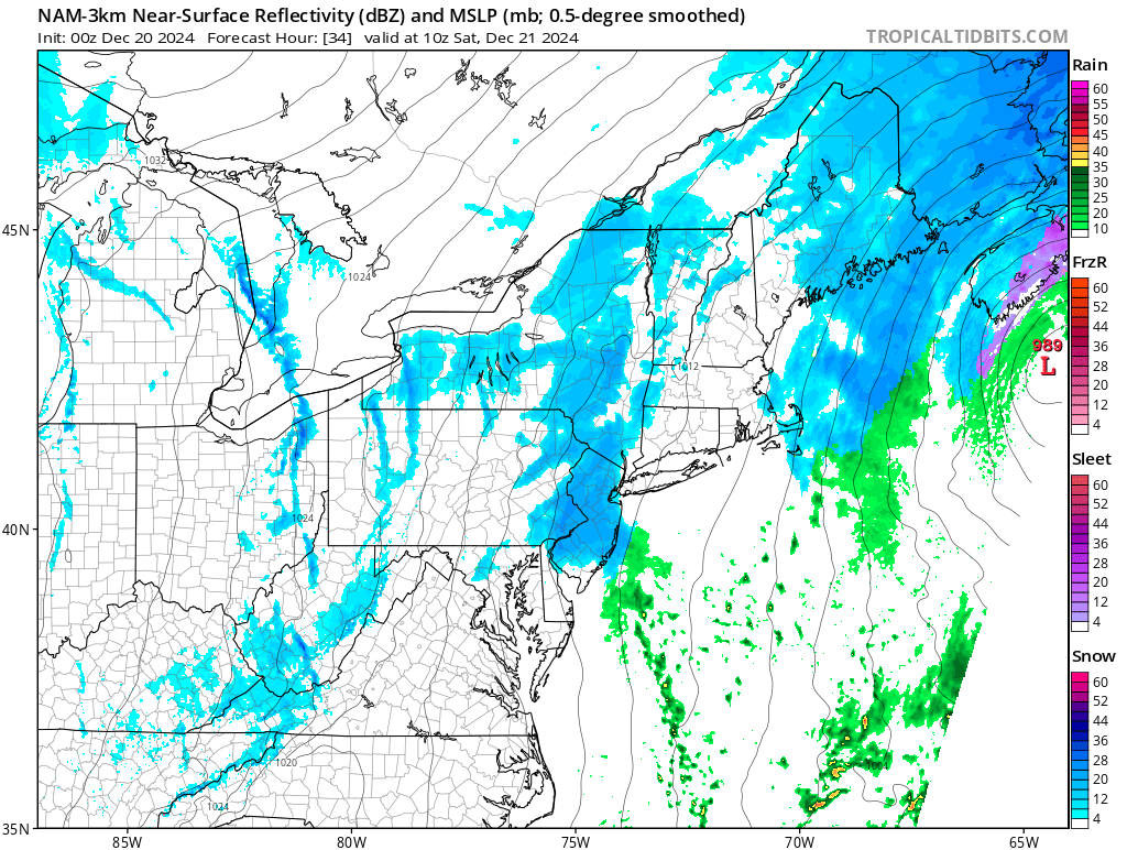
Light snow and snow showers will be likely across portions of the Northeast from Maine to Delaware Friday into Saturday as a weak weather disturbance moves through. Some areas could pick up a few inches of snow but most will just see snow showers that leave not much more than a dusting, if anything at all.
Light snow is likely across portions of the northeast Friday into Saturday: pic.twitter.com/7DNyE3Pwny
— the Weatherboy (@theWeatherboy) December 20, 2024
In the upper levels of the atmosphere tomorrow, a fairly strong, robust upper level trough will continue to dig as it moves eastward and becomes centered near the coast by late Friday night. As this occurs, the initial surface low associated with this feature will fizzle out near Ohio while as a secondary low strengthens and moves north and east off the North Carolina coast. This system will produce mainly light precipitation over the northeast from south to north through Friday morning with this continuing through the afternoon.
Moderating temperatures should allow this to be mainly rain through the day near and south of the I-95 corridor with mixed rain and snow farther north into portions of Berks county into the Lehigh Valley and then running east into portions of northern New Jersey along the I-78 corridor. North of here, precipitation should be mainly snow across the southern Poconos into northwestern New Jersey. These areas will see highs only in the low to mid 30s while farther south, near and south of the I-95 corridor, highs get into the upper 30s and 40s. By sunset Friday, there may already be some snow accumulation on the ground near and north of the I-78 corridor.
During Friday evening and into Saturday morning, the low offshore will be starting to pull away from the coast but there may be a surface trough extending back into the area that lingers keeping precipitation going much of the night. Also winds will be turning more northerly which, when combined with the diurnal cycle, will help to cool temperatures. This means the rain/snow transition line will shift south with snow likely across the I-95 corridor and even the coast before precipitation wraps up.
It appears there could be a coating up to a half inch or so of accumulation near the urban corridor, especially on grassy surfaces. Farther north and west expect around 1-2″ across the Lehigh Valley north and east into northwestern New Jersey with 2-3″ likely across the Pocono Plateau.
The National Weather Service cautions that if precipitation is a bit heavier and a change to snow occurs sooner, amounts could be higher than currently forecast, with potentially 1-2″ in the urban corridor from around Philadelphia to Trenton with 2-4″ north of there.
For Saturday, deepening low pressure continues to pull away from the northeast with a strong pressure gradient setting up as an Arctic high builds in. The result will be a very cold, blustery day with temperatures only rising a few degrees due to the cold advection pattern. Any lingering light snow will come to an end during the morning with little to no additional accumulation.