A system more common in months other than May will treat the northeastern U.S. to cool and damp conditions over many days. This nor’easter system won’t be a significant storm, but it will bring unpleasant weather toa broad region over an extended period of time.
Low pressure will move east into the Ohio Valley while a secondary low is forming over the Mid-Atlantic today. This low is forecast to slowly lift to the north and east and will merge with the primary low over New England late this week.
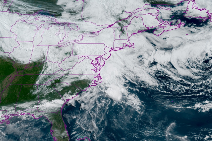
Primary low pressure, both at the surface and aloft, are centered over the Ohio Valley, while a secondary low continues to organize and develop over the Mid-Atlantic coast. The secondary low will track out to sea tonight then will lift north along the coast late tonight and Thursday morning, and will eventually be near Montauk Point late Thursday. Meanwhile, the primary low will lift into the eastern Great Lakes tonight, where it will meander through Thursday.
The first wave of rain associated with the developing secondary low is moving offshore, while another area of rain is moving in from the west, associated with some weak shortwave energy.
As the stronger shortwaves approach from the Appalachians tonight to to the East Coast, rain will ramp up along the East Coast and may be heavy at times during the overnight hours and into Thursday morning.
New Jersey, southeastern Pennsylvania, Delaware, and eastern New York will be especially wet. A widespread 0.5 to 1″ of rain will fall over the area, mostly over southeast Pennsylvania and New Jersey, while around 0.5″ will fall over the Delmarva. 1 to 1.5″ of rain is expected along the New Jersey shore.
The National Weather Service warns that minor urban and poor drainage flooding are possible by Thursday morning. They also caution that they “cannot rule out a few thunderstorms as well during the overnight as those shortwaves pass through the region.”
Rain will become more showery in nature on Thursday while conditions will remain cloudy and cool for Friday in much of the Northeast. Another shortwave approaching from the west may trigger a round of afternoon showers and isolated thunderstorms during Friday afternoon. Later Friday into Saturday, multiple weak disturbances will continue to swing through the Northeast. As a result, isolated to scattered showers will continue on Friday with a few showers on Saturday.
With clouds and the threat of showers lingering, temperatures will remain cooler than normal into the weekend.
