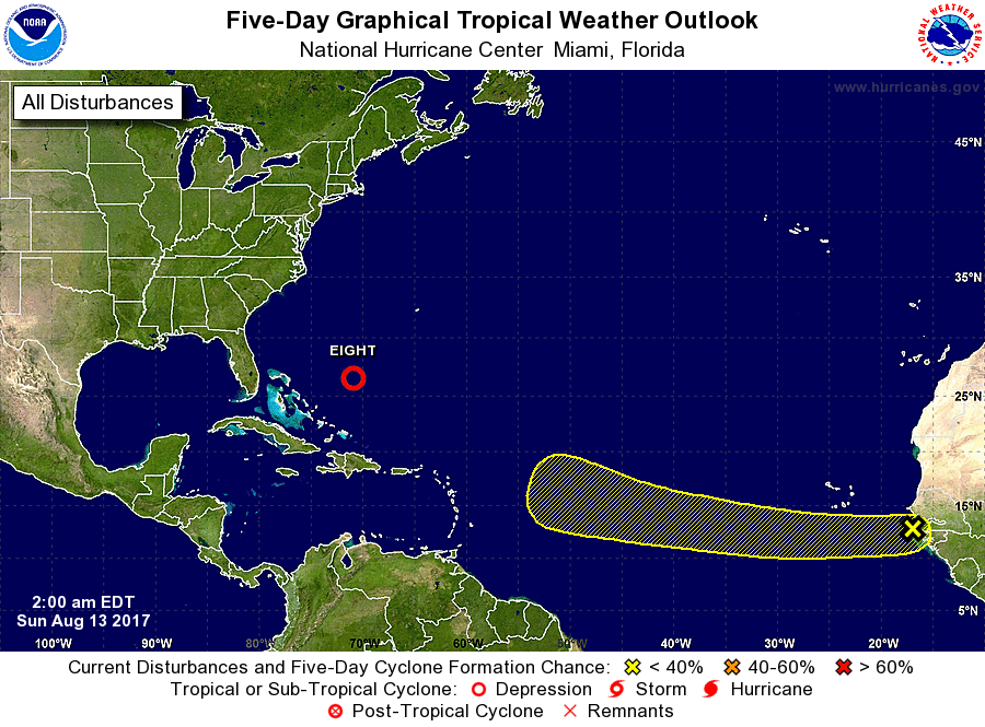
Tropical Depression #8 formed yesterday and is expected to be upgraded and named Gert today; meanwhile, the National Hurricane Center is monitoring a new disturbance over the far Atlantic; should that system be named, it would become Harvey after Gert.
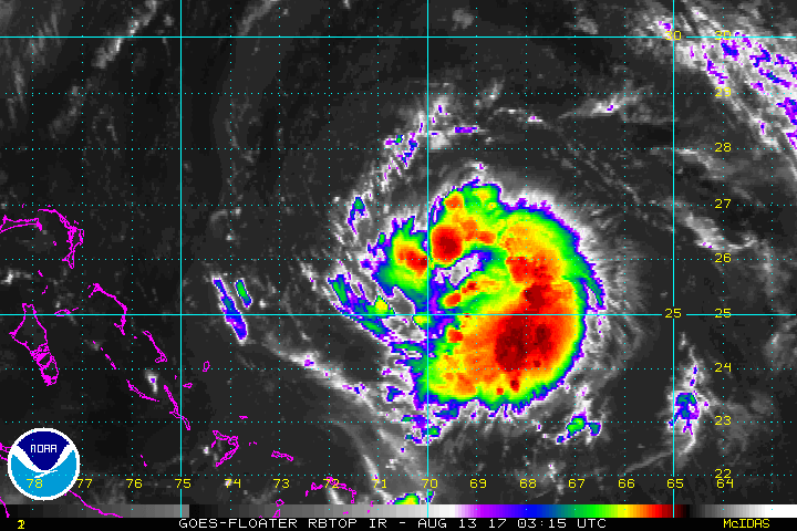
Tropical Depression #8 is forecast to move north-northwestward to northward for the next 36 hours around the western portion of a deep-layer subtropical ridge that is oriented east-west along 30-32N latitude. In about 2 days, a vigorous shortwave trough currently located over the northern Plains is expected to dig east-southeastward and weaken the ridge along the east coast of the United States from the Carolinas northward to New England. The increasing southwesterly flow ahead of the trough is forecast to accelerate the cyclone northeastward, on an optimal track about midway from the U.S. and Bermuda and keeping it away from those two land masses.
While the storm system will remain off-shore, rough seas and rip tide currents are possible along the US East Coast. Even though a direct impact is not expected at all, these indirect impacts could be hazardous and people visiting beaches from Florida to Massachusetts should exercise caution. Cruise ship passengers between the US East Coast and Bermuda should also expect rough seas.
The depression is expected to remain in a relatively low vertical wind shear environment for the next 24-36 hours, but also within a fairly dry mid-level moisture environment for the next few days. As a result, only modest strengthening is expected during the next couple of days. By Tuesday, southwesterly vertical wind shear is expected to steadily increase ahead of the aforementioned shortwave trough, which should act to cap any additional intensification.
A storm of greater consequence may be forming in the far Atlantic. A tropical wave that has just emerged off the west coast of Africa is forecast to move westward over the next couple of days and merge with a broad area of low pressure located southwest of the Cabo Verde Islands. Thereafter, environmental conditions are expected to be conducive for gradual development of the system while it moves westward to west-northwestward at 10 to 15 mph over the open tropical Atlantic Ocean.
Some global computer forecast models that aid meteorologists with their weather forecasting are quite bullish on this system over time. Both the American GFS and European ECMWF forecast this system to become a tropical cyclone over time. Some guidance also suggests that this system could become a hurricane and make landfall along the US East Coast. However, any such event is many days away; the most aggressive model brings this storm ashore no earlier than August 23. It is important to point out that long-range guidance around tropical cyclones has a huge margin of error and any one solution, landfall or not, shouldn’t be etched in stone so far in the future.
The next tropical cyclone to be named after Gert would be called Harvey.
Experts believe this Atlantic Hurricane Season, which runs through to the end of November, will be a busy one. Dr. Phil Klotzbach and the experts at Colorado State University updated their seasonal outlook again on July 5, showing a much more active than normal season expected. The National Oceanic and Atmospheric Administration (NOAA) also released their own forecast which shows this hurricane season to be likely more active than others.
