A nightmare is unfolding in Texas as Harvey approaches the Lone Star State’s coast, gaining strength as it does so. Unlike most tropical cyclones that strike landfall and quickly move on and dissipate, it appears Harvey will stall over Texas for a prolonged period of time, dumping epic amounts of rain as it does so. Beyond a significant storm surge threat, there is a major rain water flood threat with unimaginable totals in excess of 2 feet possible.
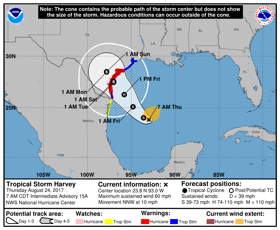
With this nightmare scenario unfolding before our eyes, the National Hurricane Center and National Weather Service have issued a large amount of watches and warnings for the region. A Storm Surge Warning is in effect for Port Mansfield to San Luis Pass, Texas, and a Storm Surge Watch is in effect for south of Port Mansfield Texas to the Mouth of the Rio Grande and north of San Luis Pass to High Island, Texas. A Storm Surge Warning means there is a danger of life-threatening inundation, from rising water moving inland from the coastline, during the next 36 hours in the indicated locations. A Storm Surge Watch means there is a possibility of life-threatening inundation, from rising water moving inland from the coastline, in the indicated locations during the next 48 hours. Persons located within these areas should take all necessary actions to protect life and property from rising water and the potential for other dangerous conditions. Residents in the storm surge advisory areas should promptly follow evacuation and other instructions from local officials.
A Hurricane Warning is in effect for Port Mansfield to Matagorda, Texas. A Hurricane Warning means that hurricane conditions are expected somewhere within the warning area. A warning is typically issued 36 hours before the anticipated first occurrence of tropical-storm-force winds, conditions that make outside preparations difficult or dangerous. Preparations to protect life and property should be rushed to completion. A Hurricane Watch is in effect for south of Port Mansfield Texas to the Mouth of the Rio Grande. A Hurricane Watch means that hurricane conditions are possible within the watch area.
A Tropical Storm Warning is in effect for north of Matagorda to High Island, Texas, and south of Port Mansfield Texas to the Mouth of the Rio Grande. A Tropical Storm Watch is effect for south of the Mouth of the Rio Grande to Boca de Catan, Mexico. A Tropical Storm Warning means that tropical storm conditions are expected somewhere within the warning area within 36 hours while a Tropical Storm Watch means that tropical storm conditions are possible within the watch area.
The National Hurricane Center also cautions people in Louisiana to watch the progress of this system; watches or warnings may be required there in the coming days.
Many threats are arriving on land as a result of Harvey, with rain and storm surge being the top threats. Wind and surf are additional concerns.

RAINFALL:
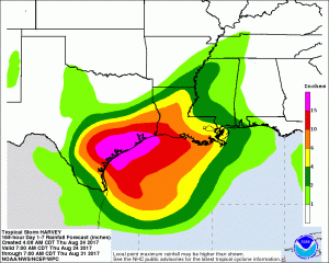
Harvey is expected to produce total rain accumulations of 10 to 15 inches with isolated maximum amounts of 25 inches over the Texas coast through next Wednesday. During the same time period, Harvey is expected to produce total rain accumulations of 3 to 9 inches along its outer radius including parts of south, central, and eastern Texas and the lower Mississippi Valley. Rainfall from Harvey may cause life-threatening flooding.
STORM SURGE:
The combination of a dangerous storm surge and the tide will cause normally dry areas near the coast to be flooded by rising waters moving inland from the shoreline. The water is expected to reach the following heights above ground if the peak surge occurs at the time of high tide:
- Port Mansfield to San Luis Pass…5 to 7 ft
- San Luis Pass to High Island…2 to 4 ft
- Mouth of the Rio Grande to Port Mansfield…2 to 4 ft
The deepest water will occur along the immediate coast near and to the northeast of the landfall location, where the surge will be accompanied by large and destructive waves. Surge-related flooding depends on the relative timing of the surge and the tidal cycle, and can vary greatly over short distances. For information specific to your area, please see products issued by your local National Weather Service forecast office.

WIND:
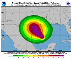
Hurricane conditions are likely within the hurricane warning area late Friday or Friday night, with tropical storm conditions expected to first reach the coast in the hurricane warning area Friday.
SURF:
Swells generated by Harvey are likely to affect the Texas, Louisiana, and northeast Mexico coasts by Friday. These swells are likely to cause life-threatening surf and rip current conditions. Please consult products from your local weather office.
Residents in or near watch/warning areas for Tropical Storm Harvey should act on their hurricane action plans. People along any Gulf or Atlantic coastline, and Hawaii, should be prepared every hurricane season; with Harvey here, people should ensure they are ready for the arrival of a potential disaster wherever they may be.
Experts believe this Atlantic Hurricane Season, which runs through to the end of November, will be a busy one. Dr. Phil Klotzbach and the experts at Colorado State University updated their seasonal outlook again on July 5, showing a much more active than normal season expected. The National Oceanic and Atmospheric Administration (NOAA) also released their own forecast which shows this hurricane season to be likely more active than others.