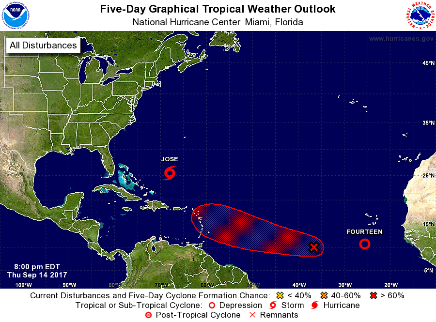
This is the peak week of the Atlantic Hurricane Season which stretches from the beginning of June to the end of November, and right on cue, the tropics are very active. New forecast guidance suggests Jose, as a hurricane, could impact the northeast. Meanwhile, the National Hurricane Center (NHC) has begun issuing advisories for the latest tropical depression of the season, Number 14.
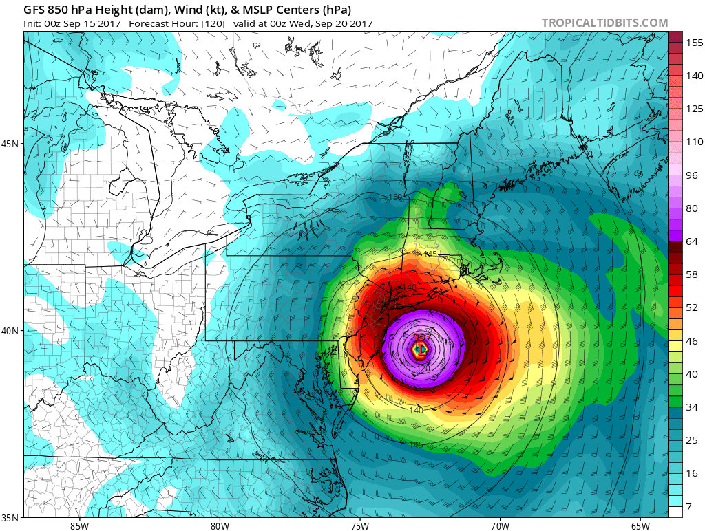
and making landfall on eastern Long Island later Tuesday evening. Image: tropicaltidbits.com
Jose, now a tropical storm, is expected to intensify back to hurricane status soon. As a strong category 1 or category 2 hurricane, the storm may impact portions of the east coast early next week. The latest run of the American GFS forecast model suggests that Jose will brush New Jersey with hurricane force winds and storm surge before making landfall over eastern Long Island; from there, it brings the storm up into southern New England, eventually impacting the Boston metro area. It is still too early to say with certainty if the GFS model is right; the National Hurricane Center only issues forecasts five days out and for now, the cone of uncertainty keeps the storm just off the Jersey coast through Tuesday. With models noticeably shifting closer to the US East coast today, it is imperative that anyone from North Carolina north to Maine have their Hurricane Action Plan in order.
While Jose potentially threatens the northeast coast as a landfalling hurricane, rough surf, strong rip currents, storm surge, coastal flooding, and beach erosion are all possible even if Jose stays off-shore. Residents along the coast need to monitor the evolving storm and be prepared to take swift action to protect life and property even if the storm only provides a glancing blow to the region.
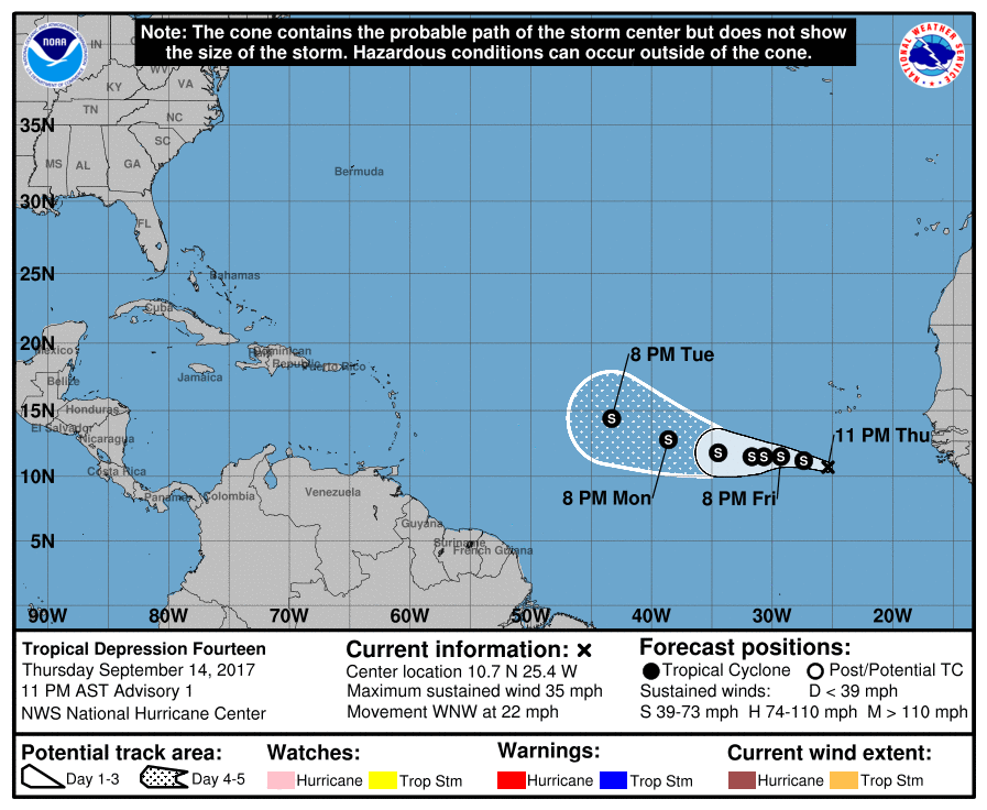
Far in the Atlantic, the next system of the 2017 Atlantic Hurricane Season is taking shape. The National Hurricane Center has classified a new disturbance south and west of the Cape Verde Islands as Tropical Depression #14. Convection associated with an area of low pressure over the far eastern Atlantic has become much better organized during the past 12 hours, with an increase in banding over the western portion of the circulation. The system is currently embedded
within an area of light to moderate easterly shear. This should not prevent the system from gradually strengthening while it moves over warm water during the next couple of days. After that time, a mid-to upper-level trough over the central Atlantic is expected to cause an increase in southwesterly shear, which could become quite strong by days 4 and 5. As a result, weakening is expected late in the forecast period. Before that period of weakening, Tropical Depression #14 is forecast to become a tropical storm; if it is the next named storm, it will be called Lee.
Also in the Atlantic is another disturbance showing signs of intensification; this system could pose a threat to areas hit hard by Hurricanes Irma and Jose in the Caribbean and East Coast with time. Locatedabout 850 miles west-southwest of the Cabo Verde Islands, this new tropical wave is producing disorganized cloudiness and showers. Environmental conditions are expected to be conducive for gradual development of this system during the next several days, and a tropical depression will likely form early next week while it moves westward at about 15 mph across the tropical Atlantic. The National Hurricane Center believes there’s an 80% chance of this system becoming a tropical cyclone within the next five days. If it becomes a tropical storm after Lee, it will be called Maria. If it develops before Tropical Depression #14, this system will be called Lee.
Experts believe this Atlantic Hurricane Season, which runs through to the end of November, will be a busy one. Dr. Phil Klotzbach and the experts at Colorado State University updated their seasonal outlook again on July 5, showing a much more active than normal season expected. The National Oceanic and Atmospheric Administration (NOAA) also released their own forecast which shows this hurricane season to be likely more active than others.
