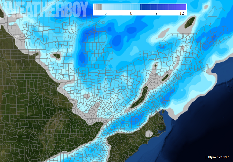
Two snowstorms are inching closer to the coast than expected yesterday, increasing possibilities for and amounts of snow for many. A wide area of 2-4″ snowfall is now expected over portions of central North Carolina, eastern Virginia, eastern Maryland, Delaware, New Jersey, eastern Pennsylvania, southeastern New York, Connecticut, Rhode Island, Massachusetts, New Hampshire, eastern Vermont, and Maine. There will be some heavier bands of 3-6″ over Delaware, eastern Maryland, southern New Jersey, and Maine, with some isolated 6-9″ amounts possible. Additional snow is expected over Michigan, Ohio, and western Pennsylvania and New York as Lake Effect snows kick up there. And while eyes are on this initial system for Saturday, eyes are also on a mid-week system for next week which could bring another round of snow closer to the coast than expected.
The first system for the weekend is showing better organization today and also a track closer to the coast. All of the operational models are now showing a good chance for some accumulating snow across parts of DelMarVa and New Jersey for the early part of the weekend. This snow may force the National Weather Service to raise Winter Weather Advisories for the region; for now, none have been issued. The snow will taper off from west to east on Saturday evening, although some snow showers will linger over the mountains of northeastern Pennsylvania and central New England. Lake Effect snows will also persist down-wind of the Great Lakes.
Temperatures will continue below normal through the weekend for the Mid Atlantic, Great Lakes Region, and New England.
A ridge of high pressure will return early in the week but a new system will come to the region by the middle of the week. Sunday and Monday will be dry at the coast compliments of that ridge; however, some clouds and widely scattered snow showers and flurries are still possible in northeast mountain communities. Later next week, the upper trough that is setting up across the east this weekend will be progressing across the Middle Atlantic and Northeast. More cyclogenesis is possible with this and it is becoming more likely that more precipitation could be across the Mid Atlantic Tuesday night into Wednesday. That next system could produce more snow than this first one and bears watching.
