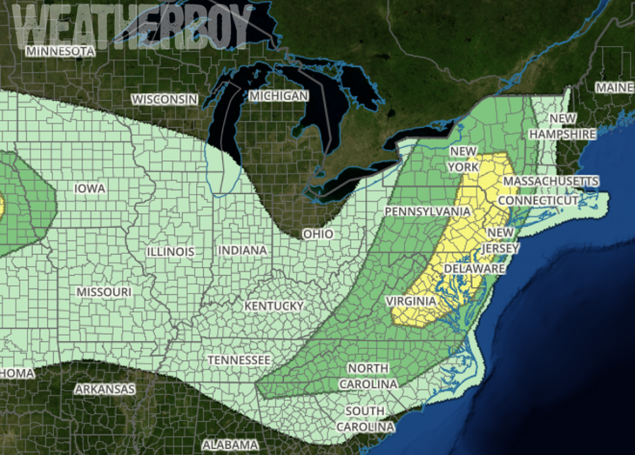
A frontal system is bringing another round of severe weather to portions of the Mid Atlantic and Northeast, prompting the National Weather Service to issue Severe Thunderstorm Watches and Warnings near the I-95 corridor. Severe thunderstorms produce hail 1″ in diameter or larger and/or strong winds in excess of 57mph and/or the presence of a tornado. Thunderstorms will also contain frequent lightning and heavy downpours, although the presence of either doesn’t give a storm the “severe” classification. The best chance for severe weather stretches from Virginia north into Maryland, Delaware, eastern Pennsylvania, and eastern New York.
The National Weather Service office in Mount Holly, NJ, believes the thunderstorm activity could be triggered in two area. “After looking at the lifting mechanisms available today, there is a feeling that convective initiation may occur in two distinct areas later today,” they said in a Forecast Discussion today. They continued, “Along a pre-frontal surface trough that is expected to sharpen to the lee (east side) of the Blue Ridge Mountains during peak heating and (2) Initially to our northwest ahead of a cold front.” In terms of timing, it appears convective activity tied to a pre-frontal trough will cross the Chesapeake Bay and move east into the DelMarVa region and southeastern Pennsvylvania between 4-8pm. The trailing convection just ahead of the primary cold front is forecast to arrive slightly later, moving through eastern Pennsylvania around Berks County, the southern Poconos, Lehigh Valley, and the Delaware Water Gap region around 6-8pm. The strongest storms will likely happen right up to sunset, with gradual weakened after sunset in the I-95 corridor as that source of heat energy storms thrive on sunsets away.
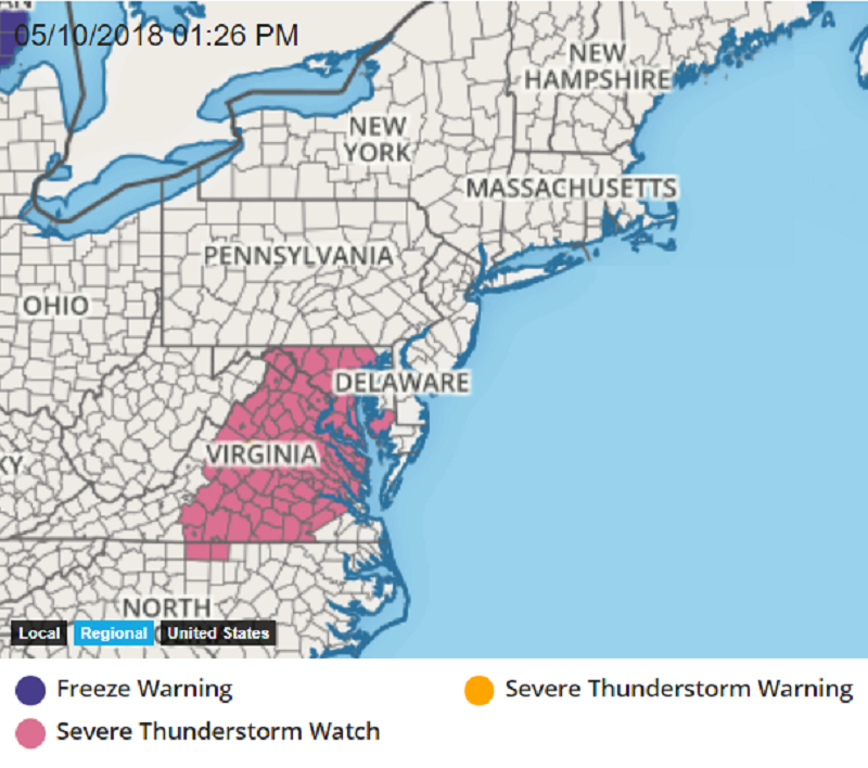
Despite cloud cover with the first round of showers late this morning and early this afternoon, National Weather Service forecasters believe that sufficient boundary-layer destabilization will occur to lead to robust convective updrafts today. The main threat will be locally damaging winds given a marginally favorable thermodynamic environment for severe wet microbursts. Due to these threats, the National Weather Service has started to issue Severe Thunderstorm Watches for portions of the Mid Atlantic; additional watches and warnings could be issued while the threat of severe weather lingers into the early evening hours.
