A very active and wet weather pattern will continue in the northeast, with another round of flooding rain and the chance of severe thunderstorms possible today. The National Weather Service has issued flash flood watches for portions of southeastern Pennsylvania and northeastern Maryland for 2pm-10pm today and they warn that additional watches and advisories, including Severe Thunderstorm Watches or Warnings may be needed as storms blossom this afternoon.
Today’s active weather is due to a cold front passing through the region. The cold front is about to propagate into western Pennsylvania now, with high pressure out ahead of it sinking into the Southeast U.S. later this afternoon. While the high sinks south, the front will push through western New York and Pennsylvania by late this afternoon and by the coast early tomorrow morning. A hot and humid airmass is developing ahead of that front, with highs rising well in the upper 80s and low 90s along the I-95 corridor from Philadelphia to Wilmington. The southerly flow in place is tapping into a robust, tropical airmass, allowing surface dewpoints to rise to uncomfortable levels in the low 70’s throughout the Mid Atlantic.
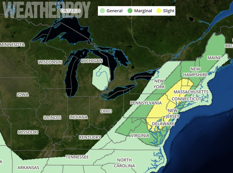
Storms associated with the front and ahead of it in the moist, unstable airmass will move from west to east today. The afternoon round of showers and thunderstorms should move into at least the southern Poconos and northern New Jersey, eventually arriving in southeastern Pennsylvania and central New Jersey by evening. With plenty of atmospheric shear and moisture to work with, expect showers and thunderstorms to be capable of producing very heavy rain. The highest threat of flooding will be across portions of southeastern Pennsylvania and northeastern Maryland which received the most rain Saturday through Tuesday. As a result of the already saturated ground, the needed threshold for flash flooding to occur is quite low. Outside of the flash flood watch, localized flooding is certainly possible, especially in urban areas and other poor drainage areas.
In addition to dumping heavy rain, thunderstorms that do form could also create damaging wind gusts. There is a threat of some severe hail, but the greatest danger from these storms will be the flash flood potential they bring.
Most of the severe weather action today should occur between 6pm and midnight, with lingering shower and storm activity wrapping up by early tomorrow. With abundant low level moisture in place, areas of fog are likely to form.
