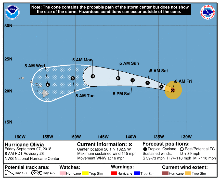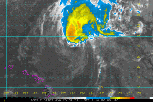
In this exceptionally busy Central Pacific Hurricane Basin, it doesn’t look like Hawaii can catch a break. Hurricane Olivia is now forecast to approach the Aloha State and eventually strike it, albeit in a weaker form. And as the impact from 2014’s Tropical Storm Iselle showed, it doesn’t take much to create a dangerous, life-threatening situation in the islands.
The National Hurricane Center (NHC) in Miami, Florida is currently tracking the hurricane as it moves across the Pacific. When it crosses 140W, the Central Pacific Hurricane Center in Honolulu, HI will take over forecasting responsibilities for the storm, including issuing any necessary Hurricane or Tropical Storm Watches and/or Warnings. For now, no warnings for Olivia have been issued for land.

In the latest advisory from the NHC, the center of Hurricane Olivia was located near latitude 20.1 North, longitude 132.5 West. Olivia is moving
toward the west-northwest near 16 mph and this general motion is forecast to continue through Saturday. The NHC expects a gradual turn
toward the west to begin sometime Saturday night or Sunday, which could set the stage for an impact with the islands next week. Maximum sustained winds have decreased to near 115 mph with higher gusts. Once a Category 4 storm, Olivia is a now category 3 hurricane on the Saffir-Simpson Hurricane Wind Scale and a slow weakening trend is expected during the next few days. Hurricane-force winds extend outward up to 30 miles from the center and tropical-storm force winds extend outward up to 115 miles. The estimated minimum central pressure is 964 mb or 28.47 inches.
Global computer forecast guidance, such as the European ECMWF and American GFS models, both agree that Olivia will strike Hawaii next week, although there are differences. The European model is suggesting a strike near Maui or the northern side of the Big Island while the American model is somewhat south. The official 5-day forecast track from the NHC puts the storm somewhere near the middle of the state. Where exactly it’ll go and what impacts it’ll make will be refined as the storm approaches the island.
Some but not all guidance suggests Olivia will strike Hawaii as only a tropical storm. In 2014 when Iselle struck Hawaii as a tropical storm, there was significant damage. Tropical storm-force winds affected much of the state as Iselle moved through, except Niihau, the rest of the Hawaiian islands all reporting gusts over 39 mph . Hurricane-force winds were confined to Mauna Kea on the Big Island, where a peak gust of 96 mph was observed. Heavy rains affected most of the southern islands, with some areas of the Big Island seeing more than a foot of rain.
The area is still recovering from the impacts of Hurricane Lane, which dropped more than 4 feet of rain in places of Hawaii’s Big Island. Whether Olivia strikes as a hurricane or tropical storm, heavy rain, potentially in excess of a foot again, is possible in eastern Hawaii.
At this time, it appears impacts on Hawaii would occur no sooner than Tuesday evening from Olivia. Because of this, it is imperative that people in Hawaii review their Hurricane Action Plan and re-stock their hurricane supplies, especially if they consumed some during Hurricane Lane which impacted the state last month. People in Hawaii should have at least 2-weeks worth of water, food, and medicine for themselves and their pets.