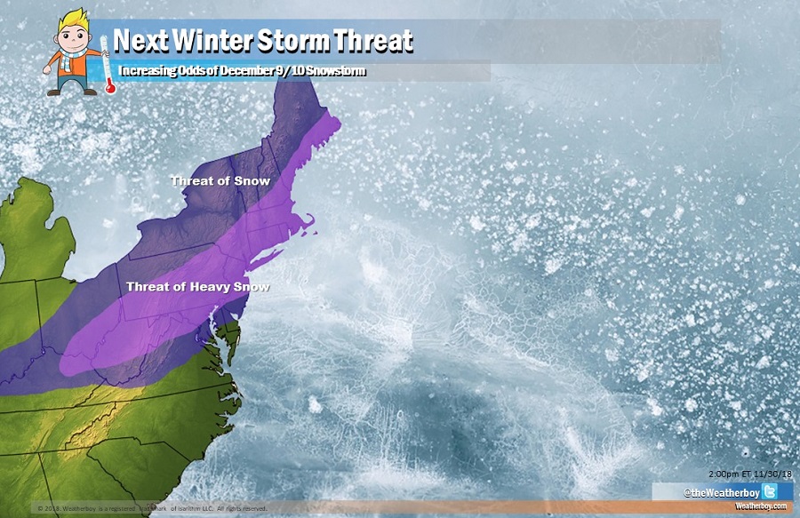
While low pressure will bring rain throughout much of the Mid Atlantic and Northeast this weekend, a much colder system is likely to impact the region next weekend, potentially bringing another round of significant, early season snowfall to the heavily populated I-95 corridor. Computer forecast models had been suggesting that something would be brewing along the east coast around this period for days, but lack of run-to-run and model-to-model consistency has led to low confidence in such a snowy solution. However, guidance is better aligned today than it has been, increasing that confidence for now.
Both the European ECMWF and American GFS forecast models depict the storm, although they both have subtle differences in track that would produce very different results. Both develop a potent area of low pressure in eastern Texas and western Louisiana around December 7/8. From there, both bring the system to the northeast for December 9/10. While yesterday’s guidance from the American forecast model suggested a slightly off-shore path which would produce heavy snow in the northeast and potential blizzard conditions in Maine, today’s guidance has shifted a bit further inland, which would be a warmer solution if it were to verify. A more inland track would bring heavy wind-whipped rains to the I-95 corridor from Washington, DC to Hartford, CT, while frozen or freezing precipitation would fall north of there. In contrast, the European ECMWF model is suggesting this afternoon a track further off the coast, which would produce heavy snow across portions of Maryland, Pennsylvania, and New Jersey. Both models depict heavy amounts of snow, in the order of 1-2 feet, but each depicts it in very different areas due to that different storm track.
For now, it seems most likely that the storm will be somewhere in between those suggested routes, which has the potential to produce a heavy snowfall across a large, heavily populated area of the northeast. It is still too soon to say with any degree of certainty how exactly the storm will evolve, but confidence is slowly increasing of a snowy result. It probably won’t be until December 7 that enough data will be in to accurately assess the rain/snow line and precipitation (snow or rain) amounts.
With the threat of wintry weather around December 9/10, those planning to decorate the outside of their homes for the holidays may wish to do so this weekend. While rain is moving into the northeast, there should be a 12 hour window of dry weather available to work outside without any immediate worry of weather. The same may not be the case next weekend, especially if heavy snow does materialize.