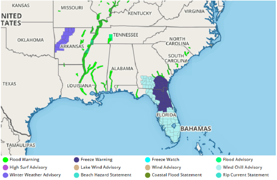
A chilly day is in store for Florida today and it’ll be followed by what many locals will consider a frigid night with temperatures expected to approach or drop below the freezing mark in many parts of the state. Even Miami Beach isn’t immune to the cold weather: the National Weather Service has issued a Wind Chill Advisory there.
The cold weather is impacting some theme parks in central Florida, with most water parks closed due to the coldsnap. Volcano Bay at Universal Orlando Resort and Aquatica Orlando have shut down; Disney’s Blizzard Beach Water Park and Disney’s Typhoon Lagoon Water Park are also closed, although Typhoon Lagoon is closed due to a planned refurbishment project.
A mid-level low will cut off from the main trough over northeastern Florida and coastal Georgia today. A surface reflection of this weather feature will end up developing a low pressure system over the Atlantic waters north of the Bahamas. The mid-level low will push southward across the Atlantic waters on Wednesday before being reabsorbed and pushed back into the open Atlantic. With this set-up, a brisk northwesterly flow will pick up later this afternoon and continue through the overnight and Wednesday morning hours. This flow will allow for polar continental air to push down the spine of the Florida peninsula towards southern portions of the Sunshine State.
Due to this set-up, dangerously cold weather is expected that can harm people and plants. Freeze Warnings are now up for southern Georgoe and northeastern Florida. There is also a potential for a freeze over portions of inland Southwest Florida. Such a freeze could bring harm to crops, including Florida citrus crops. While dangerous to plants, the cold air combined with the wind will create wind chill concerns in a state that usually doesn’t worry about such a phenomena. The presence of the low pressure system to the east and the high building to the north will create a tight gradient wind flow resulting in moderate to high winds. The cold air advection due to the persistent northwesterly flow should allow wind chill values to fall below 35 degrees across most of South Florida for several hours overnight into tomorrow morning with some portions of inland southern Florida potentially experiencing wind chill values in the mid 20s.
Temperatures will gradually rebound after this cold snap. But before it does, people need to prepare themselves, their pets, and their plants for air temperatures and apparent temperatures well below the freezing mark.
