Trouble is brewing in the Caribbean Sea and it is likely to be a first for the Tropical Atlantic: never before has “Eta” from the Greek alphabet been used to name a tropical cyclone in the basin. To date, 2020 has produced 27 named storms, 1 shy of tying record-breaking 2005 which had 28 nameable storms. In the post-season analysis, the National Hurricane Center identified an additional subtropical storm that formed near the Canary Islands in 2005. Had that storm been named, there would have been an Eta at the end of 2005 too.
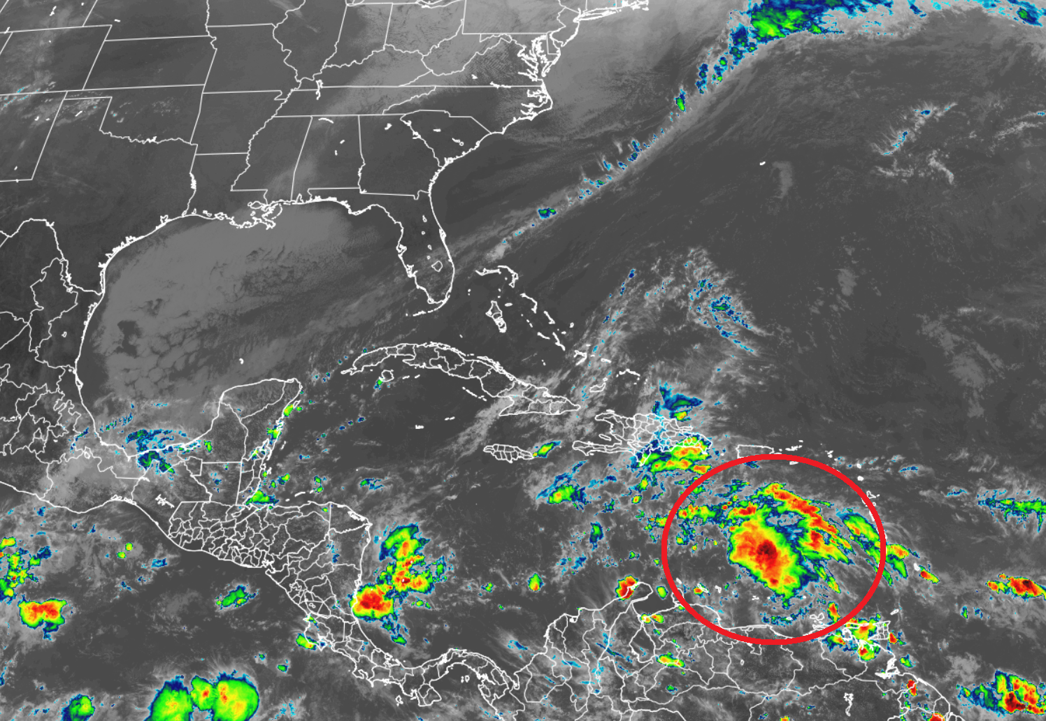
The area of concern is a tropical wave currently located over the eastern Caribbean Sea. Today, this disturbance is producing a concentrated area of showers and thunderstorms. According to the National Hurricane Center, this system is gradually becoming better organized, and conditions appear conducive for further development. The National Hurricane Center is forecasting that a tropical depression will form from this disturbance as soon as this weekend or early next week as it moves west across the central and western Caribbean Sea. The National Hurricane Center believes there’s a high chance (80%) that the tropical cyclone will take shape here within the next 5 days or sooner.
Computer forecast guidance is also suggesting a more robust tropical cyclone evolution here, with the system becoming at least a tropical storm before it approaches the Central American coast. Once and if the tropical depression becomes a tropical storm, it would earn the name “Eta”. In 2005, the 28th storm of the season formed on December 30; should this form, it’ll break that record by nearly 2 months. No other season outside of 2005 on record has had this many named storms in the Atlantic basin.
Regardless of development, this system is expected to produce heavy rainfall across portions of the ABC islands and Jamaica through the weekend.
How quickly the storm develops and the overall atmospheric set-up over Central and North America will determine how strong this system gets and where it’ll go. While odds favor a Central America landfall, it is still possible a new tropical cyclone here could move about in the western Caribbean, leaving many routes open as a possibility for a future track for this new storm.
