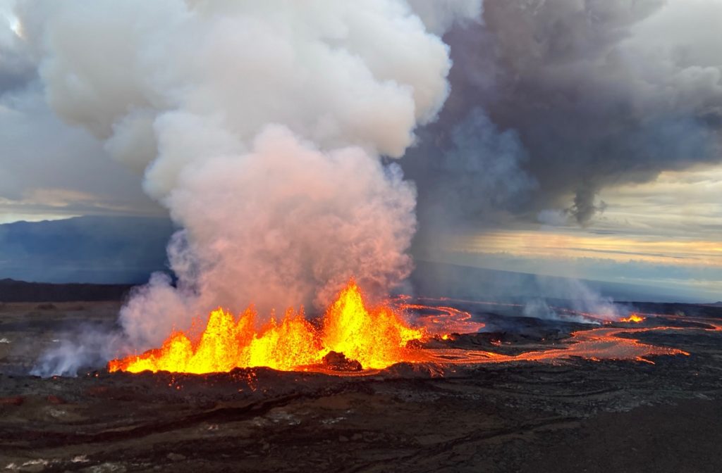
Advancing flows coming down the slopes of Mauna Loa, the world’s most active volcano which started erupting last Sunday night, could threaten the only major east-west highway that stretches across the Big Island of Hawaii. Or maybe not, according to Dr. Ken Hon, the Scientist-in-Charge of the Hawaiian Volcano Observatory (HVO) with the USGS. In a media briefing call with reporters today, Hon said if the lava flows continued to move at the current pace and in the current direction, lava could hit the Daniel K. Inouye Highway, also referred to on the island of Hawaii simply as “Saddle Road” or Route 200. But Hon cautioned reporters that is a projection based on the current speed and direction of the lava which could change due to a variety of factors in the coming hours and days. He and USGS and Hawaii County Civil Defense officials aren’t projecting inundation of the highway, but they’re preparing for the possibility.
The roadway which cuts across the “saddle” that exists between Mauna Kea volcano to the north and Mauna Loa volcano to the south, traverses the width of the Island of Hawaii, from downtown Hilo to its junction with Hawaii Route 190 near Waimea and Waikoloa . The road was once considered one of the most dangerous paved roads in the state, with many one-lane bridges and areas of marginally maintained pavement. However, in recent decades, the road was drastically improved to modern federal highway standards, with many stretches of the road straight with posted speed limits of 60 mph.

Tourists and visitors alike use the road heavily, which trims a cross-island trek from more than 2.5 hours to under 2 hours. It is also the preferred route of commercial truck traffic which avoids the curvy, slower roads that run around the perimeter of the island known as Highways 11 and 19.
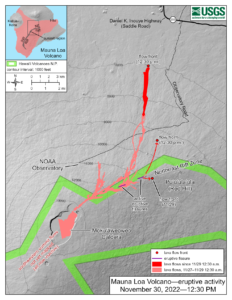
But that highway could be cut off by a lava flow from Mauna Loa, which as of the publication of this report, was only 3 miles away from the highway. And if the highway were to be closed off by lava, traffic congestion on the other island roads would add significant time to the travel time, doubling it in some cases.
According to HVO, the Northeast Rift Zone eruption of Mauna Loa continues, with two active fissures feeding lava flows downslope. Fissure 3 remains the dominant source of the largest lava flow. The fissure 3 lava flows are traveling to the north toward the Daniel K. Inouye Highway but have reached relatively flatter ground and have slowed down significantly as expected.
Advance of the largest flow slowed over the past 24 hours to a rate of 0.025 miles per hour (40 meters per hour). HVO cautions in their latest update, “Advance rates may be highly variable over the coming days and weeks due to the way lava is emplaced on flat ground. At the rate observed over the past 24 hours, the earliest the lava flow might be expected to reach the Daniel K. Inouye Highway (Saddle Road) is one week. However, there are many variables at play and both the direction and timing of flow advance are fluid and are expected to change over periods of hours to days.”
Fissure 4 is still active with lava flows moving toward the northeast at a rate of 0.04 mph (60 meters per hour). The northeast fissure 4 lava flow crossed the Mauna Loa Weather Observatory road overnight. A small lobe is moving to the east from fissure 4 at a slower rate than the main lobe. Volcanic gas plumes are lofting high and vertically into the atmosphere. Pele’s hair , which are strands of volcanic glass, is falling in the Humu‘ula Saddle area. These additional flows may threaten the HI-SEAS research facility on the island, known for it’s world class “space base” where astronauts train for life on the Moon and Mars.
While the eruption continues, there doesn’t seem to be an end in sight. Hon told reporters today that previous eruptions like this one in the Northeast Rift Zone have lasted at least 2 weeks. Some eruptions from Mauna Loa have lasted over a year. USGS said, “Our seismic monitoring detects tremor (high rates of earthquakes) in the location of the currently active fissures. This indicates that magma is still being supplied, and activity is likely to continue as long as we see this signal.” As long as lava continues to pour out of the fissures towards the highway, it remains at risk of being inundated.