The next system in an active weather pattern will push through the northeast later tomorrow into Tuesday, bringing a round of light wintry precipitation to the region. While conditions will be slick for many, perhaps the bigger story will be the powerful winds behind the storm as it exits the coast.
High pressure will move from the Mid Atlantic region tonight to offshore on Monday morning. A warm front will slowly lift through portions of New Jersey and Pennsylvania on Monday. A wave of low pressure tracking along the warm front will move across the region Tuesday before departing Tuesday night.

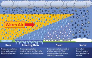
With clouds clearing the area and winds diminishing this evening, ideal radiational cooling conditions will occur. In addition to cooling the surface, it’ll also help cool the atmosphere where precipitation would typically fall through. As the front moves north tomorrow,precipitation will begin to fall from southwest to northeast. In places where the column of cold air above the surface to the origin of precipitation is below freezing, light snow will fall. In places where there’s a shallow layer of cold air above the surface, light sleet or light freezing rain or an icy mixture of both will fall. In places where the mild air surges in before the precipitation has a chance to fall through sub-freezing air, such as across central Maryland and Delaware, and places south, simply plain rain will fall.
As the warm front lifts north, temperatures will warm above freezing, and the rain/snow line should lift to around Philadelphia by lunchtime. Snow, or a mix of rain and snow, will continue across the Lehigh valley, and most of northern New Jersey, while snow continues north of I-80. Precipitation will ramp up Monday night and Tuesday as the low lifts to the north, and passes over Delmarva and southern New Jersey by Tuesday afternoon.
Precipitation should change to all rain across southern New Jersey, portions of southeast Pennsylvania, and Delmarva by late Monday afternoon, and should continue as rain through the duration of the event into Tuesday evening. Moderate to locally heavy rain is possible with the passage of the low late Monday night through Tuesday afternoon. Over an inch of rain is possible throughout the duration of the event. For areas mainly along and north of the Fall Line, upper air temperatures will gradually warm to above freezing, but it will take some time for surface temps to rise above freezing. As a result, a prolonged period of sleet and freezing rain, eventually changing to rain and freezing rain should persist across those areas Monday night through Tuesday morning. Bu Tuesday morning, though, precipitation should change to plain rain there. For the southern Poconos, the Catskills, and interior southern New England, the wintry weather will continues through Tuesday afternoon with limited mixing, if any, of non-snow precipitation. Generally no more than a few inches of light snow are expected where precipitation will fall only as snow.
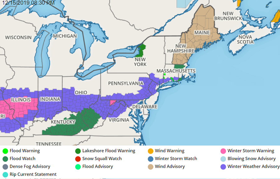
With light wintry conditions expected, the National Weather Service has issued a wide area of Winter Weather Advisories. This means travel could become tricky, especially on untreated surfaces, as the storm moves along. Remember: a little bit of ice can create big problems; the National Weather Service recommends people use caution where a mixed-bag of precipitation will fall.
As the storm exits the northeast coast, it will rapidly intensify, bringing a significant snowstorm with blizzard conditions to portions of southeastern Canada. It will also pump colder air into the U.S. on strong northwest winds. Because some of those winds will be especially strong, the National Weather Service is also issuing wind-related advisories for the northeast too. Some winds could knock down branches and/or wires, putting some people in the dark.