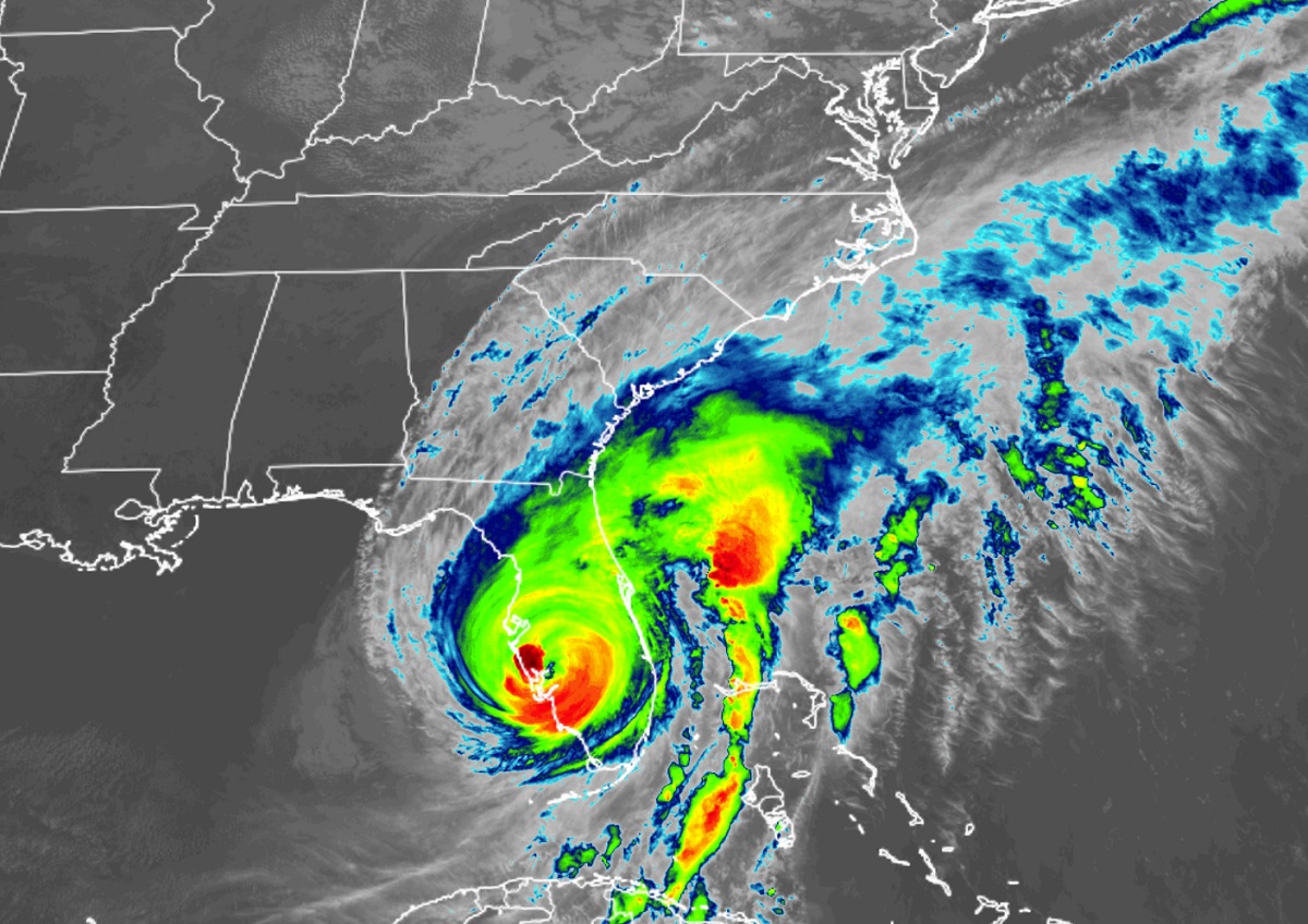
After a catastrophic landfall on the southwest Florida Gulf coast, Ian is now barreling through central Florida dumping epic amounts of rain on its journey to the Atlantic Coast, where warnings are being expanded for the incredible storm. Ian is tied for fourth place as the most powerful hurricane to strike Florida; with 150 maximum sustained winds and minimum central pressure of 940 mb or 27.75″ when it struck Cayo Costa, Florida at 3:10 pm today.
The Gulf Coast continues to be battered by incredibly heavy, flooding rains, record-breaking storm surge, destructive winds, and numerous tornadoes. The storm is huge: hurricane-force winds extend out from the center by at least 40 miles while tropical storm-force winds extend outward up to 140 miles.
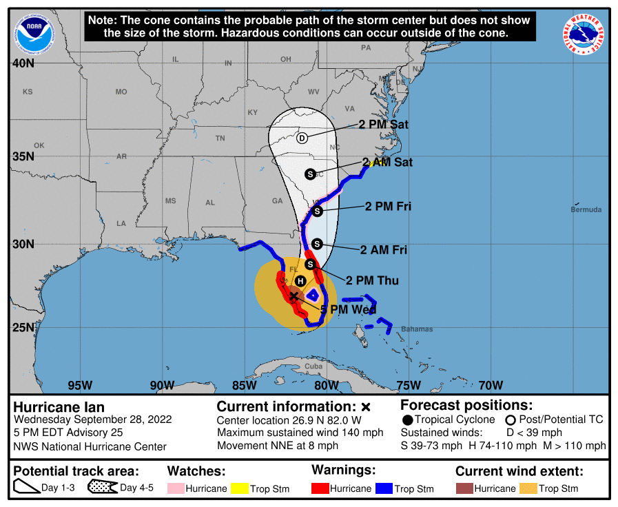
Right now, Major Hurricane Ian, with maximum sustained winds of 130 miles, is about 25 miles east-northeast of Punta Gorda, Florida and roughly 110 miles south-southwest of Orlando, Florida. The storm is moving north-northeast slowly at 8 mph. Minimum central pressure is now up to 951 mb to 28.08″.
Ian is forecast to re-emerge over the Atlantic Coast not far from Jacksonville before making another landfall near the Georgia/South Carolina Coast line. It is possible Ian could re-intensify somewhat as it heads back to the U.S. southeast coast, promoting Hurricane Watches to be issued there.
Right now, a Hurricane Warning is in effect for the area from the Chokoloskee to Anclote River, including Tampa Bay and for Sebastian Inlet to the Flagler/Volusia County Line. A Storm Surge Warning is in effect for the area from the Suwannee River southward to Flamingo, Tampa Bay, from the Flagler/Volusia County Line to the mouth of the South Santee River, and for the St. Johns River by Jacksonville. A Tropical Storm Warning is in effect for the area from Indian Pass to the Anclote River, Flamingo to Sebastian Inlet, Flagler/Volusia County Line to Surf City, Flamingo to Chokoloskee, Lake Okeechobee, and for Bimini and Grand Bahama Islands in the Bahamas. A Storm Surge Watch is in effect for north of South Santee River to Little River Inlet and Florida Bay. A Hurricane Watch is in effect from the Flagler/Volusia County Line to the South Santee River and Lake Okeechobee. A Tropical Storm Watch is now in effect for the area North of Surf City to Cape Lookout.
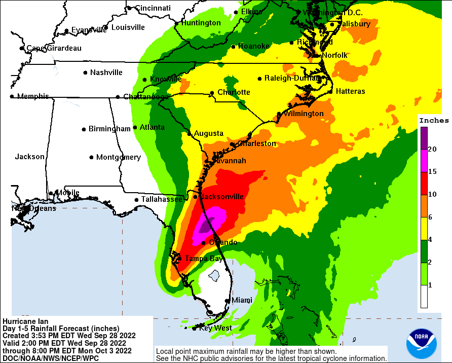
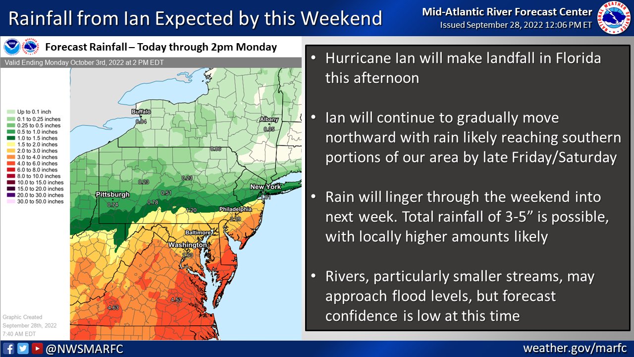
Epic amounts of flooding rains are likely over a large part of Florida and the broader southeastern U.S. Heavy rain will spread into the Mid Atlantic during the week as remnants of Ian make their way north. However, the weather pattern should keep most rain from Ian from going more north than northern Pennsylvania and New Jersey. As such, New England will escape the rain from this tropical cyclone.
