After a violent night of severe tornadic thunderstorms in portions of the southeast, the shift of severe weather is shifting east today, with a focus of rough weather this afternoon over portions of eastern Ohio, northern West Virginia, and western Pennsylvania. According to officials in Mississippi and Alabama, dozens are hurt, at least 4 people are missing, and the death toll is up to 24 from severe storms that plowed across the region. The worst storms were in Mississippi, where FEMA Administrator Deanne Criswell said today that first responders “are in a life-saving, life-sustaining mode.”
Criswell said she spoke with President Joe Biden earlier Saturday and gave him an update on the situation. She said she’ll be traveling to the area Sunday so she can get a firsthand look. FEMA is working with local officials to figure out “what the state needs right and where they have resource gaps,” she added.
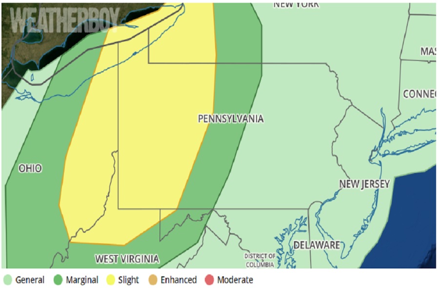
While the weather isn’t expected to be as violent as it was last night, a variety of meteorological ingredients coming together could create severe storms and wind damage. According to the National Weather Service’s Storm Prediction Center (SPC) and their latest Convective Outlook, the combination of warming surface temperatures, mid to upper 50s dewpoints, and cool temperatures aloft will support increasing buoyancy through the mid-afternoon hours. “Shallow convection evident in visible imagery along the front across western Ohio is expected to intensify as it moves into the destabilizing air mass,” the SPC warns, and observations appear favorable for for organized convection. “As a result, damaging winds appear likely across eastern Ohio to western Pennsylvania and portions of western New York, though a few instances of severe hail and perhaps a brief tornado are plausible.”
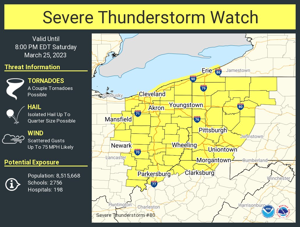
Due to the threat, the National Weather Service has issued a Severe Thunderstorm Watch for portions of the expected impact zone.
“Low-topped thunderstorms have been pulsing in intensity over the last hour or so, with at least a few near-severe gusts observed. These storms continue to progress rapidly eastward amid very strong low/deep-layer speed shear,” the Storm Prediction Center said when the Severe Thunderstorm Watch was issued.
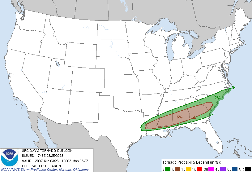
Unfortunately, the severe weather threat for the weekend won’t be over yet. According to the SPC, the threat will shift south and east, with an elevated tornado risk from central Louisiana across Alabama, Mississippi, Georgia, and west-central South Carolina.