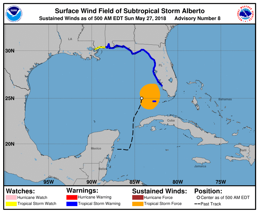
According to the National Hurricane Center, Subtropical Storm Alberto is becoming better organized, prompting additional Tropical Storm Warnings to be issued for Florida’s west coast. An area of deep convection is gradually expanding near and to the north of the center. A large band of showers and thunderstorms extends well to the east of the center from western Cuba to south Florida and the northwestern Bahamas. Based on the system’s structure, it still appears to be subtropical, but it is gaining some more tropical characteristics. An Air Force Hurricane Hunter aircraft is scheduled to investigate Alberto later this morning, and should provide a better assessment of its intensity and structure.
Alberto is expected to turn northward later today and then northwestward tonight as it moves around the eastern side of a cutoff mid- to upper-level low over the central Gulf of Mexico. After Alberto merges with the upper low, a turn back to the north is forecast by Monday night and Tuesday. The latest model guidance has shifted notably to the east and National Hurricane Center track forecast has been adjusted by about 30 miles in that direction. Due to that slight east shift, Tropical Storm Warnings were expanded along the Gulf coast of Florida.
Even though Alberto has not yet strengthened, slow intensification seems likely until it reaches the coastline on Monday. The National Hurricane Center says the reasons for intensification consist of diffluence associated with a negatively tilted upper-level trough, lower shear, and marginally warm waters in the Gulf of Mexico. However, the intensity computer forecast models show a weaker solution this cycle, perhaps because the center may move inland a little sooner. At this time, no model shows Alberto reaching hurricane strength.
Alberto is likely to complete its transition to a tropical storm within 24 hours when it moves into an area of light shear, which should allow the cyclone to develop a deeper warm core and become more symmetric. Regardless of structure and intensity, Alberto will be a heavy rain maker, with several inches of rain expected over portions of Florida this holiday weekend.
