Today marks the anniversary of the 2012 Derecho which brought death and destruction from Illinois to New Jersey. A derecho (pronounced as deh-REY-cho) is a widespread, long-lived windstorm. Derechos are associated with bands of rapidly moving showers or thunderstorms; some are known as bow echos, squall lines, or quasi-linear convective systems.
“Derecho” is a Spanish word meaning “direct” or “straight ahead.” In contrast, the word “tornado” is thought by some to have been derived from the Spanish word “tornar,” which means “to turn.” Because “derecho” is of Spanish origin, the plural form is spelled “derechos.
The word “derecho” was coined in 1888 by Dr. Gustavus Hinrichs, a professor of physics at the University of Iowa. Hinrichs used the term in a paper published by the American Meteorological Journal to distinguish thunderstorm-induced straight-line winds from the damaging, rotary winds of tornadoes. “Derecho” was adopted to a limited extent by the meteorological community during the 1880s. However, the word disappeared from use for nearly a century until it was resurrected by the National Oceanic and Atmospheric Administration’s (NOAA) National Severe Storms Forecast Center which eventually became known as NOAA’s Storm Prediction Center (SPC.)
The winds associated with derechos are not constant and may vary considerably along the derecho path, sometimes being below severe limits (57 mph or less), and sometimes being very strong (at or above hurricane force winds of 75mph.) Swaths of stronger winds within the general path of a derecho are produced by what are called downbursts, which often occur in irregularly-arranged clusters, along with embedded microbursts. Derechos might be said to be made up of families of downburst clusters that extend continuously or nearly continuously for at least 250 miles.
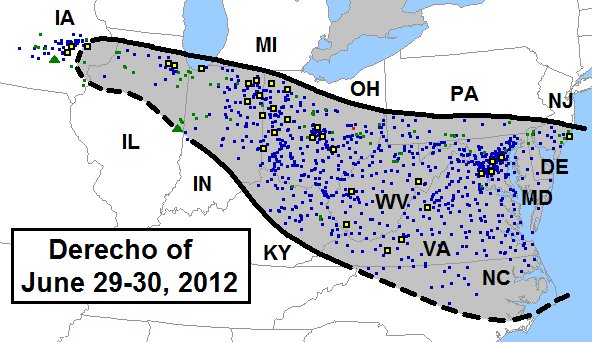
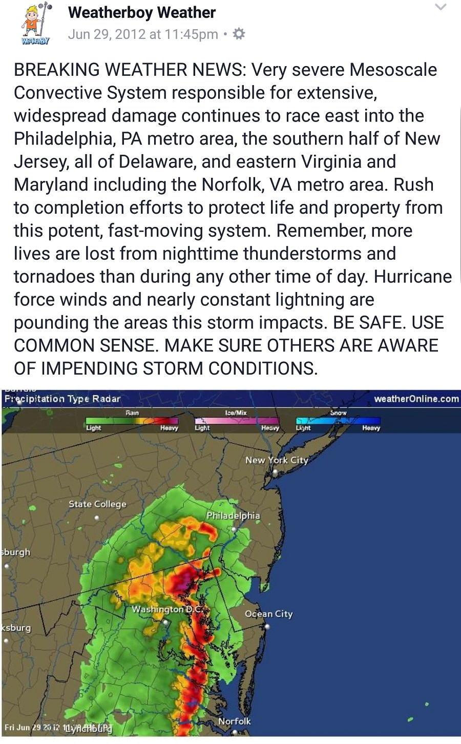
Over June 29-30 of 2012, a violent mesoscale convective system developed over the upper Mid West and traveled through the Ohio Valley into the Mid Atlantic. Along the way, the derecho became the most deadly and costly of any derecho to impact North America. In addition to 22 deaths, the damage total exceeded $2.9billion, which is the equivalent of a top-25 tropical cyclone landfall. Millions of people lost power throughout the storm; some had no power for weeks as utility crews struggled to make repairs.
