An “atmospheric river” phenomena is forecast to bring an incredible amount of moisture to California and a large part of the western U.S. in the coming days; while 2022 will end on a wet note, 2023 should start soaked with precipitation measured in feet coming in from the Pacific Ocean. In the short-term, between tonight and Sunday, upwards of 20″ of rain could fall, with that precipitation falling in colder, higher elevations as snow with a 1:12 ratio. As such, 20″ liquid equivalent falling over the higher mountains of northern California could translate into 24 feet of fresh snow in time for New Year’s Day.
An atmospheric river refers to a narrow stream of concentrated moisture in the atmosphere. The most common atmospheric river event is nick-named “Pineapple Express”; in this type of situation, a robust stream of moisture near the Hawaiian islands flows north and east into western North America, dropping copious amounts of rain and snow as it interacts with the terrain there.
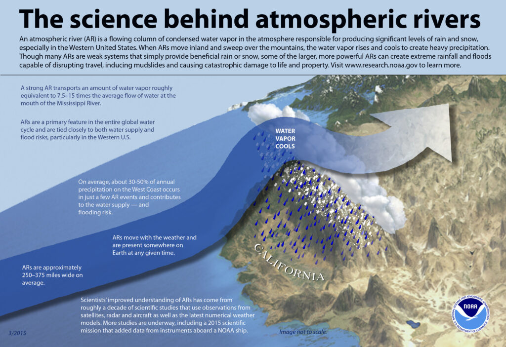
These long, narrow atmospheric rivers help transport moisture from the tropics, in water vapor form, to areas far from the tropics. The liquid equivalent of these moisture plumes could be comparable to the water flowing through the mouth of the Mississippi River, according to NOAA.
On average, 30-50% of annual precipitation on the U.S. West Coast occurs from a few atmospheric river events. In addition to replenishing water supplies, they can also create problems associated with heavy precipitation: flooding, rock/mud slides, and avalanche dangers.

As the stream of water vapor hits the mountain ranges over the U.S. west coast, the air rises, cools, and condenses the moisture out of it. This condensed moisture falls out of the sky as heavy rain, heavy snow, or both.
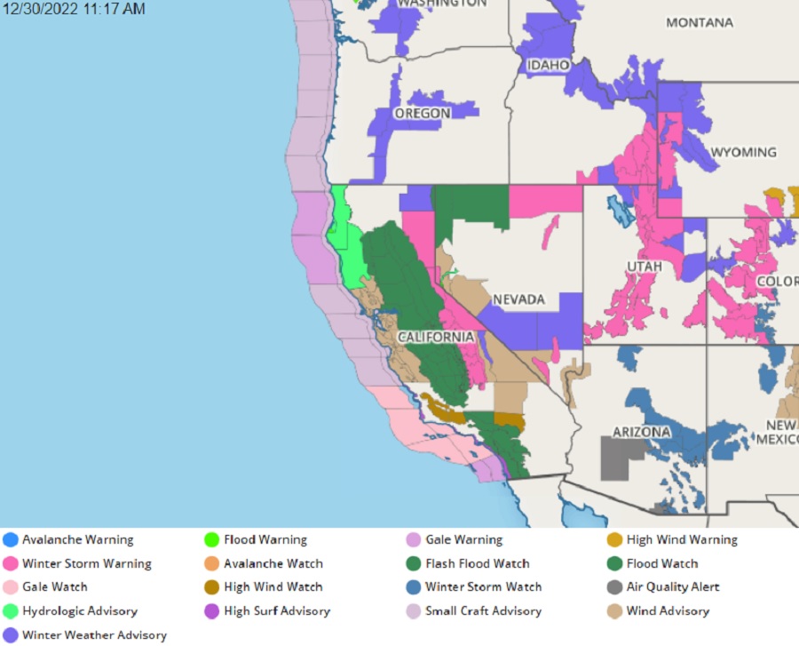
A significant atmospheric river event is expected to unfold in the coming days, with the worst arriving Wednesday and Thursday. With bad weather arriving, the National Weather Service has issued hundreds of watches and advisories across California, Nevada, Oregon, Idaho, Utah, and Arizona. In addition to heavy snow and rain, freezing conditions harmful to agriculture, damaging winds, and rough surf are also possible across large portions of California.

The heavy precipitation is also falling over areas that had previous burn scars from earlier wildfires. When heavy rain hits those scars, mudslides and debris flows may also happen, creating additional hazards on area roads and in regional communities.
Beyond the next 72 hours, it appears a wet weather pattern will remain in place for at least the first week or two of 2023, with more drought-busting heavy rain and snow likely for the western U.S..