The National Hurricane Center says a system likely to develop off the southeast coast will impact the southeast coast this weekend, bringing heavy rains to a region in time for the holiday weekend.
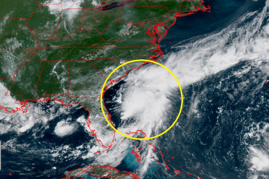
Showers and thunderstorms have increased in association with an area of low pressure located about 100 miles off the northeast Florida coast. According to the National Hurricane Center (NHC), environmental conditions are forecast to be marginally conducive for further development and a short-lived tropical or subtropical depression could form late today or on Saturday while the system drifts northward. The NHC says there is a 60% chance that a cyclone will form here within 48 hours.

Because the system is close to the coast and on the move, it likely won’t have the opportunity to strengthen into anything beyond a depression. Rather than grow more, the NHC says the low will move move inland over the southeastern U.S. Saturday night or early Sunday.
“Regardless of development, heavy rainfall is possible across portions of west-central and southwestern Florida through early Saturday, and across coastal sections of the Carolinas beginning later on Saturday,” warns the NHC.
According to the National Weather Service’s Weather Prediction Center, rainfall totals can exceed 4″ in parts of the southeast, setting the stage for flooding issues.
In the meantime, an Air Force Reserve Hurricane Hunter aircraft is scheduled to investigate the system later today. The crew will collect important weather data to help forecasters at the NHC refine their analysis and projections of where this storm is going, how strong it’ll get, and how much rainfall it will drop .
