Tropical Storm Bertha rapidly formed and struck the South Carolina coast this morning, making it the second named storm of the 2020 Atlantic Hurricane Season which technically doesn’t start until Monday and the first landfall of the year. While the storm will rapidly weaken, very heavy rainfall will continue to spread north over the coming hours.
Bertha made landfall at 9:30am today near Mount Pleasant, South Carolina. On Monday, the National Hurricane Center believed there was only a 20% chance that a storm would form; those odds were increased to 30% last night. But as the disturbance interacted with the warm waters of the Gulf Stream located just off the east coast, rapid intensification occured and the system became a tropical storm this morning.
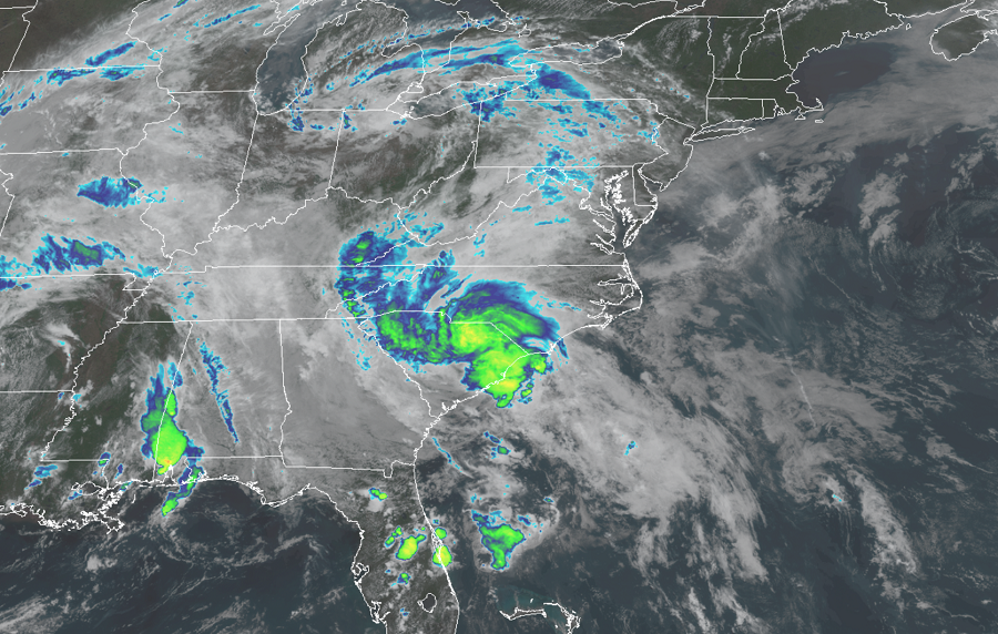
Bertha is expected to fade away as quickly as it formed, but it is still forecast to create problems in the Carolinas. As of the last update from the National Hurricane Center, the center was located inland over South Carolina about 40 miles northeast of Charleston. Bertha is moving toward the north near 15 mph and the National Hurricane Center expects that this general motion will continue through tonight, with a gradual increase in forward speed. On the forecast track, Bertha will move inland across eastern and northern South Carolina later today and into central North Carolina by tonight.
For now, maximum sustained winds are near 50 mph with higher gusts. Tropical-storm-force winds extend outward up to 25 miles from the center.
While weakening is forecast to occur during the next 48 hours, becoming a tropical depression later today, and eventually a remnant low tonight, flooding rains are expected from the system. Bertha is expected to produce total rain accumulation of 2 to 4 inches with isolated totals of 8 inches across eastern and central South Carolina into west central to far southeastern North Carolina and southwest Virginia. Given very saturated antecedent conditions, this rainfall may produce life threatening flash flooding, aggravate and prolong ongoing river flooding, and produce rapid out of bank rises on smaller rivers.
