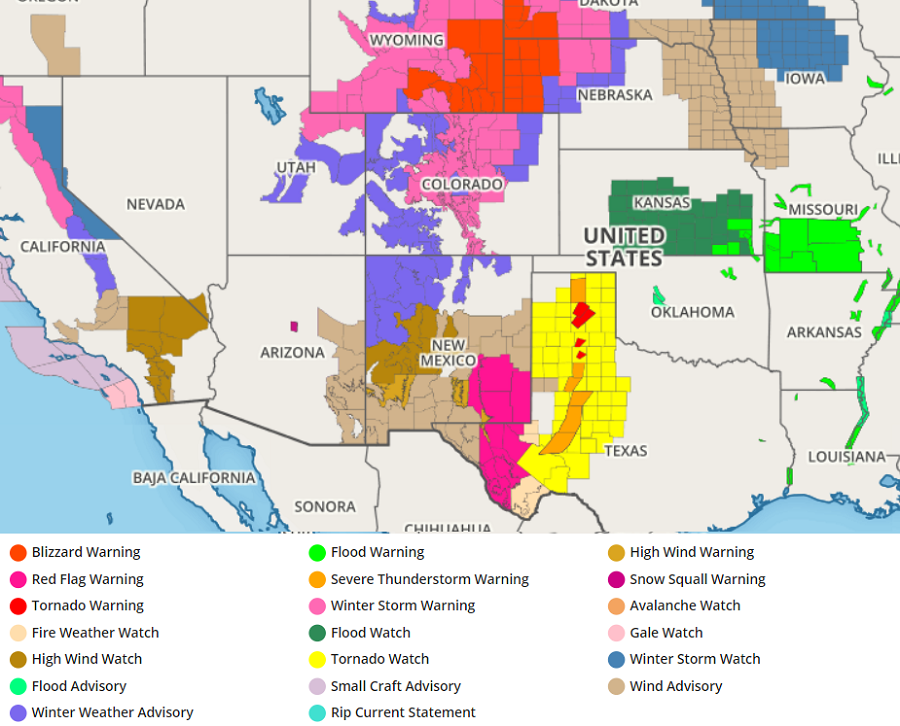
A strong storm system is bringing a wide variety of severe weather to the middle of the U.S. ranging from blizzard conditions in Wyoming, South Dakota, and Nebraska to life-threatening tornadoes in Texas.
A cold upper-level low exiting the Southwest is interacting with a boundary across the Central Plains. The boundary between cold air to the north and milder air to the south will be the focus for bouts of severe thunderstorm activity together with locally heavy rain across the Central and Southern Plains. The intensifying storm will ingest additional Gulf moisture and dump heavy rain across the Central Plains and Middle/Lower Mississippi Valley tonight. In the cold northern part of the storm, heavy snow and blizzard conditions are expected to spread across Colorado and Wyoming through Sunday. The storm should reach peak intensity tomorrow, bringing snowfall amounts of possibly 4 ‘ for the highest elevations while 1-2’ amounts are expected to be quite common across the nearby central High Plains.
Blizzard Warnings, Winter Storm Advisories and Warnings have been issued for much the Central Rockies to the central High Plains to the Black Hills of South Dakota.
While snow is breaking out to the north, severe thunderstorms are breaking out to the south. Strong to severe thunderstorms are forecast to move across the Southern Plains ahead of a strong cold front associated with the intensifying low pressure system, reaching into the Mississippi Valley, Midwest, Southeast and Mid-Atlantic on Monday.
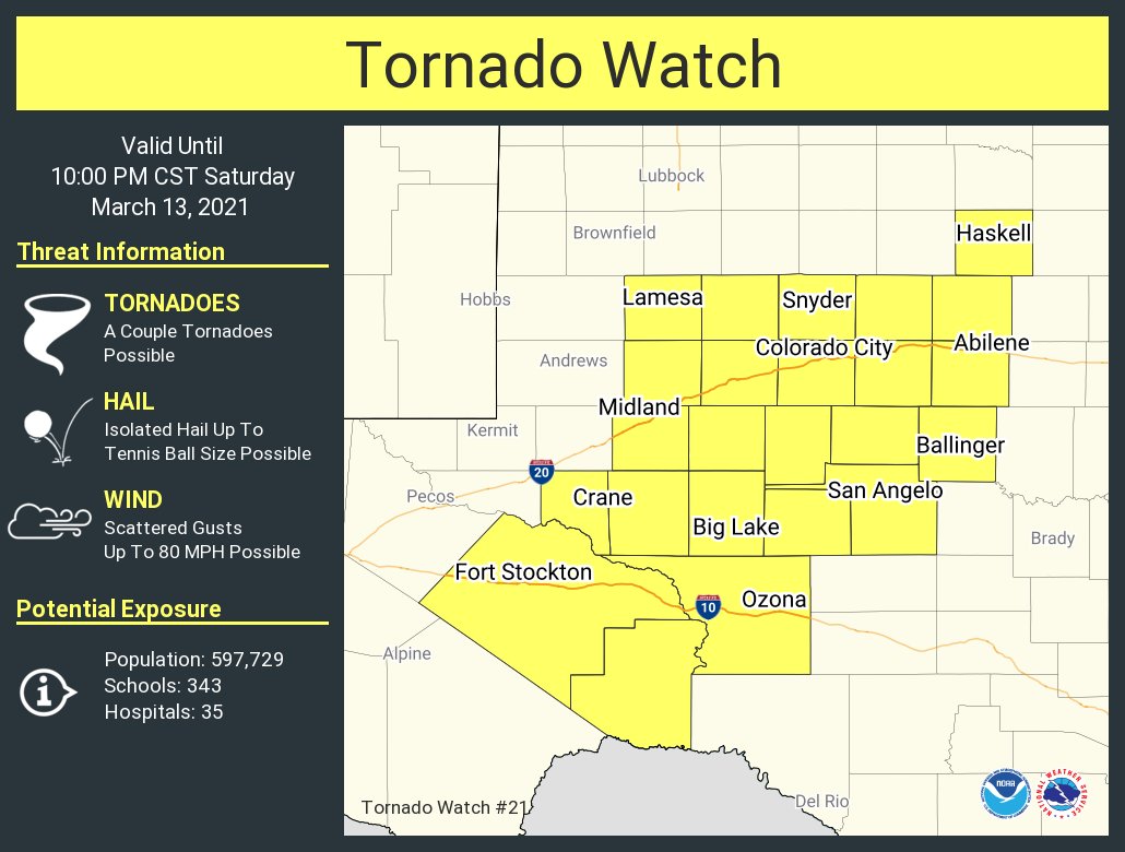
The National Weather Service has issued a Tornado Watch for much of northern and central Texas, with numerous Tornado Warnings and Severe Thunderstorm Warnings in effect within the watch box. Severe tornadoes, destructive winds, damaging hail, and heavy flooding downpours are possible in the severe storms marching through Texas this evening.
Some freezing rain may also impact parts of northern Illinois and Indiana tomorrow where near 0.1 inches may fall.
Beyond precipitation threats, there are wildfire threats too. Dry and strong downslope winds to the south of the storm are expected to
promote elevated to critical fire danger across parts of the southern High Plains through Sunday.
This storm system will push east during the week, eventually bringing rain and some snow to portions of the northeast in the coming days.
