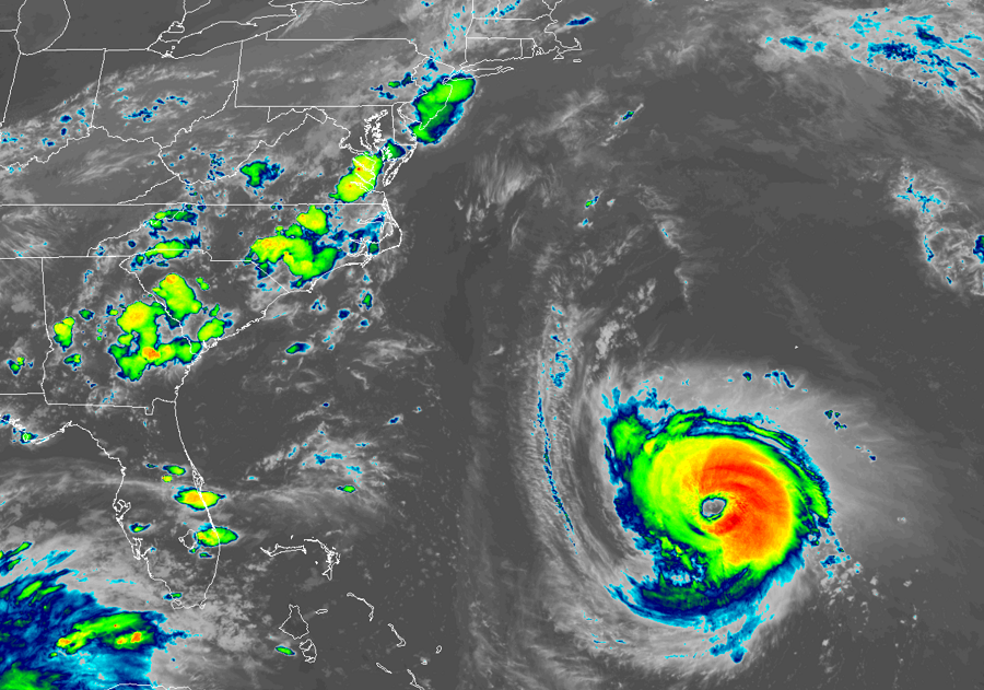
Major Hurricane Florence is headed to the U.S. East coast and is forecast to make a catastrophic landfall on the Carolina coast. While confidence is high that a landfall will occur, the confidence is not high where Florence will go after landfall. An overall lack of steering forces in the atmosphere is making it very difficult for forecasters to pin point the path after hitting land and small weather systems that could influence the eventual steering current have been problematic for computer models that forecasters use for plotting out the hurricane’s future.
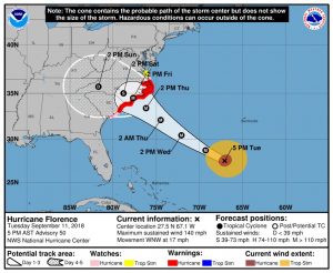
President Donald Trump had a briefing with White House Senior Staff and the Secretary of Homeland Security. “The safety of American people is my absolute highest priority. We are sparing no expense. We are totally prepared and we’re ready. We’re as ready as anybody’s ever been. It looks to me and it looks to all of a lot of talented people that do this for a living …(that) this is going to be a very large storm. Far larger than we’ve seen in perhaps decades.” Trump added, “They haven’t seen anything like this in 25-30 years. Or maybe even ever.”
The National Hurricane Center has upgraded various advisories on the U.S. east coast ahead of Florence’s expected arrival. A Storm Surge Warning has been issued from South Santee River, South Carolina, to Duck, North Carolina, and the Albemarle and Pamlico Sounds, including the Neuse and Pamlico Rivers. A Hurricane Warning has been issued from South Santee River, South Carolina, to Duck, North Carolina, and the Albemarle and Pamlico Sounds. A Tropical Storm Watch has been issued from north of the North Carolina/Virginia border to Cape Charles Light, Virginia, and for the Chesapeake Bay south of New Point Comfort.
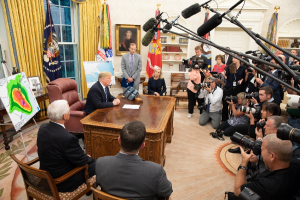
The watches issued carry different meanings and refer to different timing too. A Storm Surge Warning means there is a danger of life-threatening inundation, from rising water moving inland from the coastline, during the next 36 hours in the indicated locations. This is a life-threatening situation. Persons located within these areas should take all necessary actions to protect life and property from rising water and the potential for other dangerous conditions. Promptly follow evacuation and other instructions from local officials. A Storm Surge Watch means there is a possibility of life-threatening inundation, from rising water moving inland from the coastline, in the indicated locations during the next 48 hours. A Hurricane Warning means that hurricane conditions are expected somewhere within the warning area. A warning is typically issued 36 hours before the anticipated first occurrence of tropical-storm- force winds, conditions that make outside preparations difficult or dangerous. A Hurricane Watch means that hurricane conditions are possible within the watch area. A watch is typically issued 48 hours before the anticipated first occurrence of tropical-storm-force winds, conditions that make outside preparations difficult or dangerous. A Tropical Storm Watch means that tropical storm conditions are possible within the watch area, generally within 48 hours.
The National Hurricane Center cautions that additional watches or warnings may be needed; it may also become necessary to shift advisories up or down the coast as track adjustments are made for this major hurricane.
In the latest advisory from the National Hurricane Center (NHC), the center of the eye of Hurricane Florence was located by satellite near latitude 27.5 North, longitude 67.1 West. Florence is moving toward the west-northwest near 17 mph . According to the NHC, a motion toward the west-northwest and northwest is expected through early Thursday. Florence is expected to slow down considerably by late Thursday into Friday. On the forecast track, the center of Florence will move over the southwestern Atlantic Ocean between Bermuda and the Bahamas through Wednesday, and approach the coast of North Carolina or South
Carolina in the hurricane warning area on Thursday and Friday.
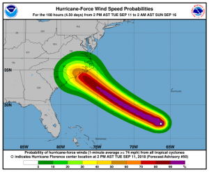
Major Hurricane Florence is a powerful category 4 hurricane. Maximum sustained winds have increased to near 140 mph with higher gusts. Further strengthening is forecast tonight and Wednesday. While some weakening is expected on Thursday, Florence is forecast to be an extremely dangerous major hurricane through landfall. Hurricane-force winds extend outward up to 60 miles from the center and tropical-storm-force winds extend outward up to 175 miles. As the storm gets closer to the coast, the wind field of both the tropical storm force and hurricane force winds is expected to widen larger.
The estimated minimum central pressure is 945 mb or 27.91 inches.
There are five major hazards associated with Major Hurricane Florence: storm surge, freshwater flooding, destructive winds, rough surf, and the threat of tornadoes.
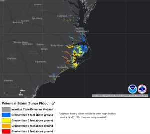
The combination of a dangerous storm surge and the tide will cause normally dry areas near the coast to be flooded by rising waters moving inland from the shoreline. The water has the potential to reach the following heights above ground if peak surge occurs at the time of high tide:
Cape Fear to Cape Lookout, including the Neuse and Pamlico
Rivers: 9-13 feet
North Myrtle Beach to Cape Fear: 6-9 feet
Cape Lookout to Ocracoke Inlet: 6-9 feet
South Santee River to North Myrtle Beach: 4-6 feet
Ocracoke Inlet to North Carolina/Virginia Border: 4-6 feet
Edisto Beach to South Santee River: 2-4 feet
The deepest water will occur along the immediate coast in areas of onshore winds, where the surge will be accompanied by large and destructive waves. Surge-related flooding depends on the relative timing of the surge and the tidal cycle, and can vary greatly over short distances.
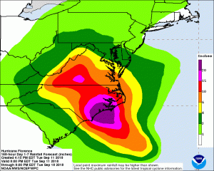
Florence is expected to produce potentially historic rainfall. Total rainfall accumulations of 15 to 25 inches with isolated maximum amounts of 35 inches near the storm’s track over portions of the Carolinas and Mid-Atlantic States from late this week into early next week are possible. This rainfall would produce catastrophic flash flooding and significant river flooding far inland to the Appalachian Mountains.
Hurricane conditions are expected to reach the coast within the hurricane warning area on Friday. Winds are expected to first reach tropical storm strength on Thursday, making outside preparations difficult or dangerous. Preparations to protect life and property should be rushed to completion.
Swells generated by Florence are affecting Bermuda and portions of the U.S. East Coast. These swells are likely to cause life-threatening surf and rip current conditions from central Florida north to Cape Cod, Massachusetts.
Landfalling hurricanes can also spin-up numerous tornadoes. While they are usually small and short lived, they can compound wind damage that occurs on the ground, especially on the northern and eastern side of the storm.