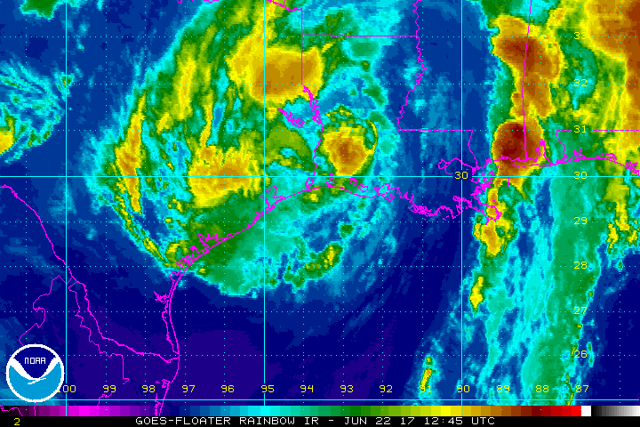
Tropical Storm Cindy made landfall at about 3am local time this morning. Radar imagery from Slidell and Lake Charles, Louisiana along with surface synoptic data, particularly those from Calcasieu Pass Louisiana, indicate that the center of Cindy crossed the coast
between Cameron Louisiana and Port Arthur Texas. A Tropical Storm Warning remains in effect for High Island, Texas to Morgan City, Louisiana.
With the storm inland, it will quickly weaken; however, extremely heavy rain will continue to plague the region. Over time, heavy rain over the Gulf region will impact the southeastern US and eventually eastern US. Rain remains the largest threat of the many dangers landfalling tropical cyclones produce.
RAIN
Cindy is expected to produce rain accumulations of 3 to 6 inches with isolated maximum amounts up to 12 inches over eastern Texas, western and central Louisiana, and southern and eastern Arkansas through Friday morning. Additional rainfall amounts of 2 to 4 inches with isolated maximum amounts of 8 inches over southern Mississippi, southern and central Alabama, and extreme western Florida Panhandle are expected through Friday morning. This rainfall could cause life-threatening flash flooding in these areas.
Rainfall is expected to begin and expand across parts of the Tennessee and Ohio valleys. Rainfall amounts of 1 to 2 inches with isolated maximum amounts of 4 inches are expected through Friday morning.
WIND
Tropical storm conditions are currently affecting portions of the Tropical Storm Warning area. These conditions should subside in a few hours.
STORM SURGE
Inundation of 1 to 3 feet above ground level is expected along the coast in portions of the Tropical Storm Warning area. Inundation of 1 to 3 feet above ground level is also possible elsewhere along the coast from southeastern Louisiana to the western Florida Panhandle in areas of strong onshore winds.
TORNADOES
A few tornadoes are possible through tonight from the lower Mississippi and Tennessee Valley regions to the central Gulf Coast.
