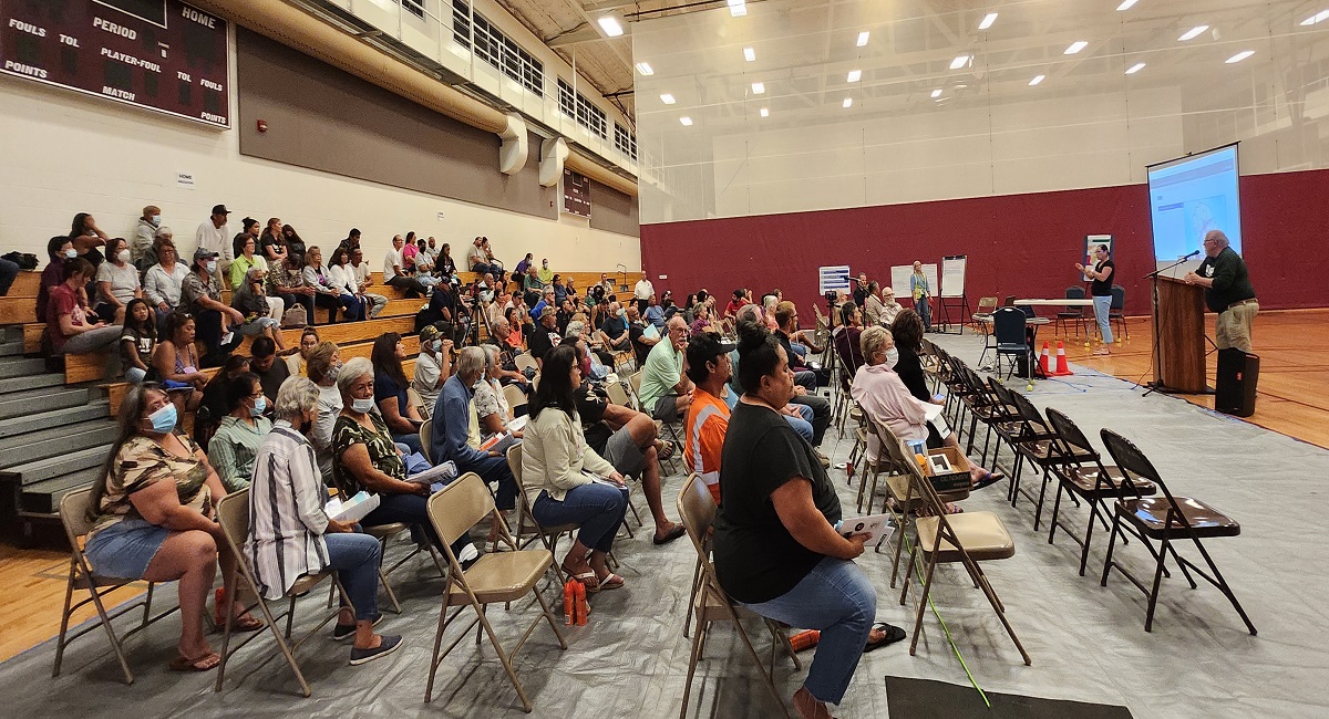
Officials with Hawaii County Civil Defense and USGS’s Hawaiian Volcano Observatory (HVO) hosted a townhall style meeting last night in Pahala on the Big Island of Hawaii as Mauna Loa, the world’s largest active volcano, shakes and quakes itself into a period of heightened unrest. The meeting, the second of a series of meetings being held around the island, are to provide complete transparency into what officials know and don’t know about the inevitable future eruption of the giant volcano. In recent weeks, seismic activity and expansion of the volcano have been on the upswing; in just the last few months, Mauna Loa grew by 6 cm as magma entering into it helps it swell.
Mauna Loa is considered the largest active volcano on Earth, rising to 13,681 feet above sea level. Mauna Loa rises up from the ocean floor of the Central Pacific at a depth of about 3 miles. Because of the volcano’s significant mass, the ocean floor directly beneath Mauna Loa is depressed by another 5 miles. According to USGS, this places Mauna Loa’s summit about 56,000 feet above its base; the enormous volcano covers half of the island of Hawaii, also known simply as the “Big Island of Hawaii.”
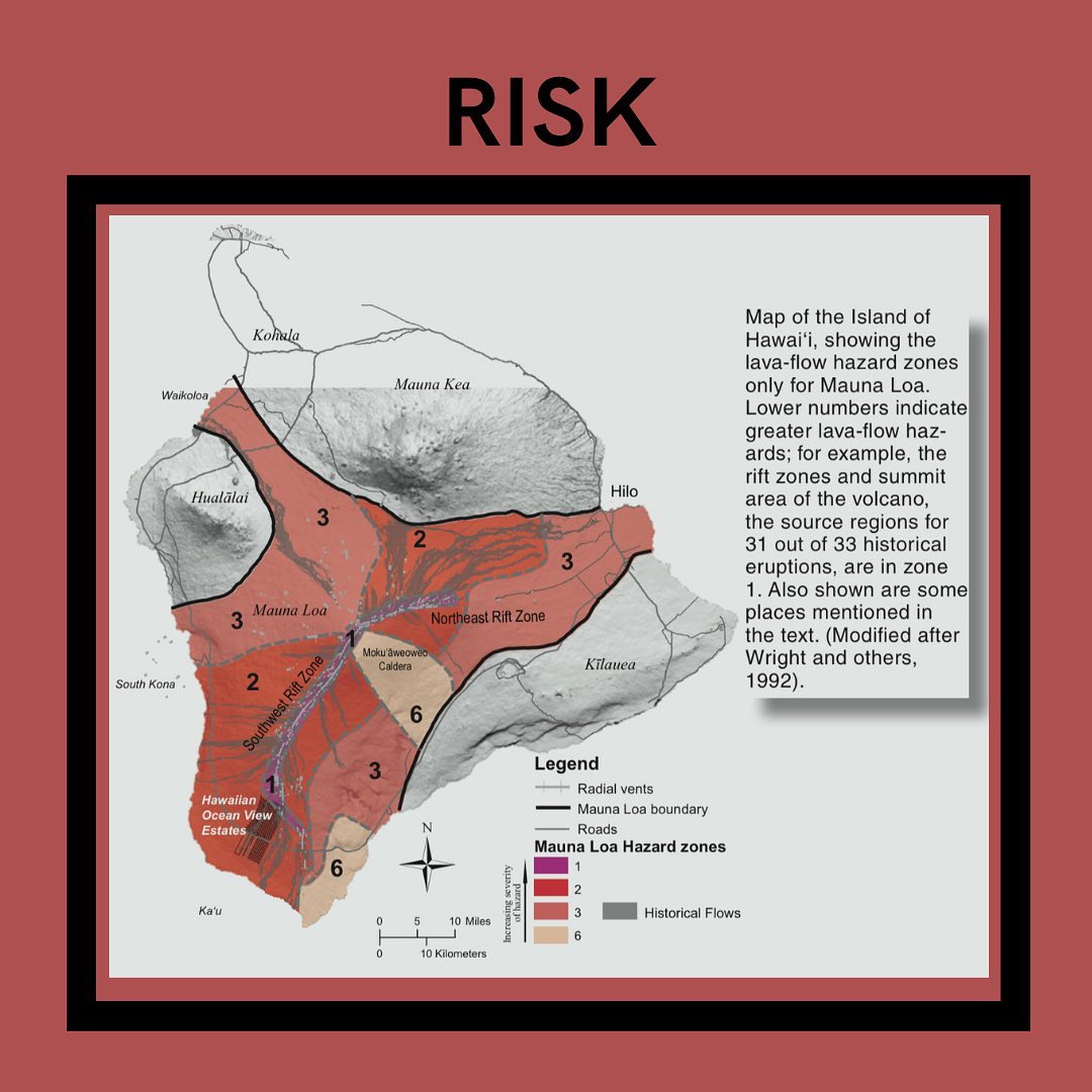
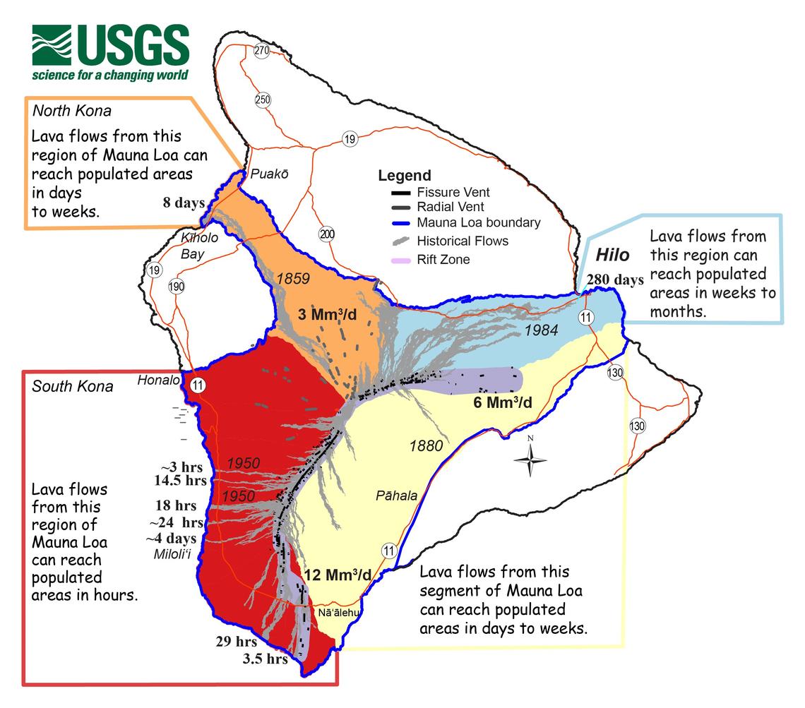
Mauna Loa eruptions tend to produce voluminous, fast-moving lava flows that can impact communities on the east and west sides of the Big Island from Kona to Hilo. Since the 1850s, Hilo in eastern Hawaii has been threatened by 7 Mauna Loa lava flows. On the south and west sides of the island, Mauna Loa lava flows have reached the coast there 8 times: in 1859, 1868, 1887, 1926, 1919, and three times in 1950.
The last eruption was in 1984 when the population of the Big Island of Hawaii was only 103,528; the population has nearly doubled to more than 200,000, with many of those living in the possible path of lava from the massive volcano. Due to that, there is growing concern by scientists, safety officials, and local residents to have a firm understanding of what’s what.
While an eruption at the giant volcano is inevitable, it isn’t imminent. USGS scientists Ken Hon, who serves as the Scientist-in-Charge for HVO, and Research Geologist Frank Trusdell, stressed to attendees of the meeting that an eruption won’t happen immediately. But they also admitted they don’t know when exactly it will erupt. “Mauna Loa continues to be in a state of heightened unrest as indicated by increased earthquake activity and inflation of the summit. The current unrest is most likely being driven by renewed input of magma 2–5 miles beneath Mauna Loa’s summit” both scientists mentioned in their presentations.
Over the last 24 hours, HVO detected 36 small-magnitude earthquakes at or below a magnitude 3.0 event roughly 2–3 miles below Mokuʻāweoweo caldera and 4–5 miles beneath the upper-elevation northwest flank of Mauna Loa. Both of these regions have historically been seismically active during periods of unrest on Mauna Loa.
This period of heightened unrest began in mid-September 2022 when earthquake rates below Mauna Loa’s summit grew from 10-20 per day to 40-50 per day. In addition to the dramatic increase of earthquakes, there’s also been an increased rate of inflation recorded by GPS stations and by a device near the volcano summit.
“The unrest is likely caused by renewed input of magma into Mauna Loa’s summit reservoir system. As the reservoir expands it is triggering small earthquakes directly beneath Mokuʻāweoweo caldera and in a region just to the northwest of the caldera,” HVO said in today’s update. “Deeper magma input is detected by the continued increase in upward movement and extension measured between GPS stations located on the ground surface. Shallower magma input was likely responsible for inflation recorded on the summit tiltmeter during the last two weeks of September. The current locations of earthquakes and deformation do not necessarily mean that the next eruption will occur there.”
In previous eruption events at Mauna Loa, earthquake activity significantly increased. However, as Hon and Trusdell took great time and detail in describing at last night’s community meeting, the seismic signature from previous events have all been unique and the current uptick in activity isn’t an exact match to past eruption events nor are there any clues to when or where an eruption will occur, if one does occur anytime soon.
“The current increase in activity does not suggest that a progression to an eruption is certain, and there are no indications that an eruption is imminent,” USGS was clear to communicate last night and in ongoing daily updates.
However, when an eruption does occur, residents may only hav a very short time to act.
“Right now, we are at a Yellow/Advisory alert level,” Hon said. “There is heightened unrest, we know magma is coming, and there’s earthquakes and deformation of the volcano.”
Hon said based on previous eruptions with Mauna Loa, it is likely lava will begin erupting at the summit. In as little as an hour or two from there, lava could break out somewhere on a rift zone high on the volcano and pour volumes of lava down its slopes.
“We will go to an Orange / Watch alert level when we believe a summit eruption is imminent,” Hon said, adding that at that moment, people should be ready to get out of harm’s way. “And once the summit eruption occurs, we will go to a Red / Warning” level,” Hon added.
Once the lava moves, Hon said HVO will issue a warning to a specific area or areas where lava could threaten people. Until the eruption occurs, lava could flow out in many directions around Hawaii’s Big Island. Once lava advances towards a specific area, USGS will issue more detailed, specific warning areas that are in imminent danger of lava inundation.
Unfortunately, things could happen quickly; Hon warns the whole process of evolving from the current Yellow / Advisory level to a Red/Warning eruption period could be as little as 1, 2, 3, or 4 hours.
“Not to panic everybody, but you have to be aware that if you live on the slopes of Mauna Loa, there’s a potential for some kind of lava disaster,” said Talmadge Magno, the administrator for Hawaii County Civil Defense. Magno said his agency is talking to residents now because communities closest to potential lava paths wouldn’t have enough time to learn how to respond and prepare once the observatory raises its alert level to Orange / Watch.
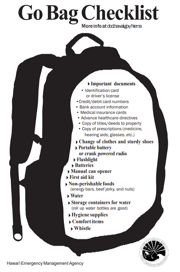
Magno said now is the time to revisit personal eruption plans. Similar to preparing for hurricane season, having an eruption plan in advance helps during an emergency.” Hawaii County Civil Defense and the Hawaii Emergency Management Agency are urging people in the possible paths of Mauna Loa’s lava to develop a plan and pack a “go bag.”
“We work with partners like the HVO for volcano and earthquakes and NOAA for tsunamis and hurricanes,” Magno said. “During the blue skies period when there isn’t an active disaster, we work with partners preparing for emergencies. But now that we’re in an advisory, we now engage with scientists and the public and put together our plans and outreach to the community.”
Magno said they are working on the next community meeting in South Kona, which is now scheduled for noon to 2pm on November 5.
“We need the community to receive our messages,” Magno said, encouraging that locals sign-up for Everbridge TXT, email, and phone alerts should things change. Users can customize the types of alerts they get, ranging from flood advisories to earthquake, tsunami, and volcano updates, when they’re issued.
Since earlier this month, USGS has been providing daily updates to the public on activity at the volcano. The activity remains heightened and scientists aren’t sure if it’ll continue to increase or decrease. Either way, officials urge caution, calmness, and plenty of preparation for “just in case.”
