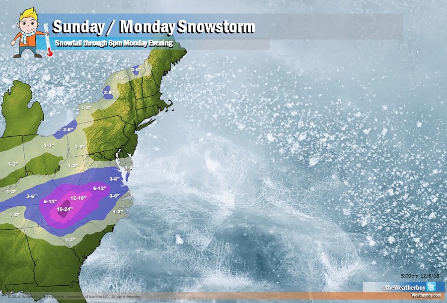
A crippling, historic winter storm is forecast to hit portions of the eastern US this weekend, dumping heavy snow in areas not used to snow, let alone significant snowfall. The National Weather Service in Greenville-Spartanburg, South Carolina said in a forecast discussion yesterday that this storm “might be a one-in-a-generation event for parts of the Piedmont.” Ashville, North Carolina, which saw 18.2″ of snow in the epic March 1993 “Superstorm”, could see that record fall by several inches with 1-2 feet of snow forecast for portions of the region.

Low pressure will track from the southwest U.S. to the Gulf Coast states through Saturday while cold high pressure builds across the Ohio Valley and Mid-Atlantic. This low will then move off the southeast coast Sunday into Monday. With the colder air in place, a prolonged period of snow is expected, starting as early as Saturday night, and lasting into Monday. Based on the forecast track, the heaviest snow is expected to occur across southern Virginia, into western North Carolina. While earlier guidance suggested the system may come up the northeast coastline, it no longer seems probable with a fast west-to-east weather pattern established over the region. As a result, snow from this primary storm will only reach as far north as northern West Virginia, northern Virginia, northeastern Maryland, and southern Delaware. While Washington, DC and Baltimore, MD could see light snow or flurries, no snow is expected at all for Philadelphia, PA, New York City, NY, Hartford, CT, Providence, RI, nor Boston, MA. There could be some light to moderate snows down-wind of the Great Lakes in portions of Ohio, western Pennsylvania, Upstate New York, and northern Vermont and New Hampshire. On the southern side of the storm, freezing rain, sleet, snow, and a mixture of all could fall, making travel extremely dangerous. This will be true in northeastern Alabama, northern Georgia, and central South Carolina. A light accumulation of wintry precipitation is even possible in Atlanta, GA; people there should exercise extreme caution when traveling late Sunday and Monday.

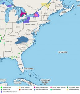
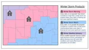
With winter weather aiming for the east, the National Weather Service has already issued Winter Storm Watches for portions of Kentucky, West Virginia, Virginia, Tennessee, and North Carolina. With the storm still a few days away, many more watches, warnings, and advisories are likely to be issued. Because some areas may not be used to winter storms and the language the National Weather Service uses to describe them or the products they issue for them, they’ve released a handy map guide to help educate people on the terminology.
Snow should wrap up from west to east on Monday, giving people a chance to dig out from yet another early season snowfall. The next potent storm to impact the eastern US is expected around December 16. By then, though, temperatures could moderate enough to produce mainly liquid precipitation with that system.