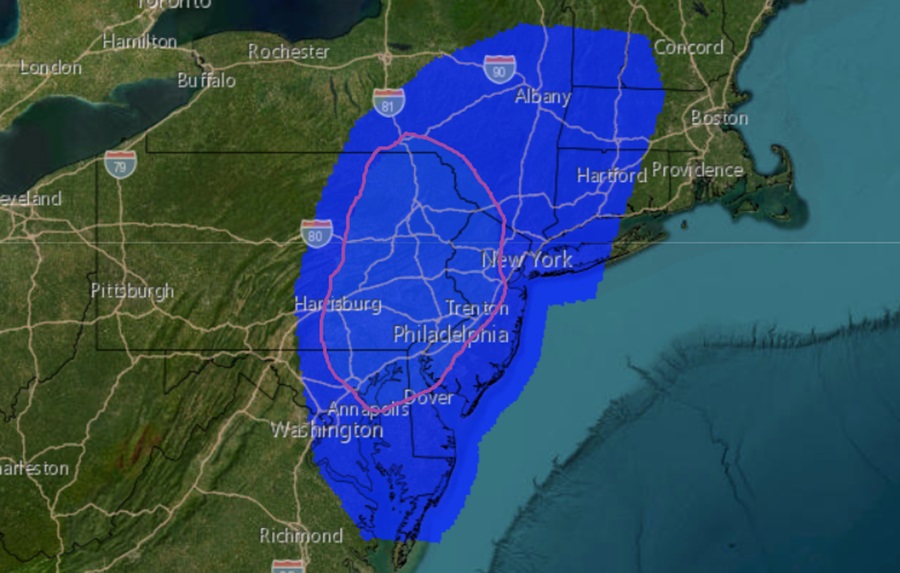
As the remnants from what was once Hurricane Debby advance north, the atmosphere will become unstable over portions of Pennsylvania and New Jersey on Friday leading to conditions favorable for tornadoes. The National Weather Service’s Storm Prediction Center (SPC) has identified an area over eastern Pennsylvania and western New Jersey and nearby portions of Delaware and Maryland as the area with the highest risk of tornadoes to form tomorrow anywhere in the country.
According to the SPC, a robust low to mid-level flow is forecast to extend throughout the eastern periphery of Debby’s remnants from eastern North Carolina into southern Maine early Friday morning. This strong flow will persist throughout the day, gradually shifting northeastward with the parent system. The strongest low and mid-level flow will remain in close proximity to the what’s left of Debby, spreading from far northeast Virginia and central Maryland early Friday into eastern Pennsylvania and New Jersey by the afternoon and into southern New England by late Friday/early Saturday.

Widespread cloud cover and limited heating is anticipated across the region, but deep convection still appears possible amid the strong warm-air advection. Buoyancy will be limited, likely tempering the overall updraft strength within this convection. However, the SPC warns that ample moisture will be in place, which should combine with the strong low-level shear to support some organized storm structures. Damaging gusts will be the greatest severe threat, but embedded circulations could be strong enough to produce brief tornadoes as well.
“Highest severe potential is expected from eastern Pennsylvania to the I-95 corridor in NJ, where the timing of the system allows for the best overlap between the buoyancy/daytime heating and the low-level shear,” the SPC warns. “Strong forcing could still result in some damaging gusts farther north into New York and western New England, despite very limited buoyancy.” They add that buoyancy will be greater farther south across eastern Virginia and North Carolina but shear will be weaker, likely keeping the severe threat isolated.
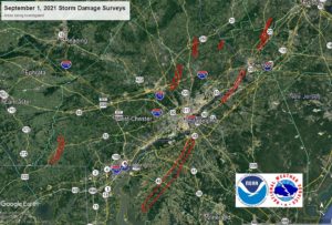
This region is no stranger to tornadoes from tropical cyclones. In 2021, the remnants of what was once Hurricane Ida passed through the Mid Atlantic, triggering numerous tornadoes to form in places like New Jersey.
The nearby passage of the remnants of Ida triggered 7 earthquakes near the Pennsylvania/New Jersey state line. An EF-3, the strongest of the bunch, hit in Mullica Hill, New Jersey. Other confirmed tornadoes from that event included an EF-2 in Fort Washington/Upper Dublin Township to Horsham Township in Montgomery County, Pennsylvania, an EF-1 in Edgewater Park, Burlington County, New Jersey which traveled to Bristol, Bucks County Pennsylvania, an EF-1 near Oxford, Chester County, Pennsylvania, an EF-1 in Buckingham Township, Bucks County, Pennsylvania, an EF-0 in Princeton, Mercer County, New Jersey, and EF-1 in Upper Makefield Township, Bucks County, Pennsylvania.