The 2018 Atlantic Hurricane Season doesn’t officially start until June 1, but that may not stop a new system from forming.. While no storm has formed and the National Hurricane Center doesn’t believe any development will quickly occur, meteorologists are keeping an eye on disturbed weather located near the Bahamas which could become a subtropical cyclone over time. A subtropical cyclone is a non-frontal low-pressure system that has characteristics of both tropical and extratropical cyclones.
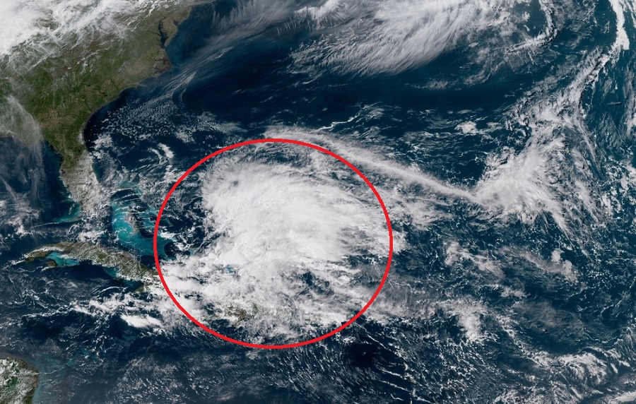
According to the National Hurricane Center, water vapor satellite imagery indicates a mid-level low has developed just north of the Turks and Caicos beneath region of upper- level divergence associated with a strong westerly subtropical jetstream. A large area of multi-layer clouds with embedded showers and thunderstorms was located northeast through southeast of the mid-level low, with a general increase in the amount and intensity of the convection noted during the past 6 hours. Ship and buoy reports, along with recent scatterometer data indicate winds of 20-25 kt continue south of the front and east of the trough from near Hispaniola. Wind gusts of 35 to 40 kt will be possible in some of the stronger thunderstorms. Meanwhile, a sharp upper-level trough extends from the north central Atlantic southward across Bermuda, to the developing mid-level low.
Gradual development of the low into the upper- and lower-levels is expected through Saturday as the system drifts southward to eastern/central Cuba by late Friday. The surface trough is expected to gradually develop into a broad low pressure system and move west north west between the Bahamas and Cuba during the next 48 hours, and be near southern Florida by early Saturday. Active weather spawned by the instability of this large and complex deep-layer low, along with abundant moisture drawn northward in a fresh to strong southeast wind flow, will result in numerous showers and thunderstorms steadily developing and overspreading most of the Greater Antilles, Bahamas, Turks and Caicos, and adjacent waters by Friday, and gradually spread westward across the Straits of Florida and into the Florida peninsula over the weekend.
It isn’t out of the question for tropical systems to form out of season; it also isn’t completely out of question for this system to take on additional tropical characteristics over time. Regardless of what happens, meteorologists will continue to monitor the region for weather hazards.
