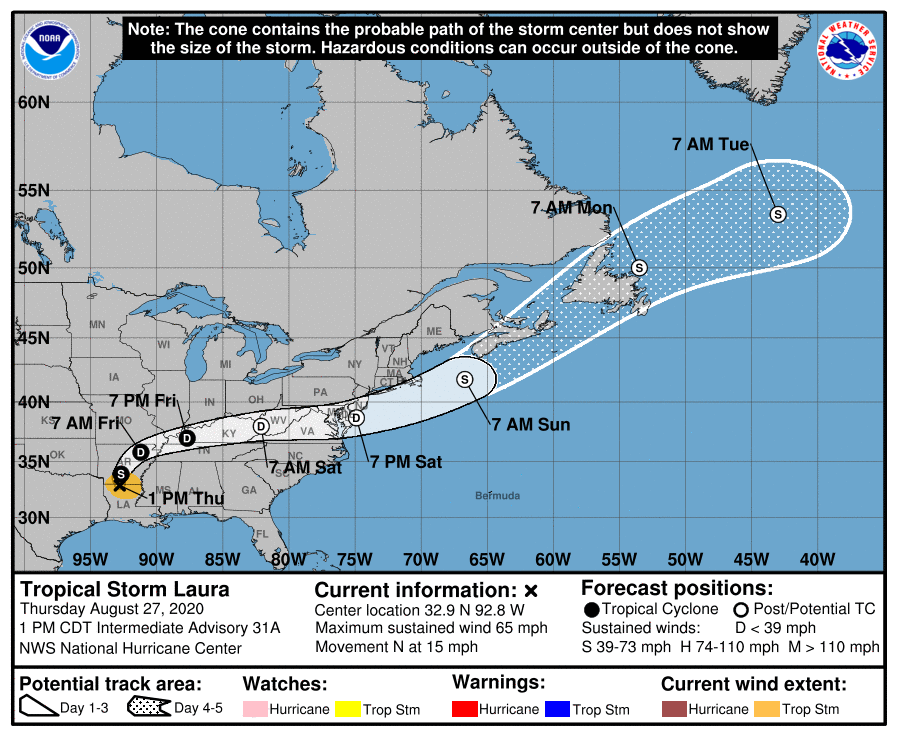
After a dramatic landfall on the Louisiana coastline in the overnight hours, Laura is on the move, now as a downgraded tropical storm; it is forecast to move north and eventually east over the next 48 hours. While the National Hurricane Center believes Laura could re-intensify into a tropical or subtropical storm after it departs the U.S. coastal waters and approaches Canada, such a re-intensification should have no impacts to East Coast weather.
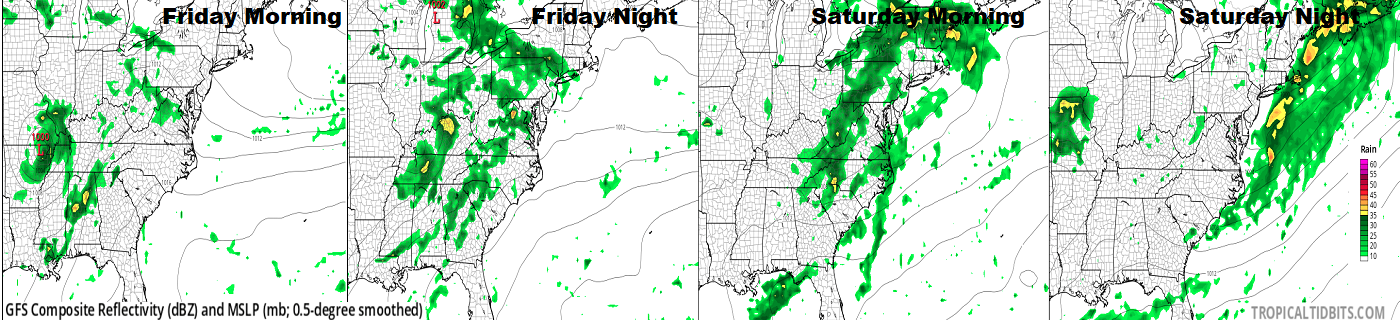
What’s left of Laura will combine with an area of low pressure near the Great Lakes to produce more rain showers over the eastern United States. The heaviest rain associated with Laura should let up a bit tonight as the center of the system moves into Missouri and Kentucky. A broader area of showers and storms will push east on Friday, with the heaviest rain clearing the Appalachian Mountains by Saturday morning. By Saturday evening, the center of what’s left of Laura should be off the east coast along with most of the rain associated with it and the broader low pressure system. On Sunday, high pressure will build in for much of the eastern U.S., giving people the opportunity to dry-out and recover from the wet and windy conditions tied to these systems.
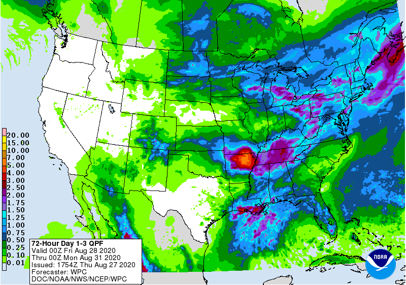
Rain will continue, though, heavy at times today as Laura moves up the Mississippi Valley. More than 5″ of rain is possible over Arkansas today, with 2-3″ possible over Kentucky and Tennessee too by tonight. But as the system rains itself out, a widespread 1-2″ is expected over the Northeast and Mid Atlantic, which will be welcome news for those dealing with drought conditions there.
Winds will also rapidly diminish as Laura weakens. While wind gusts as high as 30 mph are possible as far east as Nashville, TN, while Laura and the nearby low should produce breezy conditions in the eastern U.S., no area should see gusts greater than 25 mph. As a result, beyond Laura’s impacts today, no substantial wind damage is expected from it tomorrow and Saturday as the remnants push east.
