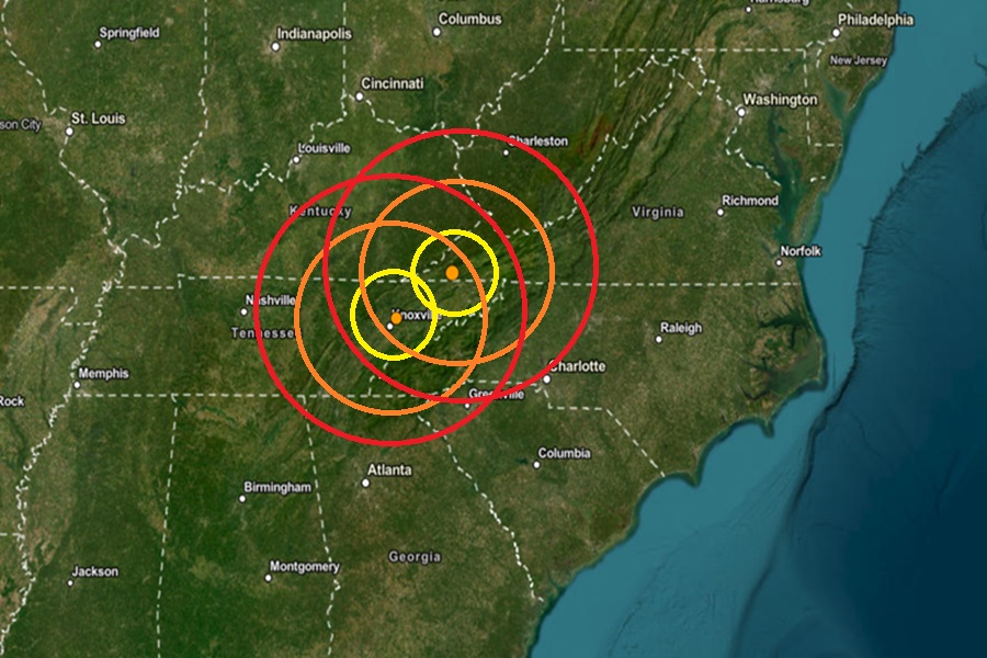
According to USGS, two relatively weak but noticeable earthquakes struck eastern Tennessee and western Virginia today, roughly 75 miles apart, with one hitting 3 and a half hours after the first.
The first earthquake struck near Clinchport, Virginia at 2:18 am this morning. Striking from a depth of 5.2 km, this earthquake was rated as a magnitude 2.1 event. Clinchport is located between the Cumberland Gap National Historical Part to its west and the Blue Ridge Parkway to the east inside the Appalachian Mountain Range.
The second earthquake struck near Mascot, Tennessee today at 5:49 am. This earthquake, rated as a weaker magnitude 2.0 event, struck from a depth of 17.7 km. This earthquake struck just northeast of Knoxville.
USGS says that earthquakes with a magnitude of 2.0 or less are rarely felt or heard by people, but once they exceed 2.0 , more and more people can feel them. While damage is possible with magnitude 3.0 events or greater, significant damage and casualties usually don’t occur until the magnitude of a seismic event rises to a 5.5 or greater rated event.
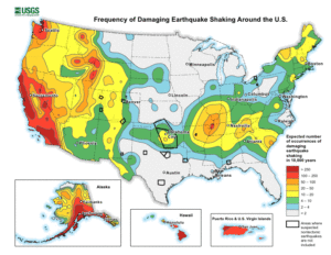
Earthquakes like the one that this morning in the eastern part of Tennessee are unlikely associated with the New Madrid Seismic Zone, an area of ongoing seismic activity located near the Mississippi River. However, while USGS says western Tennessee has a higher frequency of damaging earthquake shaking, the risk isn’t that low in eastern Tennessee. In the area of this most recent quake, USGS says its likely this area would see 50-100 damaging earthquakes over 10,000 years. While this number is low, it is much higher than it is elsewhere in the eastern half of the United States, where it’s likely to have 10 or less earthquakes over the same period.
Virginia has a history of earthquakes, although they are generally not as strong nor frequent as in other regions of the United States like California. Virginia has experienced a number of significant earthquakes, including the Mineral earthquake of 2011.
On August 23, 2011, a magnitude 5.8 earthquake hit the Piedmont region at 1:51 pm. The epicenter, in Louisa County, was 38 miles northwest of Richmond and 5 miles south-southwest of the town of Mineral. It was an intraplate earthquake with a maximum perceived intensity of VIII (Severe) on the Mercalli intensity scale. Several aftershocks, ranging up to a magnitude 4.5 event, occurred after the main tremor.
That 2011 quake was felt across more than a dozen U.S. states and in several Canadian provinces, and was felt by more people than any other quake in U.S. history. No deaths and only minor injuries were reported. Minor and moderate damage to buildings was widespread and was estimated by one risk-modeling company at $200 million to $300 million, of which about $100 million was insured.
