The U.S. East Coast is dealing with Tropical Storm Elsa today as it spreads flooding rains, damaging wind gusts, and tornadoes from south to north. The storm right now is located in central North Carolina and will race into the Mid Atlantic later today and into New England early tomorrow.
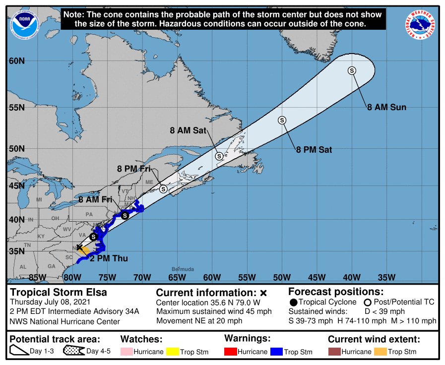
Tropical Storm Elsa has maximum sustained winds of 45 mph and a minimum central pressure of 1007 mb or 29.74″. It is moving northeast at 20 mph. According to the National Hurricane Center (NHC), this general motion is expected to continue with an increase in forward speed during the next couple of days. On the forecast track, Elsa will continue to move over North Carolina today, pass near the eastern mid-Atlantic states by tonight, and move near or over the northeastern United States on Friday and Friday night. The system should move over Atlantic Canada by Friday night and Saturday. The NHC says some strengthening is possible tonight and Friday while the system moves close to the northeastern United States. After passing through the United States, Elsa is forecast to become a post-tropical cyclone by Friday night.

Elsa is triggering numerous watches and warnings. A Tropical Storm Warning is in effect for the area from South Santee River, South Carolina to Sandy Hook, New Jersey, the Pamlico and Albemarle Sounds, Chesapeake Bay south of North Beach, the tidal Potomac south of Cobb Island, Delaware Bay south of Slaughter Beach, Long Island from East Rockaway Inlet to the eastern tip along the south shore and from Port Jefferson Harbor eastward on the north shore, and New Haven, Connecticut to Merrimack River, Massachusetts including Cape Cod, Block Island, Martha’s Vineyard, and Nantucket, A Tropical Storm Warning means that tropical storm conditions are
expected somewhere within the warning area.

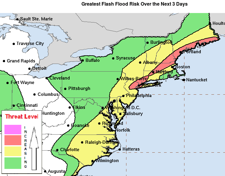
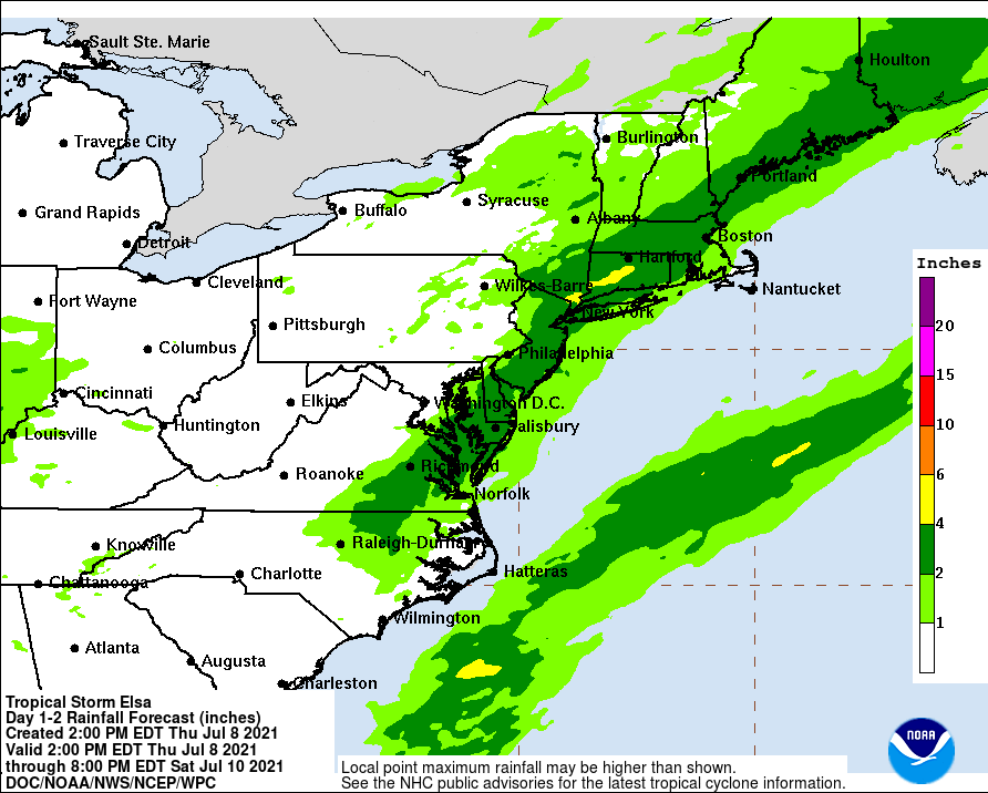
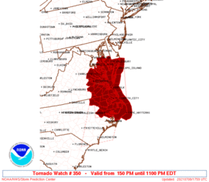
There are numerous flood and tornado related advisories too. Heavy rain of up to 4-6″ is possible over a short period of time, resulting in isolated flash and urban flooding. Spiraling winds around the tropical storm can spin up short-lived, isolated, but potent tornadoes. The greatest threat of tornadoes now is over northeastern North Carolina, eastern Virginia, and southern Maryland. Tonight, that threat of isolated tornadoes will move north into Delaware, New Jersey, eastern Pennsylvania, southeastern New York, and Connecticut. Tomorrow morning, the threat will be over southeastern New England.

By the weekend, the storm should be a distant memory in the U.S. By Saturday morning, the National Hurricane Center expects it to be near the west coast of Newfoundland. By Sunday morning, it should be south of Greenland.
Elsewhere in the tropical Atlantic, there are no signs of new tropical cyclones brewing for at least the next 5 days according to the National Hurricane Season.
The Atlantic hurricane season runs through the end of November, with a peak usually occurring in mid-September.