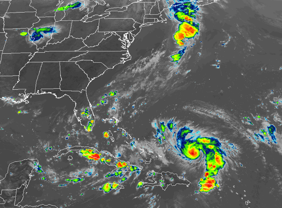
Meteorologists at the National Hurricane Center (NHC) in Miami, Florida are warning residents of the east coast that Dorian could strengthen to an extremely dangerous Category 4 hurricane before it strikes the U.S. East Coast in the coming days. The storm is currently spinning about north of the Dominican Republic and could lash the Bahamas and eventually portions of the East Coast with heavy rain and damaging winds during and after the Labor Day Holiday Weekend.
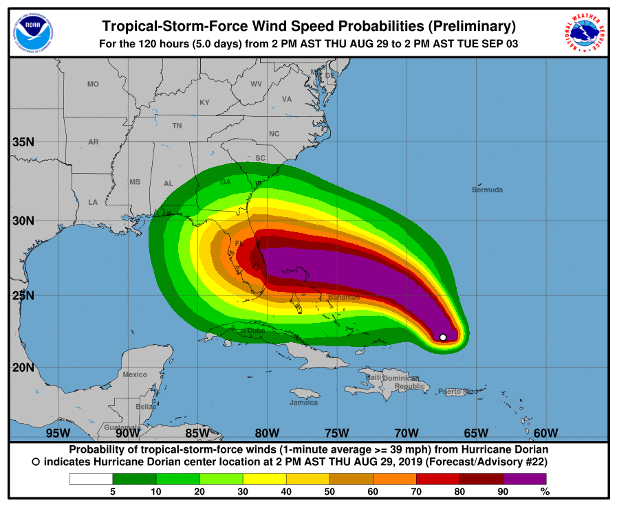
As of the 5pm update from the NHC, the center of Hurricane Dorian was located near latitude 22.5 North, longitude 67.7 West. Dorian is moving toward the northwest near 13 mph, and this general motion is expected to continue through Friday. A west-northwestward to westward motion is forecast to begin by Friday night and continue into the weekend. On this track, Dorian should move over the Atlantic well east of the southeastern and central Bahamas tonight and on Friday, approach the northwestern Bahamas Saturday, and move near or over portions of the northwest Bahamas on Sunday.
Maximum sustained winds are near 85 mph with higher gusts. Strengthening is forecast during the next few days, and Dorian is expected to become a major hurricane on Friday, and remain an extremely dangerous hurricane through the weekend. Hurricane-force winds extend outward up to 15 miles from the center and tropical-storm-force winds extend outward up to 90 miles. The estimated minimum central pressure is 986 mb or 29.12 inches.
Surf will diminish around Puerto Rico and the Virgin Islands today while it begins to pick up around the Bahamas and the southeastern U.S. over the weekend.
The National Hurricane Center wants to point out 4 key messages about Dorian right now:
- The risk of life-threatening storm surge and hurricane-force winds this weekend continues to increase in the northwestern Bahamas, and hurricane watches could be issued there tonight or Friday. Residents should have their hurricane plan in place and listen to advice given by local emergency officials.
- There is an increasing likelihood of life-threatening storm surge along portions of the Florida east coast late this weekend or early next week, although it is too soon to determine where the highest storm surge will occur. Residents should have their hurricane plan in place, know if they are in a hurricane evacuation zone, and listen to advice given by local emergency officials.
- The risk of devastating hurricane-force winds along the Florida east coast and peninsula late this weekend and early next week continues to increase, although it is too soon to determine where the strongest winds will occur.
- Regardless of the exact track of Dorian, heavy rains are expected to occur over portions of the Bahamas, Florida, and elsewhere in the southeastern United States this weekend and into the middle of next week.
