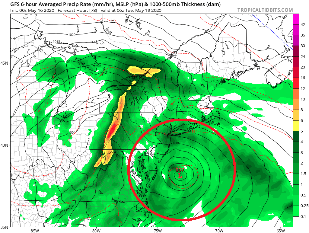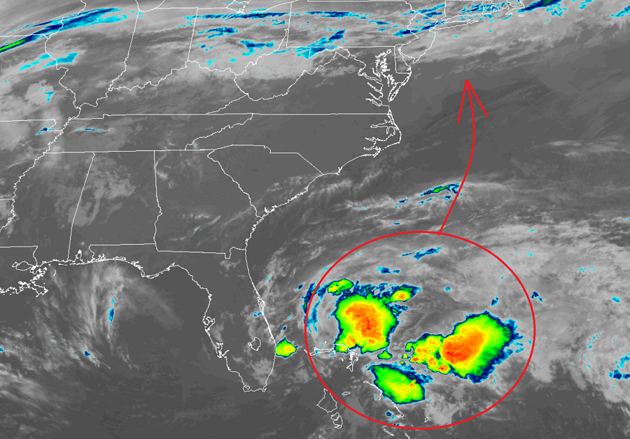
The National Hurricane Center now believes there’s an 80% chance that a tropical or subtorpical depression or storm is likely to form east of Florida today and slide up the East Coast, possibly bringing portions of the Mid Atlantic wind and rain as it does so.
For now, the area under close scrutiny consists of a broad area of low pressure located near the southeast coast of Florida. This disturbance continues to produce disorganized shower activity and gusty winds from portions of southern Florida and the northwestern Bahamas northeastward over the adjacent Atlantic waters. According to the National Hurricane Center, the system is expected to move generally northeastward over the western Atlantic east of the Carolinas.

Computer forecast guidance is mixed with this system’s future track. While some guidance suggests the storm will move off-shore, more guidance suggests it’ll be close enough to the east coast to bring gusty winds and heavy rain showers on land. Some guidance also suggests the system will move completely on-land either in the Mid Atlantic or New England. While computer forecast guidance disagrees with the future track, they’re all in agreement that the system is unlikely to strengthen to more than a tropical or subtropical storm.
Should the storm grow beyond tropical or subtropical depression strength, it would be named Arthur, the first storm of the 2020 Atlantic Hurricane Season. If Arthur does form, it would be a bit early; the Atlantic hurricane season doesn’t officially kick-off until June 1.
The National Hurricane Center cautions that regardless of development, the disturbance will continue to bring heavy rainfall and gusty winds across portions of southeastern Florida and the northwestern Bahamas through today. In addition, hazardous marine conditions will continue off the Florida east coast and in the Bahamas, where Gale Warnings are currently in effect. Dangerous surf conditions and rip currents are also possible along portions of the southeast U.S. coast this weekend and into the Mid Atlantic and southern New England coasts by early this coming week.
To better understand the mechanics of this disturbance, an Air Force Reserve Hurricane Hunter aircraft is scheduled to investigate the system this morning. While the Atlantic Hurricane Season doesn’t start until June 1, the National Hurricane Center is urging people to be properly prepared for the upcoming season. While NOAA won’t release their official seasonal outlooks until later this month, many other leading tropical weather forecasters are calling for a busy Atlantic hurricane season. With a busy season possible ahead, the National Hurricane Center recommends that people develop a written action plan, consider helping neighbors in their planning process, make sure their homes are strengthened prior to being threatened by a tropical system, make sure insurance is in-order, stock up on essential supplies, develop an evacuation plan, and ultimately identify and determine any risks you may face from a storm.

Experts with the Tropical Meteorology Project at CSU believe the upcoming hurricane season will be a particularly busy one with increased chances of a landfalling tropical system compared to typical seasons. NOAA is scheduled to unveil their official outlook for the season next week for both the Atlantic and Central Pacific hurricane basins and seasons.