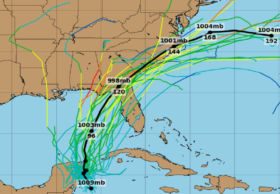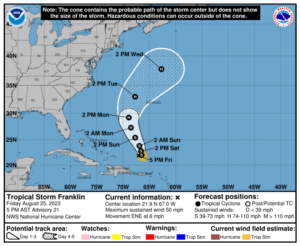
There appears to be some tropical trouble possible in the coming days along the U.S. East Coast, with two potential hurricane threats tracking up or alongside the coast. The first is Franklin, forecast by the National Hurricane Center to become a hurricane this weekend or early next week. The second is a system developing near the Yucatan Peninsula; it could become a tropical storm or hurricane as it gets closer to Florida and the U.S. Southeast Coast in the coming days too.

Tropical Storm Franklin is located about 735 miles south-southwest of Bermuda. As of the latest update from the National Hurricane Center (NHC),Franklin is moving toward the east-northeast near 6 mph and this motion will continue through tonight. A sharp turn toward the north, with an increase in forward speed is expected on Saturday, with a northward or north-northwestward motion over the western Atlantic continuing through early next week. Maximum sustained winds are near 50 mph with higher gusts. Gradual strengthening is forecast, and Franklin will likely become a hurricane by early next week.
Based on the current NHC forecast track, Franklin should remain well off shore from the U.S. East Coast, but will still be close enough to kick up rough surf and large waves, creating rip current situations along much of the coastline. Franklin’s position may also allow for a new developing system to track over the east coast rather than avoid it.
The NHC now says there is an 80% chance that a system near the Yucatan Peninsula will become a tropical cyclone in the coming days. Shower and thunderstorm activity has increased since yesterday in association with an area of low pressure over the northwestern Caribbean Sea. Environmental conditions appear conducive for further development of this system during the next several days, and a tropical depression is likely to form late this weekend or early next week while it moves generally northward over the eastern Gulf of Mexico. “Interests in the Yucatan Peninsula of Mexico, western Cuba, and Florida should monitor the progress of this system,” cautions the NHC in their latest Tropical Outlook.
Forecast models are quite bullish with the development of this storm, with many calling for a tropical storm or hurricane to develop from this tropical cyclone and impact the southeastern U.S. in the coming days. Due to that threat, residents across the Gulf and East Coasts should make sure they have a Hurricane Action Plan in place well before any threat arrives. It may become necessary to act on it as the last week of the month kicks off.
Should a named tropical cyclone form here this weekend, it would be named Idalia.