The National Hurricane Center in Miami, Florida says there’s a near 100% chance that a tropical cyclone will take shape within the next 48 hours over the Eastern Pacific; it is likely that this disturbance will become Tropical Storm Alvin, the first named storm of the 2025 Eastern Pacific Season.
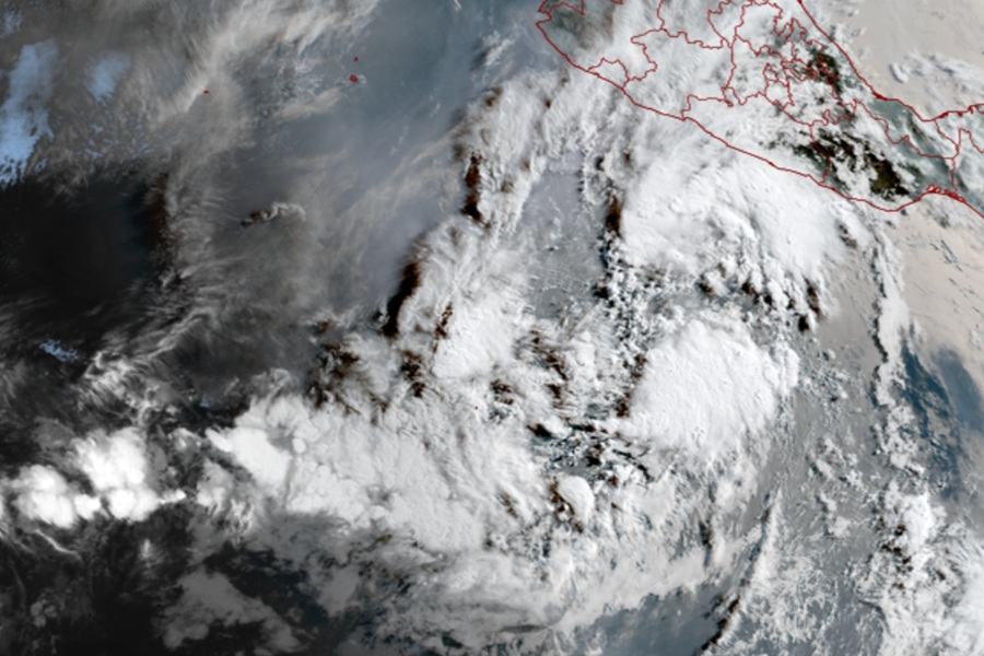
South of the southern Coast of Mexico, an elongated area of low pressure located several hundred miles south of the coast of southern Mexico continues to produce showers and thunderstorms, but the National Hurricane Center (NHC) says that the system still lacks a well-defined circulation.
Because environmental conditions remain favorable for further development, the NHC says that a tropical depression or tropical storm is expected to form here later today or tonight as the low moves generally west-northwestward at around 10 mph.

Over time, the system, which the National Hurricane Center has been tracking for days now, is expected to move up the Mexican coast and likely move up into the Gulf of California. There, it should weaken and be shredded apart by the mountains in western Mexico, with moisture associated with the system sent to the southwestern U.S.. Over time, portions of Arizona, New Mexico, and Texas could see significant rain from this system as its remnants drift across the southern U.S..
While the Atlantic and Central Pacific Hurricane Seasons begin on June 1, the Eastern Pacific Hurricane Season officially began two weeks earlier on May 15.
According to Dr. Phil Klotzbach who leads a tropical meteorological forecasting team at Colorado State University, there have been 0 Northern Hemisphere named storms so far in 2025. The latest first named storm in the Northern Hemisphere since 1950 was in 1973; Ava formed in the eastern North Pacific on June 2 that year. Should Alvin develop as forecast, Ava’s record in kicking off the tropical activity for the season should be safe.
