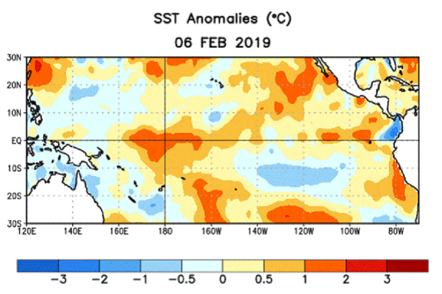
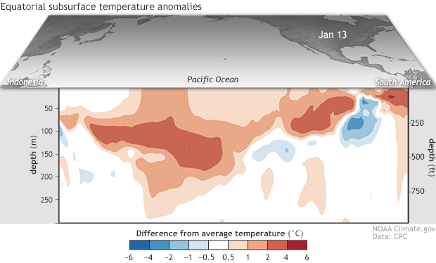
Scientists with the National Oceanic and Atmospheric Administration (NOAA) announced today the return of El Niño conditions. NOAA’s Climate Prediction Center issued an El Niño Advisory today, indicating that the climate pattern will likely to continue through the spring. While the El Niño is expected to be weak, it may bring wetter conditions across the southern half of the United States during the coming months. Weak El Niño conditions means that El Niño isn’t dominating the global circulation, and there is a lower probability of El Niño-related global temperature and precipitation effects through the next few months. Other players, including the Madden-Julian Oscillation (MJO), may continue to affect weather patterns.
During an El Niño, the trade winds weaken in the central and western Pacific. With less upwelling of cold water to cool the surface, water temperatures on the surface off of South America warm up. With water temperatures and winds disrupted in the Pacific, clouds and rainstorms associated with warm ocean waters tend to shift to the east. This is why even in weak El Niño conditions, such as those forecast for this spring, the southern United States will see conditions more wet than usual.
In contrast, a strong El Niño set-up occured in 2015-2016. During that cycle, unusually warm waters developed between the coast of South America and the International Date Line. Due to shifts in the global weather pattern due to this significant event, many impacts were felt around the Northern Hemisphere. Drought conditions in Venezuela, Australia, and a number of Pacific islands persisted while significant flooding was also recorded elsewhere. During the event, more tropical cyclones than normal occurred within the Pacific Ocean, while fewer than normal hurricanes occurred in the Atlantic Ocean.
The term “El Nino” comes from Spanish speaking countries most impacted by this weather pattern. In American Spanish, the capitalized term “El Niño” refers to “the boy.” El Nino is often the most warm around Christmas; the original name of the meteorological phenomena, “El Niño de Navidad”, traces its origin centuries back to Peruvian fishermen, who named the weather phenomenon in reference to the newborn Christ. There is also another weather pattern that occurs when the equatorial Pacific cools to below-normal levels. It is known as “La Niña”, chosen as the ‘opposite’ of El Niño. La Niña translates to “the girl”.
